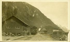
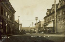
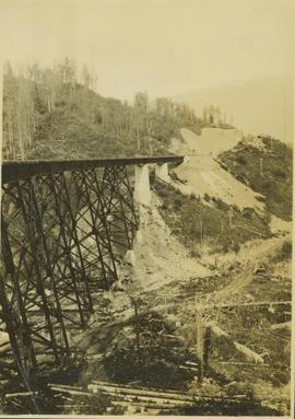
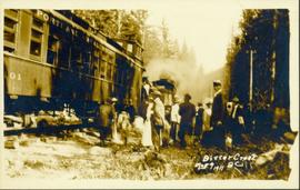
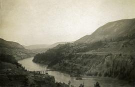
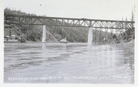
Bridge is 200ft. above water.
Power or telegraph cables are visible just above the river. On the hillside across the river can be seen a flat surface running its length - perhaps a railroad or a road?
GTP stands from Grand Trunk Pacific Railway.
Partially visible handwritten annotation on verso: "...this wall is only a few feet thick, but runs out for a long distance on both sides of the river."
Track laying machine situated on a large mound of earth which is surrounded by (flood?) water.
Unidentfied surveyor standing next to his surveying equipment situated on railroad tracks, makes notes in a hand held notebook.
Partially visible handwritten annotation on verso: "...stern....'Prince George' ". Possibly a steamship heading up the Skeena River?
The man receiving the haircut is sitting on a hand car; and two rail cars are visible in the background: "Grand Trunk Pacific 312290" and "Grand Trunk Pacific 311013".
Postcard photograph depicting Sternwheeler traveling in river with mountains in the background. Large group of people can be seen on deck, and two unidentified men stand on shore in foreground.
Printed annotation on recto reads: “S.S. Port ‘Simpson Hazelton BC”. Handwritten message on verso is dated “July 31st 1911”.
Street view photograph of two individuals watching the snow slide down one of the mountains surrounding Stewart, BC. Printed annotation on recto reads: "Snow Slide Stewart B.C. July 7/11."
Side perspective photograph of a train stopped at the Stewart railroad station. Another train can be seen arriving in the distance.
Side perspective photograph of a crowd of people gathered around a Portland Canal Short Line Railroad train, presumably either leaving or arriving Printed annotation on recto reads: "Bitter Creek BC Aug 9 1911."
Photograph depicts three men standing and sitting on a porch deck in front of a log house, trees in the background.
Photograph depicts two canvas tents set up near the shore of a small lake or stream. There is a wooden structure on the opposite side of the water. Rough cleared land in the foreground, forested hills and low mountains in the background.
Photograph depicts a view of a lake from above, aspens in the foreground, low rolling hills in the background.
Photograph depicts roughly cleared land in the foreground, canvas tents and a wagon in the midground, lake and hills in the background.
Photograph depicts three or more men near a wagon loaded with supplies. A team of two or more horses are hitched to the wagon. Lake and rolling treed hills in the background.
Photograph depicts a lake. Photograph is framed by a deciduous tree on the left. Forest and rolling hills in the background.
Photograph depicts a man standing on the edge of a trail looking to the treed hills in the distance.
Photograph depicts ten men aboard a scow on a river or lake. The scow is equipped with long poles and may be propelled by steam.
The collection consists of 9 photographs and copies of photographs showing scenes of Prince Rupert and area, groups of townspeople, a stone totem pole at Metlakatla, and a man poling a dug-out canoe probably on the Skeena River. It includes two newspaper clippings, one from the BC Saturday Sunset dated September 14, 1912 and another from The Globe dated Saturday March 23, 1907. The bound volumes of the Prince Rupert Empire newspaper were transferred to Special Collections. See accompanying note.
Sans titreFile contains two newspaper clippings, one from the B.C. Saturday Sunset of September 14, 1912 concerning economic development on Vancouver Island and the second from The Globe dated Saturday March 23, 1907 which contains two photographs of Prince Rupert.
Subseries contains material relating to the administrative functions of the Grand Trunk Railway, including financial records.
Part of a set of 41 original black & white photographs [1908-1933-?]) of the Grand Trunk Pacific Railway line in BC depicting surveying crews, town sites (Prince Rupert and its port, Hazelton and Fort George), and First Nations Peoples.
Map is entitled "Latest Map of Fort George District" and published 1912. Includes Peace River Recording Land District, Fort George Land Recording District, and Cariboo Land Recording District. Several sections are marked with red pencil.
Street view of Sixth Street in Prince Rupert BC. A small group of men is shown loitering on the sidewalk. Annotation on recto reads: "Sixth St. Prince Rupert BC." Handwritten annotation on recto is heavily obscured by glued on paper and reads: "Prince Rupert [illegible] 12th 12 Dean Harry! [Illegible] lived here last night after [illegible] pleasent[sic] trip. What do you think of this city since you saw it last. Saw George before I left Vancouver, he looks still the same. Kindest regards to you & wife. Nib [??]." Postcard is addressed to: "Mr H Banker 2732 Arch Ave West Seattle Wash USA." Postcard is affixed with a one cent Canadian stamp. Postmark reads: "Prince Rupert BC PM 2 1 JUN 12."
Photograph depicts a view from the water looking toward Swanson's Bay, BC.
Photograph depicts a long spanned bridge crossing the Fraser River near Chimney Creek, BC.. Album notes state: "views of Chilcotin"
Photograph depicts open range land and treed low hills.
Photograph depicts a muddy road in the middle of open range land with low treed hills in the distance.
Photograph depicts a large corral surrounded by open range with low hills in the distance.
Photograph depicts open range land, a river and sparsely treed hills in the distance.
Photograph depicts a double exposed photograph, a buckboard and open range land with horses and low hills in the distance.
Photograph depicts a man washing clothes using a scrub board and metal wash tub. There is a fire pit in the foreground, tents on either side and forest in the background.
Photograph depicts standing trees that have been burnt, possibly after forest fire. Low hills can be seen in the background.
Photograph depicts of Lowe Inlet BC from the water looking toward the mountains.
Photograph depicts a view from the water looking toward buildings on the shore and mountains in the distance.
Part of a set of 41 original black & white photographs [1908-1933-?]) of the Grand Trunk Pacific Railway line in BC depicting surveying crews, town sites (Prince Rupert and its port, Hazelton and Fort George), and First Nations Peoples.
Photograph depicts crowd and horses gathered in front of street building with the sign "The Northern Lumber Co Ltd."
Handwritten annotation on verso “Second St., South Fort George, 1912".
"The Kitselas of British Columbia." George T. Emmons. Reprint from the American Anthropologist (N.S.) Vol. XIV, No. 3, July-September, 1912. Signed by author.
Item is a 14 Nov. 1912 receipt of products purchased from John A. Fraser & Co., Ltd. of Quesnel, B.C., "dealers in general merchandise and lumber". The buyer was Tom Styner[?].
Photograph depicts a snow covered cemetery with gravestones, tombstones, and monuments.