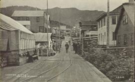
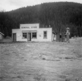
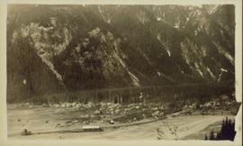
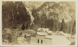
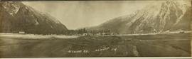
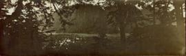
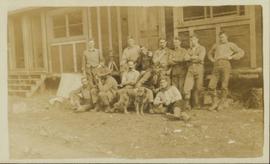
Photograph is a printed postcard of a group of unidentified men and a dog in front of a rustic building possibly near Stewart B.C.
File contains images of mine operations and construction, as well as a variety of other subjects.
- Elements of the underground mine are depicted, including miners working, the marked rock face, yellow ducting and ventilation fan, the portal, mesh rockbolted onto adit walls, shotcrete being applied, and stacked mining construction materials.
- Mining equipment depicted in this file includes underground ore haulage truck, Wabco ore haulage truck, jackleg drill, stoper drill, scoop tram, jumbo drill, conveyor, pickup trucks, unidentified mixing or grinding machine, a cable wagon and half constructed ore haulage truck in the shop, and a continuous miner (also known as alpine miner or roadheader).
- A set of images show a dozer and a lowbed truck transporting a temporary building down the pit mine access road.
- Several images depict drill core fragments, asbestos ore, and geological features of the mine.
- Mining related process are depicted, including a young man sluicing and panning, a mine building under construction, and an unidentified steel frame structure with a hydraulic device suspended on a rail.
- A set of images shows a railway or highway construction project, including stockpile of construction materials, rail cars, caboose, locomotive, front end loader, dump truck, concrete mixing trucks, semi-trucks, and a rail car with large steel drums which are speculated to be specialized for tunnel construction.
- Further images show what is speculated to be tunnel construction.
- A set of images at a high ceiling underground mine which is not Cassiar depicts a man in a suite by a underground ore haulage truck, and other mining vehicles including a crane.
- A set of images depict an ungulate herd, possibly bighorn sheep, on a mountain side.
- The file includes several images which depict personal life, presumably from a family vacation, and access to these images may be restricted. These images depict man with children on a fishing trip, adults and children around a pool, a woman on a motorcycle, and a house and kitchen. Several groups of images are contained in envelopes annotated with dates and “K. Minty”.
Image depicts the Sunset Theatre in Wells, B.C.
Wide angled photograph of a sunset on the waterfront in Prince Rupert. Several buildings are silhouetted in the foreground. Annotation on recto: "Sunset, Prince Rupert, BC No. 4465."
Photograph depicts block ships sunk to protect booming grounds at Powell River. The ships were former wartime naval vessels.
Photograph depicts the Sun Building at the intersection of Beatty and West Pender St. in Vancouver, B.C. The photo was taken after the Pacific Press Ltd. Vacated the building on December 26, 1965, and the "Sun" neon sign on the tower was removed. The view is looking west from West Pender St.
Photograph taken at Terrace Gardens, Victoria, B.C.
File contains slides depicting the Summerfest in Prince George, B.C. in 1994.
Photograph depicts what is believed to be the only remaining "summer cottage" on Beach Ave. in English Bay.
Photograph depicts the Sumas depot of the Northern Pacific Railway in the U.S. The Canadian border is at the grade crossing in the middle distance.
Image depicts Studio 2880 Arts Complex in Prince George, B.C. Map coordinates 53°54'36.9"N 122°46'30.3"W
Image depicts a building which is a part of the Studio 2880 Arts Complex on 15th Avenue in Prince George, B.C.
View of large houses on hill and city streets below. Printed annotation on recto reads: “Prince Rupert Residences on Cliff Which Runs Thru the Heart Of the City”.
Slightly elevated street view of several Prince Rupert storefronts. A large pile of rubble is visible on the left of the photograph. Printed annotation on recto reads: " Prince Rupert BC." Handwritten annotation on recto reads: " July 29, 1922."
Slightly elevated street view of a large pile of rubble next to several storefronts in Prince George. Printed annotation on recto reads: "Prince Rupert BC."
Street view down Centre Street in Prince Rupert, BC. Printed annotation on recto reads: "Centre Street, Prince Rupert, B.C. 1664." Handwritten annotation on verso reads: "Minnie sent a parcel to you by express to-day- some things you left behind you. I hope you and Bertie had a good trip up. Florrie and the children will leave on the morning train. All are pretty well and send their love to you. Harrie." Postcard is addressed to: "Miss M.V. Beattie Enderby, B.C." Verso is affixed with a two cent Canadian stamp. Postmarkson recto and verso are illegible.
Photograph is a printed postcard depicting a wagon track between buildings situated on either side. There are mountains in the back ground. Possibly Stewart, BC.
The item is a photograph of a street view looking west down 3rd Avenue Prince George. The Brick, Liquidation World, the TD building and other commercial businesses are visible.
The item is a photograph of a street view looking west down 3rd Avenue, Prince George. Royal Dry Cleaners, the TD building and other various commercial businesses are visible.
The item is a photograph of a street view looking west down 3rd Avenue Prince George. The TD building and various other commercial businesses are visible.
The item is a photograph of a street view looking east down 3rd Avenue Prince George. Various commercial businesses are visible.
The item is a photograph of a street view looking east down 3rd Avenue Prince George. The Brick, Liquidation World, Home Hardware and various other commercial businesses are visible.
The item is a photograph of a street view looking east down 3rd Avenue from Dominion Street in Prince George. Various commercial businesses are visible.
Image depicts a street of houses somewhere in Prince George, B.C.
Photograph depicts a street lamp on a wooden deck with barrels and a canvas-covered building in the background.
Photograph depicts four men and small cart standing in street, lines of log buildings on either side. Tents can be seen at end of left side of street. First building on left is larger, with the sign "STOPPING PLACE". Trees cross midground, mountains stand in background. Handwritten annotation on verso of photograph reads: "Tete Jaune Cache. B.C."
Street scene in Prince George B.C. Several Union Jack flags are visible and there is a celebration banner at the end of the street. Long shadows in photo indicate summer (perhaps Dominion Day?). River in foreground, railroad and city in mid ground and hill in background. Printed annotation on recto reads: “Prince George. B.C.”
Image depicts a street in Giscome B.C. The Giscome Store is located on the left side of the image with the church in the background. Map coordinates 54°04'18.5"N 122°21'57.7"W
Image depicts a street in Giscome. The store was previously located on the left. The church is in the background. Map coordinates 54°04'18.5"N 122°21'57.7"W
View of the road descending to the waterfront. Buildings and forested area are visible on either side of street. Annotation on recto reads: "Prince Rupert BC. '07."
Image depicts a view of the Dunkley Lumber Mill in Strathnaver, B.C.
Image depicts the BCR, as well as the Dunkley Lumber Mill, in Strathnaver, B.C.
Image depicts what is likely the Dunkley Lumber Mill in Strathnaver, B.C.
Image depicts an aerial view of Strathnaver, B.C.
Photograph depicts stores in Kaslo on Kootenay Lake, 40 miles northeast of Nelson. This town still has 15 miles of dirt road leading to it.
Photograph depicts a store 50 yards south of the B.C. Electric Railway on the west side of the Vedder crossing road in Sardis, Chilliwack, B.C.
Photograph depicts the only store in the small, derelict village of about 12-15 houses of which only one is occupied.
Image depicts a few storage sheds somewhere in Prince George, B.C.
Image depicts the school site in Stoney Creek.
Image depicts a stone marker in Lamming Mills, B.C.
Photograph depicts a stone house on 17th St. and Esquimalt St. in West Vancouver, B.C.
Elevated, wide angle photograph of Stewart, BC with mountains visible in the background.
Slightly elevated photograph of commercial and residential buildings in Stewart, BC. Printed annotation on recto reads: "Hughes #11 Stewart Looking N.W."
File contains slides depicting places in and around Stewart, B.C.
Image depicts the Robert Stewart house, built in 1910 and inhabited by the Stewart family until 1945. It is located in Stewart, B.C.
Image depicts Stewart Harbour in Stewart, B.C.
Photograph depicts view a panoramic view of Stewart B.C taken from the valley bottom.
Photograph depicts view a panoramic view of Stewart B.C. taken from an elevated view.
Image depicts an unknown individual leaning against a sign at the Stewart Access Road which warns travellers to pack several days of food. Located in Hazelton, B.C.