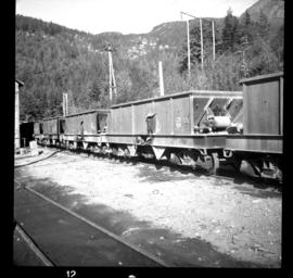
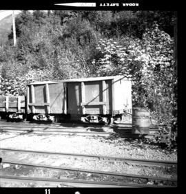
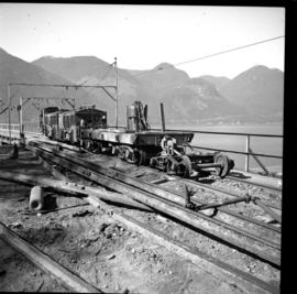
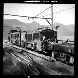
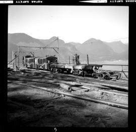
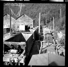
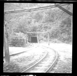
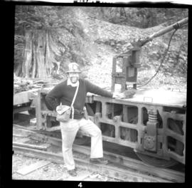
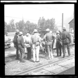
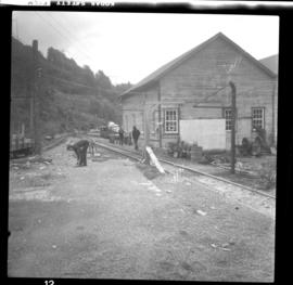
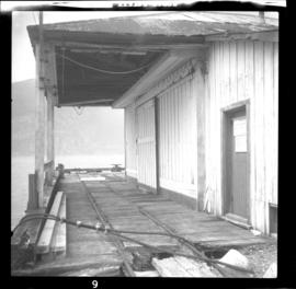
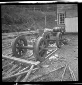
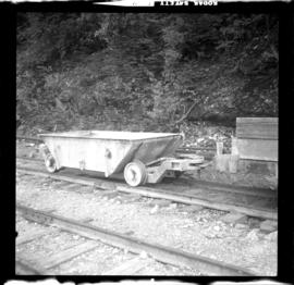
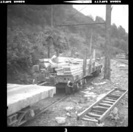
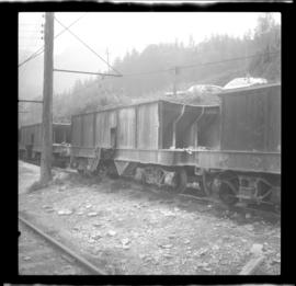
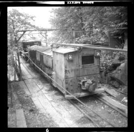
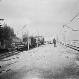
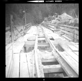
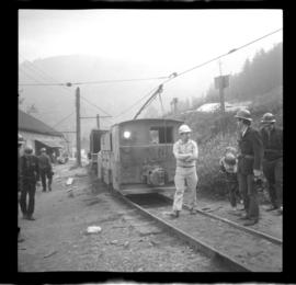
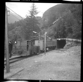
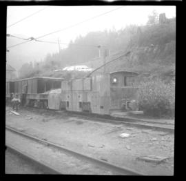
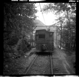
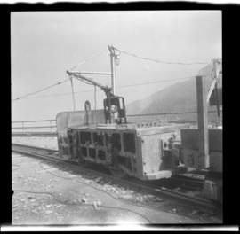
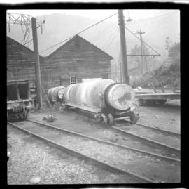
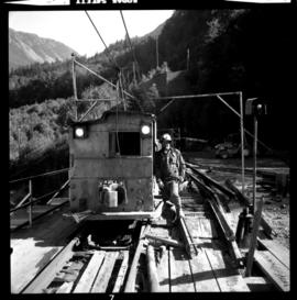
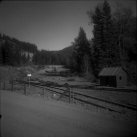
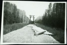
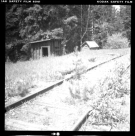
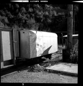
Photograph depicts a derelict mine electric railway in Britannia Beach. Visible is an ambulance car that was painted silver and was made of steel. It was likely to be cut up on site for scraps. Anacanada Britannia Mine closed on November 1, 1974.
Photograph depicts a mine electric railway. Visible are some of 10 remaining hopper cars that were awaiting removal to, possibly, Yukon after the auction in August, 1975.
Photograph depicts a mine electric railway. Visible is a powder car that was painted red and head a wooden box. It was used twice weekly on the explosives haul till the Anaconda Britannia Mine was closed on November 1, 1974.
Photo depits a mule locomotive. A contractor from Calgray won the contract to remove the rails of the Anaconda Britannia Mine that was closed on November 1, 1974. The contractor bought the locomotive to do the job. It pulled out 2000-3000 ft. of twin sets of rails from the far end of a tunnel to open air at this point. Then, it unbolted them further into lengths and stocked them for shipment possibly to the Yukon.
Photograph depicts a mule trolley locomotive, formerly Anaconda Britannia Mines Ltd. #1. It was owned by a demolition contractor.
Photograph depicts a rail retrieval train that was used by a contractor. Rail at this location was scarce as it was acquired for use elsewhere.
Photograph depicts a view of some of the auctioned mine railway equipment in the yards of the Anaconda Britannia Mine. Visible on the left are repair shops and dump ore cars. On the left are flat cars including one with pole support used to depoit graphite grease on an overhead copper cable.
Photograph depicts the access point, which is via this portal, from the yard to the main haulage tunnel at the Britannia Copper Mine.
Photograph depicts a rare photograph of the owner of the railway collection in Britannia Beach.
Photograph depicts members of the Pacific Coast branch of the Canadian Railroad Historical Association.
Photograph depicts derelict trackage on Britannia Beach wharf. Trackage was last used in about 1955-57. Davies noted fitments that were used to carry overload line.
Photograph depicts derelict traction wheels found behind a railway workshop in Britannia Beach.
Photograph depicts what Davies catogorizes to be an "oddball" piece of equipment found in Britannia Beach.
Photograph depicts one of the 8 flat cars at the Britannia Copper Mine.
Photograph depicts one of the 23 ore hopper cars built by Vancouver Iron and Engineering Company Ltd., Vancouver in about 1942.
Photograph depicts locomotive #1 that was used as an ore bin switcher.
Photograph depicts the main haulage line's portal in Britannia Beach.
Photograph depicts trackage between the haulage portal and ore bins found in Britannia Beach.
Photograph depicts part of the trackage north of a railway workshop that was not in use.
Photograph depicts what was believed to be locomotive #3 that was built by Jeffrey and was found on the main yard line.
Photograph depicts locomotive #6, built by General Electric. It used to carry 12 people half a mile into the mountain of the Britannia Copper Mine.
Photograph depicts what was believed to be locomotive #3 that was built by Jeffrey and was found on the main yard line.
Photograph depicts locomotive #1 that was spotted 100 yards south of an ore bin in Britannia Beach.
Photograph depicts locomotive #6 at the portal of the main haulage tunnel in Britannia Beach.
Photograph depicts locomotive #8 built by Baldwin and was presumably the oldest amongtst the locomotives at the Britannia Copper Mine. It was only used for track maintenance.
Photograph depicts two moran cars that were used for hauling ready-mixed cement.
Photograph depicts a mule trolley locomotive #1 that purchased in August 1975 by a demolition contractor from Calgary. It was used to remove rails from the main haulage line.
Photograph depicts a railway workshop and car yard, west of the main portal of the main line in Britannia Beach. Locomotive #5 is visible.
Phoro depicts railways workshops in Britannia Beach.
Photograph depicts a dead end 100 yard tunnel beyond the ore bins in Britannia Beach. Davies notes that it was easier to tunnel than to make a track shelf.
Image depicts the entrance to a mine with an unknown individual present. It is possibly the entrance to the closed Britannia Mine in the Howe Sound Region.
File consists of notes, clippings, and reproductions relating to the British Columbia Express Company. Barnard's Express, later known as the British Columbia Express Company or BX, was a pioneer transportation company that served the Cariboo and Fraser-Fort George regions in British Columbia, Canada from 1861 until 1921.
Map depicts annotations of the freight-way routes throughout British Columbia. These routes include: the Garnet Enterprise Truck Haul from Vancouver to Terrace, the Canadian Freightways from Vancouver to Edmonton to Alaska; the Lindsay Transfer from Terrace to Dease Lake and Telegraph Creek; and the Northland Navigation roll-on and roll-off service.
Image depicts an aerial view of the BC Rail, in Prince George, B.C. It is now known as CN Rail.
Consists of photographs depicting various scenes on the Pacific Great Eastern Railway and British Columbia Railway (later known as BC Rail).
The British Columbia Railway (BC Rail) series consists of promotional ephemera material, employee time tables, fare rates and multiple forms, used and unused, pertaining to daily train movements and BCR operations. Several employee manuals, employee examination material, employee seniority listings, and union agreements are also contained within. Three plans detail various BC Rail sites.
British Columbia RailwayGovernment map depicts railway lands, lands "disposed of", grazing leases, and timber berths. Shows the British Columbia 'railway belt' running from Greater Vancouver to Field, B.C.
Map depicts railways in British Columbia, with insets for the Lower Mainland and the Kootenays.
Map depicts annotations marking the major freight-ways: Garnet Ent. Truck Haul from Vancouver to Terrace, Canada Freightways Lyndon Trucking from Vancouver-Edmonton-Alaska Highway, Lindsays Transfer from Terrace to Dease Lake and Telegraph Creek, and the Northland Navigation roll-on and roll-off service. The cities and towns of Vancouver, Prince George, Dawson Creek, Terrace, Kitimat and Whitehorse are noted.
Photograph depicts Brodie Junction on the CPR Spences Bridge to Princeton line, located at mile 65.2 from Spences Bridge. The former northbound connector of the Coquihalla line (Hope to Brodie) is in the right foreground but it's not a dead-end spur of 200 yards in length. The mainline makes an 180 degree loop at this point. The tracks in the left rear of the photo lead to Merritt. The elevation is 3025 ft.
Photograph depicts heavy machinery believed to be a brush rake in front of a long unidentified building. Treetops can be seen in background, snow in foreground.
Photograph depicts a southbound Budd car on Esquimalt & Nanaimo Railway (CPR) track.
Photograph depicts the builder's plaque of the C.N.R. S.S. Canora.
Image depicts a vehicle parked beside a small, wooden house in Upper Fraser, B.C. Map coordinates 54°07'05.7"N 121°56'38.9"W
Railroad ties beside a track waiting to be laid.
Handwritten photo album caption below this photo reads: "D.O.T [Department of Transportation?] Bldgs & Garage, Whitehorse." Photograph depicts numerous buildings and a four-door garage on streets in Whitehorse. Dump trucks and other various vehicles surround garage. Road and gravel covered area crosses foreground.
Royal Canadian Air ForcePhotograph depicts a possible storage and coal shed, and toilets located on the west side of track about a quarter mile north of the McCulloch depot building. McCulloch depot is located at mile 76.6 on the Carmi Subdivision.
Image depicts a stretch of road through the Bulkley Valley.