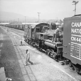
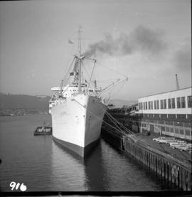
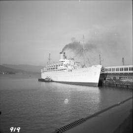
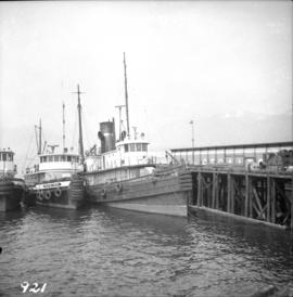
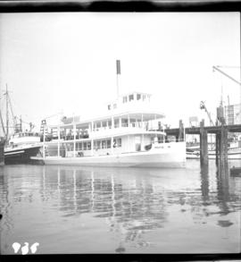
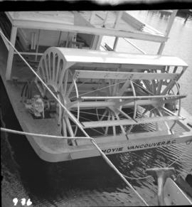
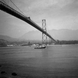
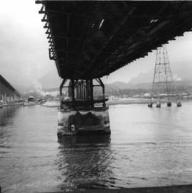
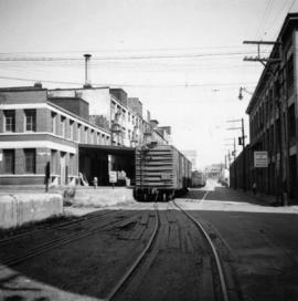
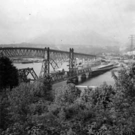
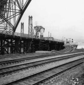
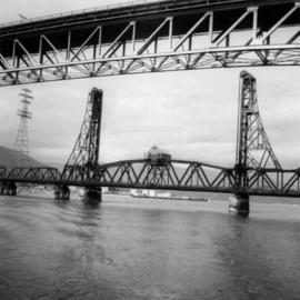
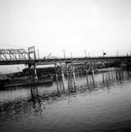
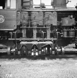
Photograph depicts Shay #115 engine at work at the Pacific Coast Terminals in North Vancouver.
Photograph depicts a 0-6-0 diesel switcher locomotive, built by Hudswell Clarke & Co. in Leeds in 1949. It still bears the number when owned by Samuel Williams of Dagenham, Essex, U.K. It is located at the Pacific Coast Bulk Terminals on the North Shore, and 1 mile east of Lions Gate Bridge.
Photograph depicts the boiler side of Shay locomotive #115 at the car tippler. It is located at the Pacific Coast Bulk Terminals in North Vancouver.
Photograph depicts Shay #115 locomotive at the Pacific Coast Bulk Terminals in North Vancouver. The engineer on locie is J.B. Kay, 4127 Yale St., in north Burnaby. He was a logging railway engineer in 20s and 30s, and then later on main line.
Photograph depicts the Pacific Coast Terminals in North Vancouver. A Shay #115 is spotting a string of cars onto tippler.
Photograph depicts the C.P. pier in Vancouver. The ship "Chusan" is unloading cargo.
Photograph depicts the Orient Line "Chusan" at the C.P. Pier . It is unloading cargo and taking on fuel.
Photograph depicts a Northland steam tug at Vancouver. The tug, "Commodore Straits," one of the largest on the coast of B.C.
Photograph depicts a replica of the S.S. Moyie built and photographed at Burrard Shipyard & Marine Ways Ltd. on 1729 West Georgia St., Vancouver. It was launched on June 15, 1965.
Photograph depicts the stern wheel details of the replica of the S.S. Moyie, taken at Coal Habour, Vancouver, two days after launching.
Photograph depicts the U.S.S. Cowell, a heavy destroyer in English Bay, Vancouver during the maritime festival.
Photograph depicts the H.N.C.S. Mackenzie in English Bay in Vancouver, during the maritime festival.
Photograph depicts the coast guard cutter "Racer" at Burrard Federal Dock in Kitsilano, Vancouver.
Photograph depicts the coast guard crash boat "Moorhen. It is an ex- RCAF rescue launch at Kitsilano Federal wharf, False Creek, Vancouver. Sister ship is the "Mallard."
Photograph depicts the Lions Gate Bridge in Vancouver, BCfrom the southeast side.
Photograph depicts the Lions Gate Bridge on the east side looking south from the shore of North Vancouver, BC
Photograph depicts the decking and piers of the northern section of the Lions Gate Bridge, looking north from the shore of North Vancouver, BC
Photograph depicts the south tower of the Lions Gate Bridge looking east with the SS Prince George in the background.
Photograph depicts the span of the Second Narrows bridge lifting from the southwest bank of Vancouver, BC
Photograph depicts the Second Narrows railway bridge in Vancouver, BCfrom the south end of the road bridge with the lifting span up.
Photograph depicts the Second Narrows Railway Bridge in Vancouver, BC, as a coastal tanker going upstream to a refinery passes beneath it.
Photograph depicts the Second Narrows Railway Bridge in Vancouver, BC, as the lifting span is starting to drop. The view is looking east towards Capitol Hill and Berry Point.
Photograph depicts the underside of the lifting span of the Second Narrows Railway Bridge in Vancouver, BCView is from the south, fixed side.
Photograph depicts the Second Narrows Railway Bridge in Vancouver, BC; view from the lifting span looking south.
Photograph depicts the lifting span of the Second Narrows Bridge with a motor car on the west roadway, as the span is about to close to its normal, flush position.
Photograph depicts the Second Narrows Railway Bridge in Vancouver, BC, from a view on the lifting span looking north.
Photograph depicts the Second Narrows Railway Bridge in Vancouver, BCfrom the south east shore.
Photograph depicts a trestle bridge for road traffic leading to the Second Narrows Bridge in Vancouver, BCThe shot is taken from the south bank.
Photograph depicts the Cambie St. Bridge in Vancouver, BC, looking east and showing the central swing span.
Photograph depicts a home located at 1459 Robson St., at the northeastern intersection of Robson and Nicola, in Vancouver B.C.
Photograph depicts Hamilton St. in Vancouver, looking northeast.
Photograph depicts a former C.P.R. connection between the False Creek yards and the south side of Vancouver harbour on West Pender St. in Vancouver, B.C. This spur used daily to get cars into the B.C. Electric Rail yard at the Georgia Viaduct from the C.P.R. False Creek yards.
Photograph depicts Mainland St. in Vancouver, B.C. , looking northeast with Helmken St. intersecting.
Photograph depicts a fire hall for fire float VFD "J.H. Carlisle" at False Creek. It is on the north shore and in line with Willow St., Vancouver.
Photograph depicts the False Creek Trestle bridge open and the Granville Bridge looking east.
Photograph depicts the piers of the south tower on the Lions Gate Bridge in Vancouver, BC
Photograph depicts the Lions Gate Bridge on west side looking south from the shore of North Vancouver, BC
Photograph depicts the Second Narrows railway bridge in Vancouver from the south bank. The bascule does not move.
Photograph depicts the north side lifting tower of the Second Narrows railway bridge in Vancouver, BC
Photograph depicts the Second Narrows Railway Bridge in Vancouver, BCwith the lifting span up.
Photograph depicts the road and rail bridges at Second Narrows, Vancouver B.C. The photograph was taken from Boundary Rd. looking north.
Photograph depicts the rail approach to the Second Narrows Railway Bridge in Vancouver, BCThe shot taken on CPR trackage and from underneath the road bridge on the south bank.
Photograph depicts the Second Narrows Railway Bridge, looking east.
Photograph depicts the road bridge crossing the south section of the north arm of the Fraser River at Fraser St. The view is from the north bank of Lulu Island.
Photograph depicts the Fraser St. road bridge over the north section of the north arm of the Fraser River, looking north from Mitchell Island to Vancouver, BC
Photograph depicts the Cambie St. Bridge in Vancouver, BC, looking southeast and showing the southern fixed span on the bridge.
Photograph depicts the building for the Vancouver Supply Company located at 25 Alexander St. in Vancouver, B.C. It is at the center of the old downtown and may have been a former fire hall.
Photograph depicts the former C.P.R. route connecting existing False Creek rail yards and the Burrard shoreline main line. The view is looking southwest from the intersection of Powell St. (in foreground) and Columbia St. (not seen) in Vancouver.
Photograph depicts the Grand Central Hotel at the intersection of Marpole Ave and Hudson St. in south Vancouver. The hotel was built in 1912 by J.J. Graver and run from 1913-1915. It re-opened in 1920 as a home for incurables (veterans). In 1937 it became the provincial infirmary and closed in May 1965.
Photograph depicts a corner building on Chilco and West Georgia St. facing Stanley Park in Vancouver, B.C. The view is looking east across Chilco St.