Mostrar 4134 resultados
Archival description
"Bella Coola, British Columbia" 1989 map
"Bella Coola, British Columbia" 1989 map

McGregor Canyon? - Above the Herrick River
"Vancouver Island's Forests"
"Vancouver Island's Forests"
"Province of British Columbia (Road Map)"
"Province of British Columbia (Road Map)"
"Biogeoclimatic Zones of British Columbia"
"Biogeoclimatic Zones of British Columbia"
"B.C.'s Endangered Wilderness: A Comprehensive Proposal for Protection"
"B.C.'s Endangered Wilderness: A Comprehensive Proposal for Protection"
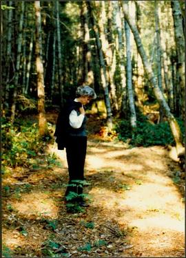
Iona Campagnolo standing alone on a path in a sun-dappled forest
"Street Map of Greater Vancouver, British Columbia"
"Street Map of Greater Vancouver, British Columbia"
"Canada Federal Electoral Districts - 1987"
"Canada Federal Electoral Districts - 1987"
Paddlewheel Park, Prince George
Paddlewheel Park, Prince George
Ashcroft - Kamloops - Hat Creek
Ashcroft - Kamloops - Hat Creek

Hat Creek Ranch - Box Barn

River Ferry

River Ferry

Abandoned Church
Maps of Prince George
Maps of Prince George

City of Vancouver, British Columbia

Gravel Pit
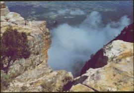
CUSO Mission in Angola - Cliffs above unknown community, clouds below
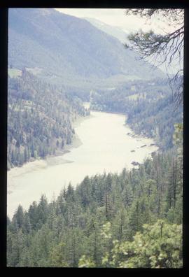
Kamloops - Lillooet
Kamloops - Lillooet

Water in Gravel Pit

Conveyor & Dump Truck at Gravel Pit
CUSO Mission in Angola - Cliffs above unknown community
Kootenay Plains
Kootenay Plains

Blackwater Road
"South Fort George: A trip to the past"
"South Fort George: A trip to the past"

Graveyard

Hat Creek Ranch - People and the Ranch House

Hat Creek Ranch - People on Ranch House Porch

Hat Creek Ranch - Road
"Saxton Lake, British Columbia" 1987 map
"Saxton Lake, British Columbia" 1987 map
Saskatchewan - 1992
Saskatchewan - 1992
L.C. Gunn Park, Prince George
L.C. Gunn Park, Prince George

Ferry into Horseshoe Bay

Hat Creek Ranch - Ranch House - Front
Small River

Sue Sedgwick and Camper

Sue Sedgwick and River
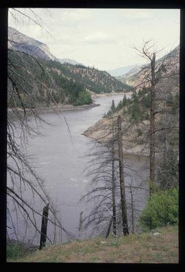
Fraser or Thompson River?
Fraser or Thompson River?
"Peace River - Liard, British Columbia" 1986 map
"Peace River - Liard, British Columbia" 1986 map
Central Interior bibliographic references
Central Interior bibliographic references
"Okanagan Connector"
"Okanagan Connector"

Bridge
Chemanus
Chemanus

Fort George Park
"Salmon Valley" 1986 map
"Salmon Valley" 1986 map
South Fort George townsite
South Fort George townsite
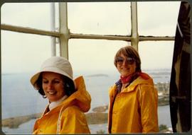
Two unidentified women in rain jackets at a window overlooking the ocean
Heritage Trail, Cottonwood Park Opening
Heritage Trail, Cottonwood Park Opening