Six men stand on boardwalk in front of theatre.
Typed annotation on recto: "Douglas Lodge Scenes Stuart Lake, B.C." Man and woman standing with fishing gear in front of log fishing bungalows in forest. Tree trunks in foreground. It is believed that this couple may be the same two people pictured in item 2004.6.28, (possibly the Factors).
Typed annotation on recto: "Fort St. James H.B.Co. Post Stuart Lake, B.C." Photograph depicts a variety of numerous white buildings enclosed behind wood fence. Field in foreground, distant hills in background.
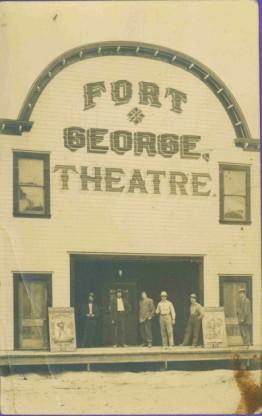
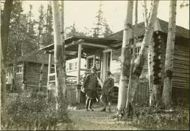
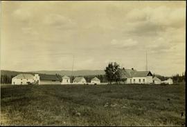
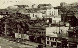
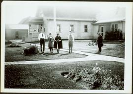
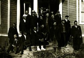
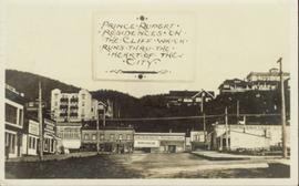
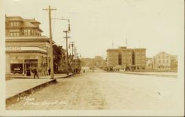
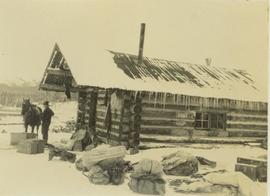
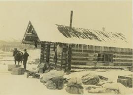
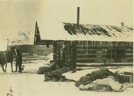
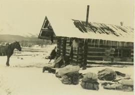
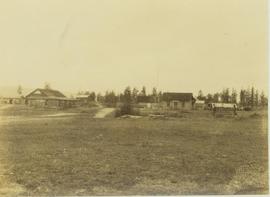
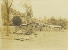
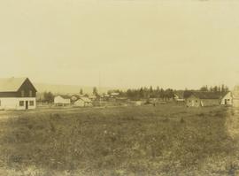
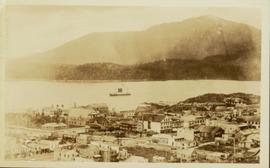
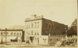
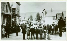
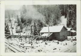
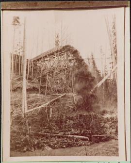
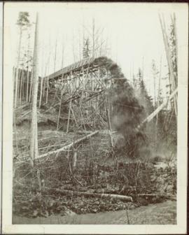
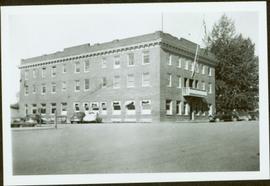
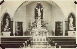
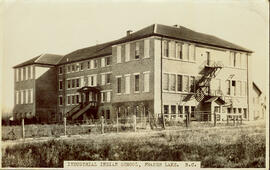
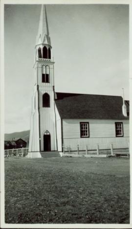
The Fred Jeffery Collection consists of three photograph albums comprising a total of 303 b&w photographs all dating from ca.1924-1933. The subject matter of these images consist primarily of the fishing industry, river & landscapes, salmon cannery images (housing, people, workers, machinery, boats) on the Nass River and North Pacific Coast. Notable are the photographs depicting indigenous (Nisga'a) people and places and Chinese and Japanese cannery workers. Identified canneries featured in these photographs include: Mill Bay Cannery, Namu Cannery, Klemtu Cannery, Shushartie Bay Cannery, Balmoral Cannery, North Pacific Cannery, Nass Harbour Cannery, Port Essington Cannery, Kitwanga Cannery, Port Nelson Cannery, Alert Bay Cannery, Dominion Cannery and ABC Co. Cannery. Photographs also include images of the Canadian Pacific Railway in both Vancouver and Sicamous, BC., as well as, images of the Legislative Assembly buildings in Victoria, the 1924 Special Service Squadron ships in Vancouver, early construction of the University of British Columbia in Vancouver, and town overviews of Yokohama, Japan (pre WWII).
Zonder titelBoardwalk in foreground, buildings and roads in mid ground, cut banks in background. Printed annotation on recto reads: “Prince George. B.C. 1921 by Moore”. Handwritten annotation in ink on verso reads: “The Netchaco river is between the mountain and the city and the C.N.R. runs along the river bank nearest the city. This picture is taken looking north.”
Slightly elevated street view of several Prince Rupert storefronts. A large pile of rubble is visible on the left of the photograph. Printed annotation on recto reads: " Prince Rupert BC." Handwritten annotation on recto reads: " July 29, 1922."
Slightly elevated street view of a large pile of rubble next to several storefronts in Prince George. Printed annotation on recto reads: "Prince Rupert BC."
Photograph depicts two women with flowers and three men standing on grass and boardwalk in foreground, large building in background.
Handwritten annotation on verso: “Government Agency at S. Fort George 1922."
Photograph depicts a group of 18 men wearing suits and ties, standing on front steps of large building with pillars.
Handwritten annotation on verso reads: "Conference of Sand Question Committee at Kincolith on Sunday, June 3rd 1923. Mr. [O'Heara?] present. [illegible initials]".
River in foreground, railroad and city in mid ground and hill in background. Printed annotation on recto reads: “Prince George. B.C. 1924”
Street view of Prince Rupert storefronts. A high cliff can be seen in the background with several large houses perched atop it. Printed annotation on recto reads: "Prince Rupert Residences on the Cliff which runs thru the Heart of the City." Handwritten annotation on verso reads: "8-18-24 I am still on the go but heading for home when [illegible] to be by Soft cot. Here seen some great scenery in Canada. Trains by boat to-night for Vancouver. Nan felt better. Love for all Chas[??]." Handwritten address on verso reads: "Mrs. Friderich Eley R [illegible] 3 Santa Ana Calif. U.S.A." Postmark stamped on verso reads: "Prince Rupert BC. 10 PM Aug 18 1924."
Wide angle photograph of a forested area with Prince George in the distance. Printed annotation on recto reads: "Prince George, B.C. 1924."
Side perspective street view of the Canadian Bank of Commerce on a deserted dirt road. Printed annotation on recto reads: "2nd Ave Prince Rupert BC." Illegible faded photographer's mark on lower right corner. Handwritten annotation on verso reads: "The houses and pavements are made of wood. Love Daddy. xx." Postcard is addressed to: "Miss Greta Poole 'Airoudale'[??] Collingwood Road Paigulou Devon England." Postmark on verso reads: "Prince Rupert BC 10:30 AM Aug 5 1925."
Plan of Port Essington consists of an architectural plan for the townsite of Port Essington compiled from plans in Land Registry and described as Composite Plan 537 (originally deposited October 17th 1893). Depicts Skeena River, Hocsal River, individual lots and streets, the B.C. Fishing and Packing Co. Ltd., a graveyard, and the Anglo British Columbia Packing Co.
Photograph depicts a man and horse standing outside a log cabin covered in snow and icicles. In the foreground of the image several loaded packs are laid out surrounding the cabin. The cabin belonged to ranger Alex Nelles' and was located at Willow Creek.
Photograph depicts trekking supplies piled outside Alex Nelles' log cabin. An unidentified man is standing outside the cabin with a horse.
Photograph depicts ranger Alex Nelles' log cabin covered in snow and ice. Beside the cabin is an unidentified man standing next to a horse with travel packs in front of the cabin.
Photograph depicts ranger Alex Nelles' log cabin covered with snow and ice. Surrounding the cabin are cabin are several loaded packs and a horse.
Photograph depicts a townsite with with several buildings and fences. The image possibly depicts Moberly, though It has been suggested that this is more likely Hudson Hope.
Photograph depicts a log cabin at Peace River with a dirt clearing in the foreground and a tree-covered environment in the background. Fist sign in images reads: "18 MLS to Rolla"; second sign reads: "Rolla Landing".
Photograph depicts the main street of Rolla with a dirt street and wooden sidewalks, tethered horses, and the storefront of H.G. Atkinson General Merchants. Three people are visible walking through the streets.
Photograph depicts a cluster of buildings at Hudson's Hope with a grassy field in the foreground. Hudson's Bay post is the building on the left.
Photograph depicts the townsite of Hudson's Hope featuring a number of small wooden buildings clustered in a field. The Hudson's Bay post is building visible on far left.
Slightly elevated photograph of Prince Rupert buildings. A lone vessel is visible in the background. Printed annotation on recto reads: "Courtesy of Can Nat'l Rys. Prince Rupert. B.C." Handwritten annotation on verso reads: "Dear Elma. We reached Prince Rupert (in the picture) today. Friday we arrive at Skagway and the glaciers. Having a fine trip- good weather and a good crowd. Love from Claire." Postcard is addressed to: "Mrs. Claude Millersh, River Forest, Guerneville, Sonoma Co., California." Postcard is affixed with a two cent American stamp. Postmark on verso reads: "Ketohikan Alaska. Jun 28 3 PM 1928."
Postcard featuring a car parked outside of Prince Rupert City Hall. Handwritten annotation on verso reads: "Alex Hall, Glyn P.O., Victoria, B.C. Prince Rupert, Billy S."
Man driving a two horse cart in front of beehive burner, cart is full of bark presumably sawed off the logs.
Handwritten annotation in pencil on verso: "Mill Burner".
Street view photograph taken at the intersection of Front Street and Carson Avenue. Several men are gathered at Cowan's Hardware store on the corner. Also visible in this photograph is the Cariboo Hotel (visible furthest to the left), and the British American Hotel which is partially visible behind the J.A. Fraser store. Printed annotation on recto reads: "On Front Street, Quesnel, B.C."
Handwritten annotation on verso “ Barkerville in 1930’s".
Street view photograph looking down Carson Avenue at the Front St. intersection in Quesnel, BC. Several identified businesses line the gravel avenue on the right; however Cowan's Hardware store is visible at the intersection on the left. Printed annotation on recto reads: "Carson Ave., Quesnel, B.C. 1930 Looking East."
Overview of the Giscome sawmill behind road. Lumber yard is visible in foreground while mill stands in background.
Handwritten annotation in pencil on verso: "Giscome Mill / lumber yard in foreground".
Bertha Collison stands on lawn in front of house (wife of Rev. W.E. Collison).
Handwritten annotation on verso reads: "Mother / Prince Rupert".
Item is a photograph of the Boy’s Parliament taken on the steps of the Legislature in Victoria. Mr. Williston is on the left in the second row from the front.
Overview of Giscome, BC showing built and natural landscape.
Handwritten annotation in pencil on verso: "Bunkhouse & Dining Room / Giscome BC".
Handwritten annotation in pencil on verso: "Daily Capacity 100,000 f.b.m. sawmill in foreground planer mill and lumber yard in background.”
Photograph depicts a large totem pole next to groomed dirt paths. Power poles and river visible in background.
Handwritten annotation on verso reads: "Edenshaw pole in park at Prince Rupert."
Groups of men and women can be seen gathered on paths between two large totem poles.
Handwritten annotation on verso reads: "Totem Park Pr Rupert park."
Photograph depicts a totem pole standing on what appears to be a large wooden deck or boardwalk, view of the city in background.
Handwritten annotation on verso reads: "Totem pole in park in Prince Rupert".
Photo is adhered to paper backing, upon which handwritten annotation on recto reads: “Placer mining Hixon B.C. Hungry 30ies. This picture taken on top of hill across from Quesnel Quartz Mine maybe 800 ft west of Quartz taken approx 45 yrs ago (1933) 1978.12.19”
Photograph depicts two wooden buildings in a snow covered forest environment. Photo is adhered to paper backing, upon which handwritten annotation on recto reads: “Quesnelle Quartz Mining Co. Hixon BCTaken in mid 1930ies. Power house from rear. Present day (1973) Logging road would run through powerhouse at immediate rear of it at which you are looking. Tom Marsh Box 150 Squamish BC 1978.12”
Photograph depicts a dam and spillway obstructing a creek. Photo is adhered to paper backing, upon which handwritten annotation on recto reads: “This is the dam and spillway about nine miles up Hixon Creek belonging to the Hixon Creek Cariboo Gold Co., whose main camp on Hixon Creek was at the falls. A fellow Sterling or Bill Tordiffe & I took a contract to cut the logs for this dam in January 1934. The first few winters Quart [sic] Quesnel Quartz had to shut down for snow”
Photograph depicts a snow-covered forest clearing with six structures and a truck. Buildings have been numbered 1-8 with pen. Original handwritten annotations on verso of photograph are signed by Tom Marsh. Photograph is taped to paper. Typed annotation on recto of paper reads: “1. Bridge over creek. 2. Blacksmith shop. 3. Powerhouse. 4. Headframe over 200’ shaft. 5. Office 6. Water tanks from powerhouse. 7. Bunkhouse. 8. Truck. 9. Cookhouse behind #6 cannot be seen. We were always able to find the cookhouse even though hidden in this picture. Taken about 1935 by Russell Ross, supt. Quesnel Quarts Mine. Tom Marsh, Box 156, Squamish B. C.”
Photograph depicts two wooden buildings in a snow covered forest environment. Photo is adhered to paper backing, upon which handwritten annotation on recto reads: “Quesnelle Quartz mining Company Hixon, B.C. Taken in mid nineteen thirties. Powerhouse from rear. Present day (1973) logging road would run through powerhouse at immediate rear of it at which you are looking. Tom Marsh Box 156 Squamish BC V0N 3G0 December 1978”
Photograph depicts a wooden flume funneling water in a forested area. Photo is adhered to paper backing, upon which handwritten annotation on recto reads: “First wash for gold by Hixon Creek Cariboo Gold Co. Across Hixon from Quesnel Quartz up the hill. North side of creek 1930’s”
Photograph depicts a wooden flume funneling water in a forested area. Photo is adhered to paper backing. Original annotations on verso of photo are covered by paper mounting. Typed annotation on recto of paper reads: “First wash for gold by Hixon Creek Cariboo Gold Co. Across Hixon from Quesnel Quartz up the hill. North side of creek 1930’s”
Item is a photograph of Ray and Gladys Williston in front of their home in Princeton.
Photograph depicts large three story building, road and parked cars in foreground.
Annotation on verso: “Court House and Prov. Govt. offices at Pr. George. Once used to be 'Alexandra Hotel' now site occupied by Kresge’s. Alexander Hotel. Opened Sept 25, 1915."
Interior photograph of a church. Printed annotation on recto reads: “Chapel, Indian school, Fraser Lake B.C.”
Exterior photograph of a residential school. Printed annotation on recto reads: “Industrial Indian school, Fraser Lake. B.C.
Exterior side view of a Catholic church built between 1876-1878 by Father George Blanchet. Handwritten annotation on verso in pencil reads: “Our Lady of Good Hope, Stuart Lake, Fort St. James, BC ”
Street view of a large crowd of veterans marching down a street in Prince Rupert. Printed annotation on recto reads: "3." Handwritten annotation on verso reads: "Prince Rupert: Nov. 11. 1940. Main St."