Photograph depicting a dirt road winding between grass and trees in Soda Creek.
Photograph depicting a dirt road winding between grass and trees in Soda Creek.
Photograph depicts an open grassy field surrounded by trees in Soda Creek.
Photograph depicts a monument and grave stone for Captain Frank Odin of the Steamboat Charlotte. Annotation on verso: "Capt. Odin Monument, Soda Creek cemetery, 2010".
Photograph depicts Celia M Dusseau's grave stone in the Soda Creek Cemetery.
Photograph depicts the graves of Edmund Shepherd, Elsie Rankin, and Elize Shepherd at the Soda Creek Cemetery.
Photograph depicts the graves of Seward Rankin, Gerald Rankin, and James Rankin at the Soda Creek Cemetery.
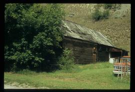
File consists of photographs depicting Soda Creek Cemetery and presumably the general Soda Creek area. Also includes photographs of a personal residence and Kent Sedgwick with a dog.
File consists of photographs depicting the North Thompson region. Includes photographs of a CN locomotive, an old barn, and Blue River Store. Also includes photographs of Trelle Morrow and Jim Rankin at the Soda Creek Cemetery in 2010.
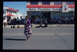
Image depicts a woman, wearing clothes reminiscent of traditional First Nations, who appears to be dancing in the street outside of a Native Friendship Centre in Prince George, B.C. A large crowd is looking on.
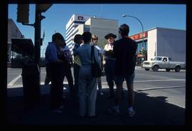
Image depicts a group of individuals standing on the corner of 3rd Ave in Prince George, B.C.
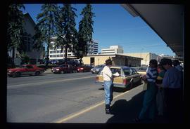
Image depicts a group of individuals on the sidewalk outside Spee-Dee Printers on Brunswick Street in Prince George, B.C.
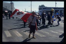
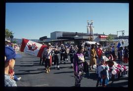
Image depicts a marching band with numerous other unidentified individuals. One man is carrying a Canadian flag with the depiction of men in a boat and the words "Canada Sea-to-Sea" on it.
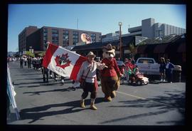
Image depicts a marching band with numerous other unidentified individuals. One man is carrying a Canadian flag with the depiction of men in a boat and the words "Canada Sea-to-Sea" on it, and there is a mascot beside him that appears to be a chipmunk in an RCMP uniform.
Image depicts a marching band with numerous other unidentified individuals. One man is carrying a Canadian flag with the depiction of men in a boat and the words "Canada Sea-to-Sea" on it.
Image depicts the government liquor store in Atlin, B.C.
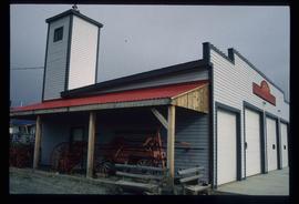
Image depicts the fire hall in Atlin, B.C.
Image depicts the Moose Hall in the Atlin Museum. A sign above the door reads: "In 1905 this building was the new Arctic Brotherhood Hall in Discovery. Some years later it was hauled here in two parts by horses to become the Moose Lodge and Community Hall."
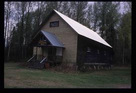
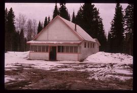
Image depicts the community hall in Penny, B.C.
Image depicts the Giscome Community Hall in Giscome, B.C. Map coordinates 54°04'18.5"N 122°21'57.7"W
Image depicts the community hall in Dome Creek, B.C.
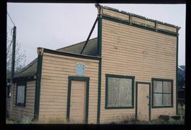
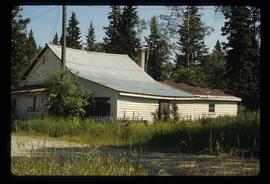
Image depicts an old, boarded-up store/office in Lamming Mills, B.C.
Image depicts the old, boarded-up community hall in Lamming Mills, B.C.
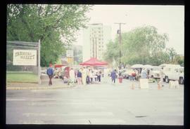
Image depicts a street, possibly in Kamloops, which has been closed for a Sunday morning Farmer's Market.
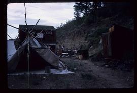
Image depicts a gathering of people for an uncertain event at an uncertain location, possibly in Lillooet, B.C. A few tents are set up in the picture.
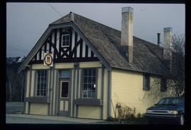
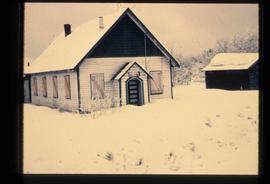
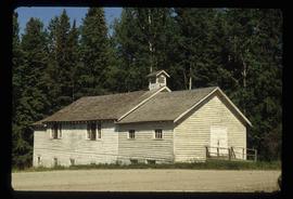
Image depicts the old community hall in Soda Creek, B.C.
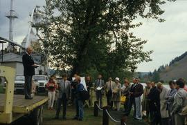
Image depicts a group of people in Cottonwood Park with an individual, possibly former mayor Elmer Mercier, making an announcement.
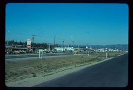
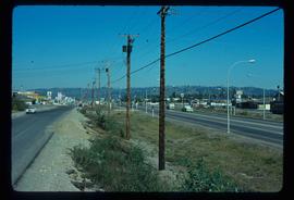
Image depicts Highway 97 at 15th Ave. looking north. Map coordinates 53°54'42.1"N 122°46'53.1"W
Image depicts Highway 97 at 15th Ave. looking north. Map coordinates 53°54'36.0"N 122°46'55.5"W
This fonds consists of material created and collected by Kent Sedgwick, author, professor, Prince George urban planner, and prominent local historian. This body of records documents Sedgwick’s research interests in the history and geography of the Central Interior of British Columbia. The fonds also reflects his work as a Prince George Senior City Planner, his involvement in local community organizations, and his teaching at the College of New Caledonia and the University of Northern British Columbia.
The fonds includes:
1) Photographs taken by Kent Sedgwick across British Columbia, predominantly in the Central Interior region;
2) Research subject files consisting of original research documentation and collected reference material, predominantly focusing on topics relating to local history, city planning, and geography in the Prince George area and the British Columbia Central Interior;
3) Documentation of Kent Sedgwick’s community involvement, including records created over the course of his work with the Prince George Heritage Commission, , the Alexander Mackenzie Heritage Trail Association, and other local organizations;
4) Writings, publications, and lectures written, edited, or conducted by Kent Sedgwick;
5) Professorial records consisting of lectures and material relating to Sedgwick’s teaching appointments at the College of New Caledonia and the University of Northern British Columbia;
6) Maps collected by Kent Sedgwick covering historical and contemporary British Columbia.
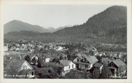
Overhead view of a residential area in Prince Rupert, BC. Printed annotation on recto reads: "Prince Rupert, BC Photo by J.W."
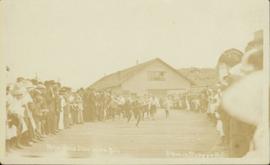
Photograph of a large crowd gathered around several young boys running a race in Prince Rupert, BC. Printed annotation on recto reads: "Boys Race Dominion Day Prince Rupert BC."
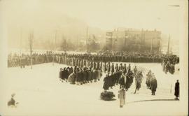
Slightly elevated view of a large crowd gathered in a park during the winter in Prince Rupert, BC. They appear to be observing some sort of ceremony or event that is out of frame.
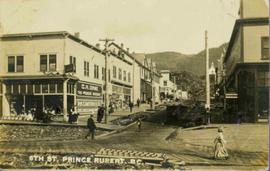
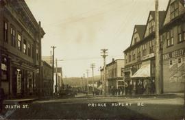
People, boardwalks, and store signs visible in street scene. Printed annotation on recto reads: “6th St. Prince Rupert. B.C.” Handwritten message in ink on verso is addressed to: “Mrs. Loistram Halls Buildings Nicholas St Limerick Ireland”. Verso stamped "PRINCE RUPERT JUN 30 10".
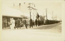
Street view of a large crowd of veterans marching down a street in Prince Rupert. Printed annotation on recto reads: "3." Handwritten annotation on verso reads: "Prince Rupert: Nov. 11. 1940. Main St."
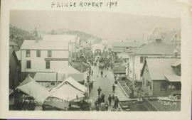
Photograph depicts crowds of people walking through street, hills in background. Printed annotation on recto reads: “Centre St. Prince Rupert May Celebrations 1909, Allen Photo July 09.” Handwritten annotation in ink on recto reads: “Prince Rupert 1909”
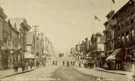
Street view of Third Avenue in Prince Rupert. A large crowd of people is gathering along the sidewalks. Printed annotation on recto reads: "Third Ave. Prince Rupert. B.C."
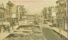
Typed annotation in red ink on recto reads: “3rd Ave. Prince Rupert. B.C.” People, boardwalks, horse & wagons and store signs are visible. Rubble and unknown material lies on ground between boardwalks. Typed annotation in red ink on recto reads: “3rd Ave. Prince Rupert. B.C.”
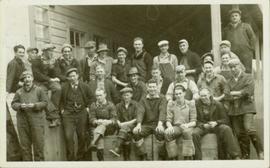
Large group of working men gathered for a photo on the porch of a building in Prince Rupert. Some men are wearing gumboots, perhaps indicating that they are fisherman.
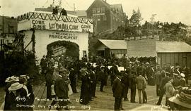
Large crowd gathered on the street in downtown Prince Rupert around a lavishly decorated arch which reads "Come One Let 'Em All Come Come All. Welcome to Prince Rupert." Annotation on recto reads: "Arch Prince Rupert, BC. Dominion Day Celebration 1909. Allen Photo."
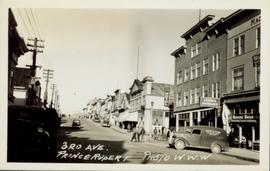
Side perspective street view of the Royal Hotel in Prince Rupert BC. The "Ladies [sic] Entrance" sign is visible on the right side of the building. Several vehicles can be seen on the street. Printed annotation on recto reads: " 3rd Ave Prince Rupert Photo W.W.W."
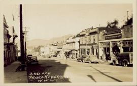
Street view of several business in Prince Rupert BC. "McRae Bros. Ltd." and "Mussallems Economy Store" are situated on the right side of the street. Printed annotation on recto reads: " 3rd Ave Prince Rupert B.C. W.W.W."
Street view of Sixth Street in Prince Rupert BC. A small group of men is shown loitering on the sidewalk. Annotation on recto reads: "Sixth St. Prince Rupert BC." Handwritten annotation on recto is heavily obscured by glued on paper and reads: "Prince Rupert [illegible] 12th 12 Dean Harry! [Illegible] lived here last night after [illegible] pleasent[sic] trip. What do you think of this city since you saw it last. Saw George before I left Vancouver, he looks still the same. Kindest regards to you & wife. Nib [??]." Postcard is addressed to: "Mr H Banker 2732 Arch Ave West Seattle Wash USA." Postcard is affixed with a one cent Canadian stamp. Postmark reads: "Prince Rupert BC PM 2 1 JUN 12."
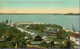
Hand coloured view of early Prince Rupert with row of tents facing large Hotel. Printed annotation in red ink on recto reads: “The Beginning of Prince Rupert B.C.: Grand Trunk Pacific Hotel in foreground”.
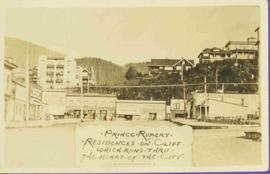
View of large houses on hill and city streets below. Printed annotation on recto reads: “Prince Rupert Residences on Cliff Which Runs Thru the Heart Of the City”.
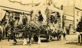
Photograph depicts a team of Clydesdale horses pulling a decorated wagon. Printed annotation on recto reads: “Dominion Day Prince Rupert BC 1914” Handwritten annotation in pencil on verso reads: “1914 Dominion Day Prince Rupert.” Handwritten annotation in ink on verso is addressed to “Mrs. Herbert Hampton New Harvey House Niagara Falls New York” Cancelation mark on Canadian 1 cent stamp is dated: July 22, 14
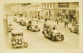
People, cars, and trucks visible on street, buildings in background. Handwritten annotation on verso reads: “P. Rupert Main Street British Columbia Canada, McRae Bros".
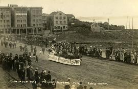
Crowd is gathered for Dominion Day Parade. Decorated float can be seen in centre of street, and Hotel Prince Rupert stands in background. Printed annotation on recto reads: “Dominion Day Prince Rupert 1914 Photo W.W.W.” Handwritten message in ink on verso is addressed to “Mr. S. Smart 2550 Blackwood St Victoria B.C.”
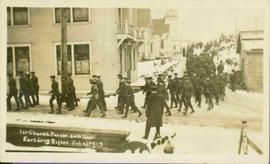
Parade of uniformed men through streets. There is snow on the ground. Printed annotation on recto reads: “1st Church parade 30th Batt Earl Grey Rifles Feb 21st,15, McRae Bros,” handwritten in pencil on verso: “Prince Rupert”. Handwritten message is addressed to “Dear Grandma”.
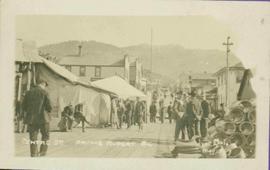
Street scene depicts people, boardwalks, tents, and store front. Printed annotation on recto reads: “Centre St. Prince Rupert: B.C., Allen Photos May 17. 09” Handwritten message on verso is addressed to “Dearest Darr”
