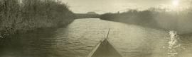
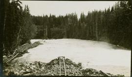
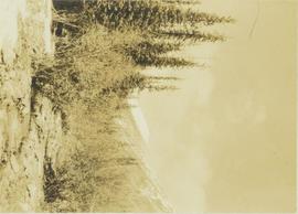
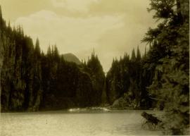
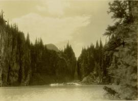
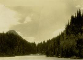
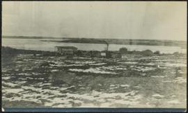
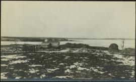
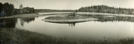
Photograph depicts reeds and marsh grasses in the foreground, a beaver house at center of photograph with open water and treed shoreline in the distance.
Photograph depicts the bow of a boat in the foreground, a wide shallow channel extending beyond the boat perhaps opening to a lake beyond. Treed forest on the far shore, a lone mountain peak in the distance.
Image depicts a small lake somewhere in Mt. Robson Provincial Park.
Image depicts a small, abandoned house in Woodpecker, B.C.
Young unidentified girl stands on wood sidewalk in front of wood building.
Track is laid next to a construction area for a fish ladder.
Man in suit and hat is believed to be R.A. Harlow
Photograph depicts a two men on small fishing boat, called a gillnetter, moored at a fish packer dock with six men at work. One man is transferring materials from crates into large bags while several others watch. Handwritten annotation in pen on verso reads: “Fish Packer”
Image depicts an aerial view of what appears to be a small farm, possibly in the McGregor Canyon.
Photograph depicts a small creek running through a wooded landscape with part of the Rocky Mountains visible in the background.
Photograph of a small creek traveling through several rocky embankments.
Photograph depicts a small coaster.
Photograph depicts a small coal tram at Tsable coal pit near Fanny Bay on Vancouver Island.
Photograph depicts a small coal drift mine which worked perhaps 6 months prior to the picture being taken. Timber lands # 8, Cranberry, about 17 miles south of Nanaimo.
Child stands in distance beside tall totem pole. Tree stumps in foreground, forest and mountains in background.
Handwritten annotation on verso reads: "[Sanabati near Upper Queen?] Kasaan Alaska".
Photograph depicts a small water proofed car, fitted with mops.
Photograph depicts small building speculated to be a house in a farm yard. Frozen water crosses midground, opposite shore in distance.
Unidentified boy walks on a wood boardwalk, carrying large bundle. Forest in background.
Handwritten annotations on verso read: "Young boy carrying furs - Village of Kincolith"; "Little Indian boy carrying bear skin [?] at Gitlakdamix".
Photograph depicts James Joseph Claxton, on board the M.S. Columbia, awaiting the arrival of a public health nurse, lighthhouse keeper and assistant lighthouse keeper who are approaching in a small boat. Handwritten annotations on verso read: “James Joseph Claxton - my uncle. Cook on the Columbia”; “James Joseph Claxton. JJC awaiting arrival of Public Health Nurse, Lighthouse Keeper and Asst Light house Keeper at Pine Island between Port Hardy & Bull Harvour. M.S. Columbia, Columbia Coast Missions (Anglican)”
Photograph depicts a small barn that had just been built within the last 12 months.
Caption describing photograph: "Small area of transplants on West side of clearing, established Spring 1966. Note thrifty stand of aspend with Spruce understory, typical of stands on this soil type and history of burning."
Image depicts the location of a slump type of landslide at Moose Heights, north of Quesnel, B.C.
Image depicts an aerial view of a section of land, likely near the Fraser River, that is possibly either a slump or part of a mining operation. The slide is labelled "slump or mining."
Image depicts what is likely a slump slide at an unknown location.
Image depicts an unknown individual standing near what is most likely a slump slide at an uncertain location.
Image depicts two unknown individuals standing near what is most likely a slump slide at an uncertain location.
Image depicts an unknown individual standing next to what appears to be a slump type of landslide at an unknown location.
Photograph depicts sluicing monitors that were used to tear down and break up alluvial gold bearing material.
Photograph depicts sluice trunk in mining area, men on tall structure in background.
Photograph depicts the sluice gates off the Nicola River, on a ranch at Nicola village, 7 miles northeast of Merritt.
Image depicts a slug on the forest floor somewhere on Haida Gwaii.
Image depicts a few unknown individuals canoeing in a slough area while on approach to Bowron Lake.
Image depicts a slough area while on approach to Bowron Lake.
Image depicts the slopes of Tabor Mountain in Prince George, B.C.
Photograph depicts what is thought to be the Slocan branch line, near Passinae which is at mile 10.8 gtom south Slocan. This is at the point where the rail road and river lie close together. Approximately 20 miles west of Nelson.
Photograph depicts the Silver Ledge Hotel, Ainsworth Hot Springs, on the west side of Kootenay Lake, north of Nelson.
Photograph depicts the general view of a slipway that was used for pulling stormwheelers out of the water. It had 5 sets of ways.
Photograph depicts two men preparing to sling asbestos bags from a collapsed unit on a ship, possibly in Sydney harbour.
Photograph depicts Slim Williams and four members of his dog team in the centre of the image, with a group of men, women and children standing behind him looking towards the camera. Handwritten annotation along bottom of photograph reads: "'Slim' Williams and Dog Team From Alaska to Chicago 1933". It is believed this photograph was taken in Hazelton, BC. and documents Slim Williams on his way to the Chicago Fair.