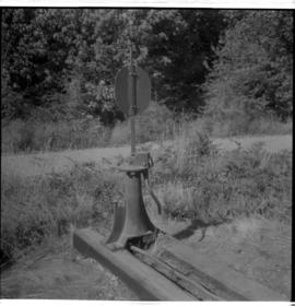
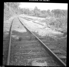
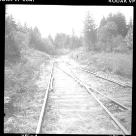
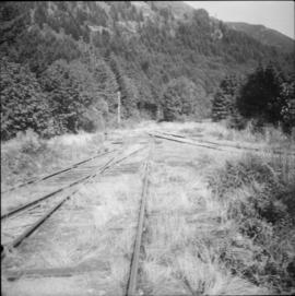
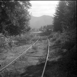
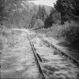
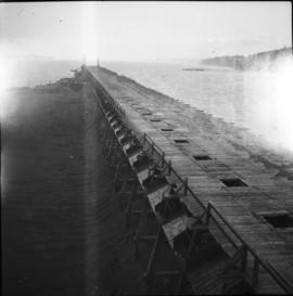
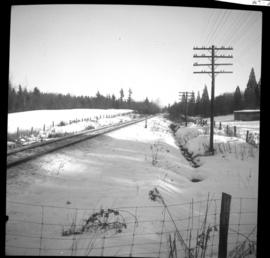
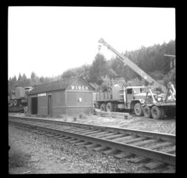
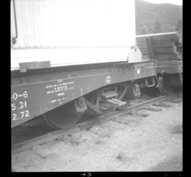
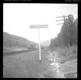
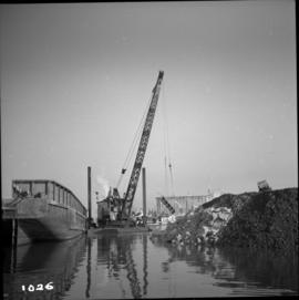
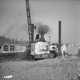
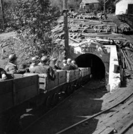
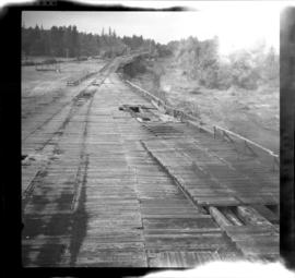
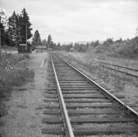
Photograph depicts double tracking that was in progress. Existing siding was about to be spliced into a new south bound track.
Photograph depicts the grade crossing at Topham Road in the community of Walnut Grove within Langley, BC
Photograph taken at the "Winch Spur" depot, located 1 mile south of Lytton and Fraser Canyon. Image displays contractors erecting a high voltage transmission line from the Peace Dam to Vancouver. They had just reached this point and now were using a used single spur to offload trucks, electric cable, etc.
Photograph depicts a setak decked, flat car with old style springs carring a modern bunk car. It was part of a 5 car work train containing a gondola, tool, generator, above car, and a depressed flat car to carry a bulldozer.
Photograph depicts a tool generator car. Image captures part of a five car work train containing: a gondola, tool car, box car, bunk, as well as a depressed flat car to carry a bulldozer.
Photograph depicts work cars found in the background. Siding here could hold 54 cars. Davies notes that Wire Cache was named so because an overland telegraph company dumped a telegraph wire by the a stern wheeler.
Photograph depicts details of a switch stand built by Canadian Ramaco Iron Works, Niagara Falls patented 1933. Found adjacent to the BC Forest Products Mill.
Photograph taken 200 yards west of the Youbou depot which can be seen through the trees at the top right. The spur lead to the BC Forest Products Mill.
Photograph taken at the end of the CNR track on Vancouver Island. The track was built in 1928 and it went to the end of Cowichan lake at Kissinger, but it was cut back in 1936 to Hawes on mile 90.6. The track was reduced by 8 miles to this point prior to 1972.
Photograph taken at the end of the branch line from Cowichan Bay to the BC Forest Products Mill in Youbou.The spur on the right was the second of 2 rail entrances to the mill and was the one that was most often used.
Photograph depicts a private spur leading to the BC Forest Products Mill.
Photograph depicts a switch found in the immediate foreground that lead to a totally overground "Y" on the right.
Photograph depicts a coach stock in the C.P.R. False Creek yards in Vancouver, B.C.
Photograph depicts Coal Harbour in Vancouver. The view is looking east.
Photograph depicts Coal Harbour in Vancouver. The view is looking east at the Bayshore Hotel and facing the Harbour Park Development site, newly filled with rock.
Photograph depicts Coal Harbour in Vancouver. The photo was taken nearly at the head of the harbour on the south side.
Photograph depicts a general view of Coal Harbour in Vancouver, taken from its head in Stanley Park, looking east. The Bayshore Inn is shown on the extreme left of the image.
Photograph depicts the upper end of Coal Harbour, on the south shore looking southwest and taken from the dock of the Vancouver Shipyards Ltd.
Photograph depicts a general view of Coal Harbour in Vancouver, looking southeast and taken from Royal Vancouver Yacht Club premises. Photo shows the Bayshore Hotel on the extreme left.
Photograph depicts the west end of Coal Harbour looking south to West Georgia St. and Chilco-Gilford block beyond. The old pilings exposed at low tide.
Photograph depicts a general view of the upper and south shore section of Coal Harbour in Vancouver, B.C.
Photograph depicts a general view of the last 300 yards of the upper neck of Coal Harbour in Vancouver, B.C. The view is looking west and taken from the south side.
Photograph depicts the west end of Coal Harbour looking south to West Georgia St. and Chilco-Gilford block beyond. The old pilings exposed at low tide.
Photograph depicts a general view of Coal Harbour in Vancouver, looking southeast and south with Marine Building (downtown) on extreme left and Stanley Park (unseen) at extreme right.
Photograph depicts the Tsable coal pit on Vancouver Island as the first coal of the afternoon shift being hauled up.
Photograph depicts coal miners near Buckley Bay. The afternoon shift (3 p.m.) is going down the Tsable drift mine, which is the only working coal pit on Vancouver Island in 1964 and has a total of 70 employees. It is run by the Comox Colliery Co. and has a daily production of 200-300 tons.
Photograph depicts coal wharves at the seaward end of the railway that connected with coal mines at Cumberland and Union Bay. Image captured looking northwest with coke ovens located on the right and covered by brush.
Photograph depicts coal wharves of a defunct railway that ran bewteen coallieries at Cumberland and Union Bay. The ground on the left appeared to be filled, recently dumped and bulldozed flat.
Photograph depicts the coaling wharf at Union Bay on Vancouver Island. It is the property of the Canadian Colliery Resources Ltd. It was last used on August 15, 1960. Thereafter, all equipment and railways were dismantled but the water tank is still standing.
Photograph depicts the coast guard crash boat "Moorhen. It is an ex- RCAF rescue launch at Kitsilano Federal wharf, False Creek, Vancouver. Sister ship is the "Mallard."
Photograph depicts the coast guard cutter "Racer" at Burrard Federal Dock in Kitsilano, Vancouver.
Image depicts the coastline of Haida Gwaii, B.C.
Image depicts a view of the coast of Haida Gwaii.
Image depicts an aerial view of the coastline of Haida Gwaii, B.C.
Image depicts a view of the coast of Haida Gwaii.
Image depicts the coastline of Haida Gwaii, B.C.
Image depicts a view of the coast of Haida Gwaii.
Photograph depicts a dock on the left, water, low treed hills in the center of the photo and mountains in the distance.
Image depicts the coastal forests on the shores of Haida Gwaii, B.C.
Image depicts the coastal forests on the shores of Haida Gwaii, B.C. An unknown individual is crouching on the beach in the image.
Image depicts numerous trees in the coastal forest of Haida Gwaii, B.C.
Photograph depicts a view from a water vessel looking toward an inlet and mountains near the shore.
Photograph depicts a coastal shoreline with docked boats and residential area in background.
Photograph depicts a Coastgaurd ship, "Narwhal," at the Department of Transport wharf in Seal Cove.
Photograph depicts the coasting vessel "Hecate Prince" owned by the Northland Navigation Co. Ltd. at their wharf on the southeast side of Vancouver Harbour.
Photograph depicts the Cobble Hill Station on the Esquimalt and Nanaimo Railway on Vancouver Island. The view is looking south.