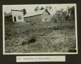
2011.3.3.111
·
Item
·
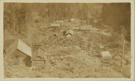
October 1909
Part of North Coast & Central BC Postcard Collection
Photograph of Prince Rupert businesses amidst clear cut stumps. Businesses include "Stewart and Mobley Groceries, Fruits and Produce." Printed annotation on recto reads: "Prince Rupert, B.C., Oct. 09."