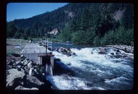
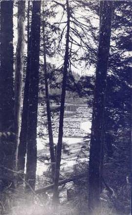
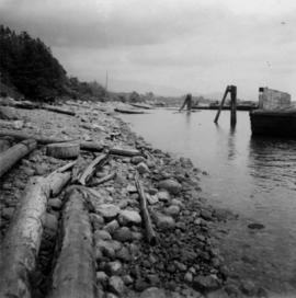
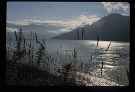
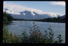
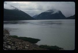
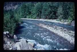
Image depicts a small river somewhere in or near Seton Portage, B.C.
Image depicts a river somewhere in or near Seton Portage, B.C.
Image depicts the train station in Seton Portage, B.C.
Photograph depicts several wooden buildings on the shoreline with a forested area in the background.
Photograph depicts several cannery buildings on pilings with water in the foreground and a forested area in the background.
Photograph depicts several log booms on the water with a forested area in the foreground.
Image depicts a woman, possibly Sue Sedgwick, sitting in a shack on a beach on Haida Gwaii.
Image depicts two old shacks and a mountain in the background. Possibly located in or near Longworth, B.C.
Photograph depicts tree shadows halfway up the steep slope of man-made embankment, forest in background. Tracks made my machinery are visible in dirt of the cut.
Image depicts a shed in an unknown location.
Image depicts a shed on the shore somewhere on Haida Gwaii.
Image depicts several ships on the water in Prince Rupert, B.C.
Image depicts the shore line and surrounding land of a lake or river at an airport, possibly in Prince George, B.C.
Image depicts a downward view of a small section of the shore of Haida Gwaii.
Photograph depicts a the shoreline of Vancouver Harbour, looking east from the property line of the Burrard Grain Elevator, 375 Low Level Rd, North Vancouver.
Image depicts a vehicled parked on the side of the road, with a view of the coast of Haida Gwaii in the background.
Side view photograph of a small harbor close by a shoreline littered in organic debris. A foggy mountain range is visible in the background. Annotation on recto reads: "Wharf and Harbor Prince Rupert. May 1908 JDA."
File consists of a photograph commemorating the signing of the first Aleza Lake Research Forest Management Plan. Front row, left to right: Ken Pendergast, BC Forest Service Prince George District Manager; Harry Coates, BCFS Forest Research Technician (1957-1993); John Revel, BCFS Silviculture Forester (1960-1993). Back row, left to right: Mike [?], BCFS Prince George Silviculture Manager; Henry Benskin, BCFS Research Branch; Michael Jull, BCFS Research Silviculturist, Prince George Region; Dan Lousier, BCFS Prince George Region Research Section Head; Brian Harding, Northwood Pulp & Timber Ltd. Woodlands Manager.
Image depicts layers of silt along the Chilako River near Blackwater Road, Prince George, B.C.
Image depicts a beehive burner covered in snow in Sinclair Mills, B.C. Map coordinates 54°01'17.4"N 121°40'53.0"W
Image depicts railway tracks and buildings with a beehive burner on the left. The location is likely Sinclair Mills, B.C. Map coordinates 54°01'17.4"N 121°40'53.0"W
Map reproduction of the Sinclair Spruce Lumber Co. Ltd. T.S.H.L. A01848 C.P. 310 cutting area, likely in the Aleza Lake Research Forest.
Image depicts the Skeena River at Hazelton, B.C.
Image depicts the Skeena River.
Image depicts the Skeena River at Hazelton, B.C.
Image depicts the Skeena River, as well as a stretch of highway that appears to be under construction.
Image depicts the Skeena River somewhere near Prince Rupert, B.C.
Reproduced map on mylar depicts locations of elevations and benchmarks at the Aleza Lake forest.
Image depicts the community of Skidegate on Haida Gwaii.
Image depicts a skier in a costume with a fake sword, somewhere on the Birchleg Ski route on Tabor Mountain in Prince George, B.C.
Image depicts a vehicle and a large group of skiers somewhere on Tabor Mountain in Prince George, B.C.
Image depicts numerous skiers and skis that are standing upright in in the snow on Tabor Mountain in Prince George, B.C.
Image depicts numerous skiers on the Birchleg Ski route on Tabor Mountain in Prince George, B.C.
Image depicts numerous skiers cross-country skiing on a trail through trees on the Birchleg Ski route on Tabor Mountain in Prince George, B.C.
Image depicts the sky at either dusk or dawn, from an unknown location.
Image depicts the slopes of Tabor Mountain in Prince George, B.C.
Image depicts a slough area while on approach to Bowron Lake.