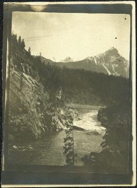
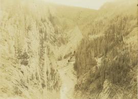
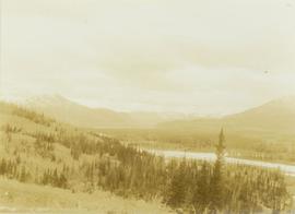
Showing 3113 results

Archival description
Ranch of the Vikings
2012.13.1.85.32 · Item · [1978?]
Part of J. Kent Sedgwick fonds

Image depicts the ranch house of the Ranch of the Vikings, originally owned and operated by Bjorger Pettersen, a member of the Canadian Ski Hall of Fame, from 1970 until 1985. It is located somewhere west of McBride, B.C.

2000.19.1.154 · Item · 20 Sept. 1926-19 Oct. 1926
Part of Prentiss Gray Collection

Photograph depicts a man and horse standing outside a log cabin covered in snow and icicles. In the foreground of the image several loaded packs are laid out surrounding the cabin. The cabin belonged to ranger Alex Nelles' and was located at Willow Creek.

Raven Lake Area
2012.13.1.79.24 · Item · Aug. 1977
Part of J. Kent Sedgwick fonds

Image depicts several individuals hiking in the area surrounding Raven Lake; the lake is visible in the background.

Raven Peak
2012.13.1.79.01 · Item · June 1977
Part of J. Kent Sedgwick fonds

Image depicts Raven Peak in the Sugarbowl Grizzly Den Protected Area located on Highway 16 east of Prince George, B.C.

Rearguard Falls
2012.13.1.85.02 · Item · 1970
Part of J. Kent Sedgwick fonds

Image depicts the Rearguard Falls in Rearguard Falls Provincial Park near Tête Jaune Cache along the Yellowhead Highway.

Red Rock (?)
2012.13.1.4.33 · Item · [2000?]
Part of J. Kent Sedgwick fonds

Image depicts a road, forest, and hill rise in an uncertain location possibly near Red Rock, B.C.

2006.18.5.18 · File · 1974
Part of Aleza Lake Research Forest Society fonds

File is a Resource Folio of maps and accompanying information created by Northwood Pulp & Timber regarding Timber Sale Harvesting Licence A01847, Willow River Block, Willow River P.S.Y.U. Includes maps that depict ungulates, waterfowl, recreation areas, special influence areas, and timber types. Most of the sheets have a duplicate, some with very slight variations. The following maps are supposed to be included in the but were missing upon arrival at the Archives: fish & topography, cutting permits & roads, and soils.

River
2012.13.1.50.080 · Item · [1978?]
Part of J. Kent Sedgwick fonds

Image depicts a river and a hillside at an unknown location.

River
2012.13.1.3.124 · Item · 12 Oct. 1989
Part of J. Kent Sedgwick fonds

Image depicts a river, possibly the Nechako, in Prince George, B.C. Possibly taken from the Foothills Bridge.

River
2012.13.1.50.112 · Item · 1980
Part of J. Kent Sedgwick fonds

Image depicts a river, possibly the Fraser, at an uncertain location.

River and Canoe
2012.13.1.46.31 · Item · 1980
Part of J. Kent Sedgwick fonds

Image depicts a man in a canoe on a river somewhere in South Tweedsmuir Provincial Park. The man is possibly Kent Sedgwick.

River and Mountains
2012.13.1.6.101 · Item · Aug. 1980
Part of J. Kent Sedgwick fonds

Image depicts a river, possibly either the Nechako or the Fraser, and a mountain range from an unknown location.

River and Mountains
2012.13.1.59.11 · Item · July 1980
Part of J. Kent Sedgwick fonds

Image depicts a river on the left of the image and a range of mountains in the distance, located somewhere near Bralorne, B.C.

River and Snow
2012.13.1.87.154 · Item · [between 1975 and 1995]
Part of J. Kent Sedgwick fonds

Image depicts what appears to be a small, narrow river, and mounds of snow. The location is uncertain.

River Ferry
2012.13.1.66.01 · Item · June 1987
Part of J. Kent Sedgwick fonds

Image depicts a ferry on a river, possibly the Fraser River in the Lillooet area.

River Ferry
2012.13.1.66.02 · Item · June 1987
Part of J. Kent Sedgwick fonds

Image depicts a ferry on a river, possibly the Fraser River in the Lillooet area.