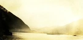
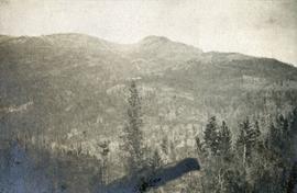
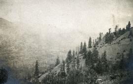
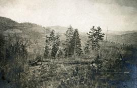
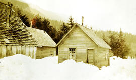
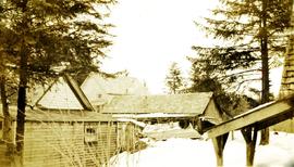
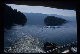
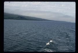
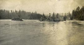
Photograph depicts the rough waters and rocks at Fort George Canyon.
Image depicts the canoe group around a campfire at the head of Indianpoint Lake.
Image depicts the head of Lillooet Lake.
Photograph depicts open water, treed shoreline on the perimeter and distance. Handwritten annotation below photograph reads, "Head of Portland canal, taken 7:30 pm 25/6/28".
Photograph depicts the Head table at a New Aiyansh potluck with an Anglican priest, an RCMP constable, Iona Campagnolo, chief Johnny Clifton, and others.
Photograph depicts the head table at a New Aiyansh potluck with Iona Campagnolo, chief Johnny Clifton, Senator Guy Williams, an RCMP constable, an Anglican priest, and others.
Photograph depicts the headquarters and general offices of the National Harbours Board in Vancouver, B.C., located at the foot of Dunlery St.
Photograph depicts a sparsely forested mountainside.
Photograph depicts a high mountain meadow with alpine trees.
Photograph depicts a sparsely forested mountainside.
Photograph depicts a Health and Welfare Canada sign in front of outdoor sports activity stations as part of a Recreation Canada event in Kitimat, B.C. The photograph was taken while on Iona Campagnolo's Skeena riding tour.
Caption describing photograph: "Heavy crop of female flowers at Davie Lake (note center tree) from top of one of Dr. Eis scaffolds."
Slide depicts a man operating heavy equipment in a forest, likely at the Aleza Lake Experiment Station.
Image depicts a piece of heavy machinery lifting numerous logs off the back of a logging truck. It is likely located in Prince George, B.C.
Image depicts a piece of heavy machinery lifting numerous logs. It is likely located in Prince George, B.C.
Annotation on slide: "Heavy Residual Basal Area: Summit Lake".
Photograph depicts deep snow on buildings. Handwritten annotation below photograph reads, "March snow, 1925".
Photograph depicts a man standing beside a building, outdoors on a boardwalk, snowy trees and hillside in the background. Handwritten annotation below photograph reads, "spring thaw wanted".
Photograph depicts buildings surrounded by heavy snow. Handwritten annotation below photograph reads, "at Naas Harbour March, 1925".
Photograph depicts piles of new snow between buildings. Handwritten annotation below photograph reads, "snowed in a little"
Photograph depicts Heber Maitland holding a commemorative plaque at the opening of the Haisla Recreation Centre in Kitamaat Village.
Photograph depicts Heber Maitland and three unknown men at the opening of the Haisla Recreation Centre in Kitamaat Village.
Photograph depicts Heber Maitland cutting the ribbon at the opening of the Haisla Recreation Centre in Kitamaat Village.
Photograph depicts Heber Maitland speaking at microphone with Iona Campagnolo, Mrs. Ivy Maitland, and others seated at the opening of the Haisla Recreation Centre in Kitamaat Village.
Photograph depicts Heber Maitland with cut ribbon at the opening of the Haisla Recreation Centre in Kitamaat Village.
Image depicts what is possibly either the Hecate Strait or Minette Bay from somewhere near Kitimat, B.C.
Image depicts the Hecate Strait near Prince Rupert, B.C.
Image depicts the waters of the Hecate Strait.
Image depicts the waters of the Hecate Strait, possibly on approach to Haida Gwaii, B.C.
Image depicts the Hecate Strait near Prince Rupert, B.C.
Image depicts what is possibly either the Hecate Strait or the Minette Bay from somewhere near Kitimat, B.C.
Photograph depicts the Hedley Gold Mine, 26 miles east of Princeton. Crusher workings.
Photograph depicts a ridge showing asbestos fibers.
Image depicts a man standing in front of a helicopter; a waterfall is visible on the cliffs in the background. The slide itself is labelled "BC Parks Tour."
Photograph depicts crusher plant in centre foreground. Shifter shack and vehicles can be seen in front of pit area. West Peak semi-visible in right midground. Mine valley an northwestern mountain range in background.
Photograph depicts the West Peak of the Cassiar mine on McDame Mountain. Pit area visible between West Peak and road in foreground. Mine valley and north mountain range in background. Photo speculated to have been taken from a point on or near the South or North Peak.
Photograph depicts mine valley and road in foreground. Cassiar plant and tailings pile visible in left midground, townsite in right midground. Mountainside of McDame Mountain in foreground, southern mountain range in background.
Photograph depicts plant buildings in front of tailings pile in midground. Forest, power line, and tramline in foreground; south mountains in background.
Photograph depicts plant buildings below, tailings pile in foreground. Valley and mountains in background. Handwritten annotation on recto of photograph: "CASSIAR".
Photograph depicts two unidentified men entering building with the sign "THE ROYAL BANK OF CANADA" above main entrance. Photographer with tripod in foreground.
Photograph depicts two unidentified men in front of yellow and red helicopter at unknown location. Power lines and trees in background. It is possible that this photo may have been taken at Clinton Creek, Y.T. rather than Cassiar, B.C.
Photograph depicts row of houses behind trees. Power line, road, and vehicles in foreground; mountain in background.
Photograph depicts row of houses behind trees. Road, front yards, and vehicle in foreground, mountains in background.