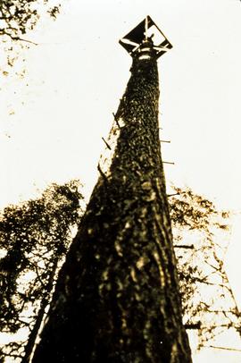
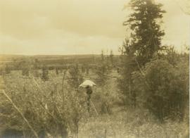
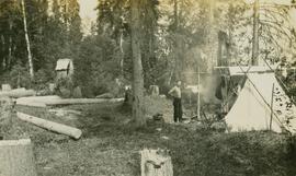
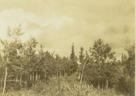
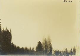
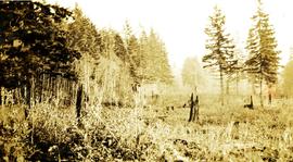
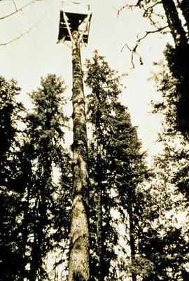
Photograph depicts a roughly cleared area with large trees on the perimeter. Handwritten annotation below photograph reads, "Langley B.C.".
Original forest cover map shows timber history in the area of Giscome, BC.
Item is a photograph of a forest fire at Shawnigan Lake on Vancouver Island.
Item is a photograph of a copy print that has been reproduced as a slide, resulting in low photographic quality. Location of original photograph unknown.
"A large Douglas-fir veteran on the ridge above the camp towered above the Spruce-Balsam forest. A decision was made to convert it into a forest fire lookout. This photo shows a climber going up to top it. After the top was removed, a platform was built. Large spikes were used to provide steps." --from the notes of Ralph Schmidt in accompanying file
Photograph depicts an unidentified forest fire site with an area of dense shrubbery in the foreground.
Image depicts a group of trees in the Cottonwood Park, with a sign which reads: "This is the primary plantation for the 'Forest for the World' project. These trees were planted on August 5, 1985, commemorating Prince George's 70th birthday by the citizens of Prince George & Expo 86'."
Item is a photograph of a forested area southwest of Chittagong, Bangladesh close to the border with Burma.
Image depicts a forested area located somewhere near the Tseax Lava Flow.
Image depicts a forested mountain side somewhere near Murray Ridge.
This digital document is a scanned PDF of a Prince George Forest Region Forest Research Note #PG-12: "Experimental Project 660 - Overview of Three Experimental Installations - A 30-year Progress Report".
This digital document is a scanned PDF of a Prince George Forest Region Forest Research Note #PG-12-1: "Experimental Project 660 - 30-year Progress Report - Buckhorn Installation".
Slide depicts a heavily forested area with fallen logs, likely at the Aleza Lake Experiment Station.
Item is a negative reproduced from the British Columbia Forest Service photographic records held at BC Archives.
Item is a copyprint reproduced from the British Columbia Forest Service photographic records held at BC Archives.
Forest soil sulphur research was a continuing interest for Dr. Paul Sanborn for more than 30 years, beginning at UBC in the mid-1980s when he took a graduate course in Forest Soils from Dr. Tim Ballard. Among the things that he learned was that soils in much of BC were deficient in sulphur (S). Simultaneously, he became aware of the large amount of research on prescribed fire in BC forests, with broadcast burning being the main method of site preparation across much of the province at that time.
Sanborn undertook various projects in this area of research:
- UBC Postdoctoral Project on effects of prescribed fire on sulphur in forest soils (1988-90)
- Cluculz retrospective study (E.P. 886.10) with the BC Ministry of Forests and UNBC
- Sulphur stable isotope tracer study (E.P. 886.15) with the BC Ministry of Forests and UNBC
Image depicts a trail through the forest somewhere on Haida Gwaii.
Image depicts a trail through the forest somewhere in or near Seton Portage, B.C.
Photograph depicts a forested landscape with leafy trees and bushes in the foreground.
Photograph depicts the tops of trees in a forested landscape.
Photograph depicts an unidentified forested landscape with leafy bushes in the foreground.
Bulkley Valley (?)
Photograph depicts a forest in the foreground with a tree covered valley in the midground. In the background of the image a snow-covered mountain peak is visible.
Image depicts a forested mountain side somewhere along the White Pass railway. The thin ridge along the mountain side is possibly either a highway or part of the railway.
Photograph depicts a forested mountain slope leading up to a snow-covered peak.
Image depicts a view of a forested, mountainous area and a river, somewhere along the White Pass railway. The slide is labelled "begin climb," suggesting the image was taken at the beginning of the White Pass Train's ascent into the mountains.
Image depicts a view of a forested valley in the mountains somewhere along the White Pass railway.
Location further identified as perspective from above upper Dimsdale Lake, looking through Gray Pass to Mt. Koona.
Photograph depicts men on river boat and small canoe floating just off shore. Men sit and stand on shore among square bales and large cut lumber. Forest in background. Handwritten annotations on recto of photograph: "Fort Fraser wooding up at Giscome Portage", "Chilco at Giscome Portage".
Image depicts a forestry cabin located in Tête Jaune Cache, B.C.
Image depicts several pieces of heavy machinery used in forestry. The Coast Inn of the North is seen in the background.