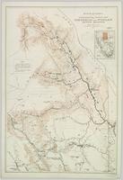
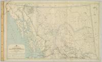
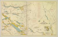
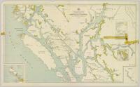
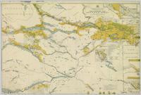
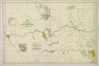
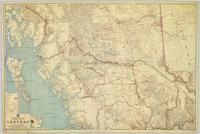
Wyld, James. "Map of the Colony of New Caledonia and the British & American Territory West of the Rocky Mountains including Vancouvers Island and the Gold Fields" by James Wyld, Geographer to the Queen & the Prince Consort, Charing Cross East & 2 Royal Exchange, London, July 16, 1858.
Reports as follows: Number 2. Report of the Exploration from Quesnal to Lake Tatla, via Natla and Nakosla, by Major Frank L. Pope. 1865. Title page, map, and pages 1-36. (Pages 15-17: Indian tribes; pages 32-36: vocabulary of "Siccany" (Sekani) tribe, living n. w. of Lake Tatla.) Number 3. Report of the British Columbia and Stekine Exploring Expedition, by Major Frank L Pope. 1866. Title page and pages 1-42. (Pages 27-28: Indian tribes; pages 29-30, Trading with Indians.) Number 4. Report of the Lake Babine and Skeena River Exploration, by Captain James L. Butler. 1866. 19 pages. Number 5. Report of the Atnah & Northern Explorations, by Captain J. Trimble Rothrock. 1866. 10 pages. Number 6. Report of Provisions Expended by the Stekine Exploring party; and proposed plan of an exploration from the Stekine to the Youkon, by George Blenkinsop. 1866. 8 pages, including map.
Chismore, George. "Log-book of a trip among the Siwash of British Columbia." George Chismore Papers. Bancroft Library, University of California, Berkley. BANC MSS P-K 219.
Details from Bancroft Library:
Logbook of "a trip among the Siwash of British Columbia" (August 31-September 28, 1866), on the way to join, as surgeon, the Western Union Telegraph Company's expedition for the Russian Extension; record of a hunting trip to Old Tongass, March 3-9, 1870, and of a prospecting trip in British Columbia, June 25-July 20, 1870; a paper read before the Geographical Society of the Pacific in 1881, "From the Nass to the Skeena [Stikine]." An obituary clipping relates to Dr. Chismore's practice of medicine in San Francisco after 1873. (25p.)
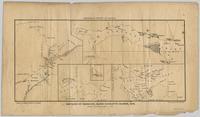
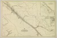
Pope, Frank L. “Sketch Map Showing the Proposed Route of the Western Union Telegraph Between Fort Frazer and the Stekine River, British Columbia. From exploration by the party under the command of Maj. Frank L. Pope Ass’t Engineer, 1866.
Chismore, George. "Record of travel from Skeena Mouth to Peace River mines." George Chismore Papers. 1871-1900. Bancroft Library, University of California, Berkley. BANC MSS 81/24p.
Details from Bancroft Library:
Include: journal of journey to Peace River Mines, British Columbia, June-Dec. 1871, with descriptions of mines and mining, encounters with Indians, and an account of performing surgery on an injured miner; eleven journals, 1883-1893, primarily of hunting trips to Rogue River, Oregon, and one journal of trip to Siskyous, with descriptions of wilderness, life in hunting camp, account of associations with black ex-slave woodsman-hunter of Rogue River area; journal of trip to St. Petersburg, Russia, June-Sept. 1898, with descriptions of museums, churches, palaces, impressions of life in St. Petersburg, Moscow and other European cities; journal of trip to Panama, Jan.-March 1900; collection of speeches to Bohemian Club; collection of his poems, ca. 1897. Also includes articles about Chismore's medical career. (32p.)
Cooper, James. “Maritime matters on the Northwest Coast and affairs of the Hudson’s Bay company in early times.” 1878. Hubert Howe Bancroft Collection. Bancroft Library, University of California, Berkley. BANC MSS P-C 6.
Details from Bancroft Library:
Describes his maritime service with the Hudson's Bay Company from 1844, and the early development of Victoria and Vancouver Island. Primarily an account of the Hudson's Bay Company control over the region and the evolution of local and provincial government.
(32p.)
Mckay, Joseph William. "Recollections of a chief trader in the Hudson's Bay Company." 1878 Hubert Howe Bancroft Collection. Bancroft Library, University of California, Berkley. BANC MSS P-C 24.
Details from Bancroft Library:
McKay came from Canada to Fort Vancouver in the Hudson's Bay Company service in 1844. Describes disturbed conditions in the old Oregon country, in consequence of the American influx; duties in 1845-1846 escorting British officers; visit to San Francisco and Hawaii in 1846 on Company business; Frémont's activities; experiences in charge of Fort Simpson, 1846-1849; relations with the Russian American Company and Indians of the Northwest Coast; duties on Vancouver Island, 1850; discovery of gold on Queen Charlotte Island, 1851, and of coal at Bellingham Bay, 1853; life at Fort Simpson during the Crimean War. Includes typed transcript. (21p. )
Compton, Pyms Nevins. “Forts and fort life in New Caledonia under Hudson’s Bay Company regime.” 1878 Hubert Howe Bancroft Collection. Bancroft Library, University of California, Berkley. BANC MSS P-C 5.
Details from Bancroft Library:
Compton landed at Victoria in 1859, and was afterward stationed at Fort Simpson. A sketch plan of Fort Simpson is included. (9p.)
Handwritten ethnological notes concerning locations and dialects of Chilcotin, Carrier, Sekani, and "Nah-anes" peoples.
Swanton, John Reed. “Materials relating to the Haida.” [1898?]. Manuscript 4117-a, National Anthropological Archives, Smithsonian Institution.
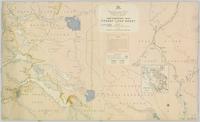
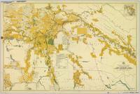
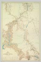
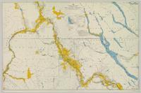
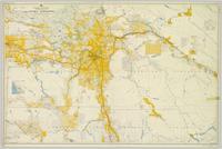
Colour-coded map depicting lands open for preemption, in “University Reserve,” or reserved for public auction. Depicts land recording divisions, communities, bodies of water, and transport routes.
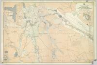
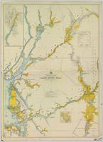
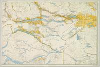
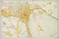
Colour-coded map depicting lands open for pre-emption, lands in “University Reserve,” and lands reserved for public auction. Depicts land recording divisions, communities, bodies of water, transport routes, and game reserves.
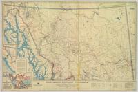
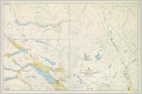
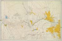
Topographic map depicting regions, communities, unexplored areas, bodies of water, transport routes, and glaciers.
Regional map depicting land recording divisions, communities, bodies of water, transport routes, elevation, and lighthouses.
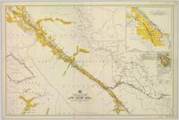
Map depicting surveyed lands, statutory timber lands, land recording divisions, game reserves, communities, bodies of water, and transport routes. Includes inset of McBride townsite.
Colour-coded map depicting lands surveyed as alienated, reserved, Statutory Timber Lands, B.C. Land Settlement Board Area, or open for pre-emption. Depicts land districts, land recording divisions, communities, game reserves, bodies of water, transport routes, and communication lines.
Colour-coded topographic map depicting lands surveyed as alienated, reserved, or statutory timber land. Depicts land district boundaries, land recording divisions, HBC posts, triangulation stations, telephone lines, communities, bodies of water, and transport routes. Defines resource type areas (“Land Form,” “Soil,” “Forest Cover,” “Grazing,” “Geological & Mineralogical,” “Fur-Bearing Animals & Game”). Includes explanatory “Natural Resources Reference.”
Colour-coded map depicting lands surveyed as alienated, reserved, and having a timber license, lease, or sale. Depicts land recording divisions, land district boundaries, communities, bodies of water, and transport routes. Includes insets of Stephens Island and Egeria Reach.
Colour-coded map depicting surveyed lands alienated, reserved, in B.C. Land Settlement Board Area, or open for preemption. Depicts land districts, land recording divisions, communities, bodies of water, transport routes, and communication lines.
Colour-coded topographic map depicting lands surveyed as alienated, reserved, or open to preemption. Depicts land districts, land recording divisions, communities, bodies of water, communication lines, and transport routes.
Topographic map depicting regions, communities, government posts. bodies of water, transport routes, surveyed areas, and reserves.
Colour-coded map depicting surveyed lands respectively open and closed to preemption. Depicts land recording divisions, land district boundaries, government reserves, communities, bodies of water, and transport routes. Includes topographical inset.
Colour-coded map depicting surveyed lands respectively open and closed to preemption. Depicts land recording divisions, game reserves, communities, bodies of water, and transport routes. Includes inset of McBride townsite.
Regional map depicting communities, parks, customs posts, airports, radio stations, hatcheries, bodies of water, transport routes, communication lines, elevation points, and lines of batholith contacts. Includes an inset of St. Elias Mountains. Includes “Special Note on the Mineralization of this Map Area” from Bureau of Mines, Victoria, B.C.
Colour-coded map depicts lands surveyed as alienated, available for purchase or lease under Taxation Act, or reserved. Depicts land district boundaries, land recording divisions, triangulation stations, telegraph/telephone lines, communities, bodies of water, and transport routes.
Colour-coded topographic map depicting lands surveyed as alienated, available for purchase or lease under Land Act, or reserved. Depicts land district boundaries, land recording divisions, provincial forest boundaries, HBC posts, triangulation stations, telephone lines, communities, bodies of water, and transport routes.
Topographic map depicts communities, bodies of water, transport routes, parks, game reserves, posts, ports, radio stations, power sites (figures in horse power), steamship routes (distance in nautical miles), and precipitation. Mineral resources summarized locally in red ink.
Colour-coded topographic map depicts surveyed lands alienated, available for purchase or lease under Land Act, and available for pre-emption. Depicts land districts, land recording districts, provincial forests, parks, triangulation stations, communities, bodies of water, transport routes, and communication lines.
Colour-coded map depicting surveyed lands alienated, available for purchase or lease under Land Act, and available for pre-emption. Depicts land districts, land recording districts, provincial forests, parks, game reserves, communities, bodies of water, transport routes, communication lines, and triangulation stations.
Colour-coded topographic map depicting surveyed lands alienated, available for purchase or lease, or available for pre-emption. Depicts land districts, land recording districts, parks, communities, bodies of water, transport routes, communication lines, and triangulation stations.
Colour-coded map depicts surveyed lands alienated, available for purchase or lease under Land Act, or available for pre-emption. Depicts land districts, land recording districts, provincial forests, parks, game reserves, communities, bodies of water, transport routes, communication lines, triangulation stations, and government reserves.
This clip of original film footage depicts Pacific Great Eastern Railway (PGE) track inspection with a V-8 vehicle.
Clip description with timing reference to scenes:
- 0.01 The Fraser River above Marble Canyon near Moran
- 0.22 At the Tunnel at mile 168.9 between Fountain and Glenfraser
- 0.25 Scenes at Moran mile 181
- 0.37 Inspecting the 2 tunnels at mile 186.5
- 0.44 Water tank just north of Kelly Lake and south of the wye at Kelly Lake Mile Mile 191.5
- 1.04 Wood Trestle at 51 mile creek Mile 206
- 1.15 Lac La Hache station and section house in the background
- 1.30 Williams Lake station
- 1.43 Lone Butte Water tower
- 1.46 The Lone Butte rock formation
- 2.01 Alta Lake station right and Water tower in distance
- 2.06 Outside the east side of the Squamish roundhouse. Track ahead of car leads to yard. Water tower to right
- 2.15 A shot of the back side of the Squamish roundhouse looking south. 563 has had its trucks converted from 6 wheel to 4 wheel and is looking real clean. This must be late 1954. Steam locomotive 163 in final months of service and was cut up for scrap in July 1956
- 2.20 Cheakamus
- 2.24 Garibaldi Mile 59.5. Line to the left goes to the sawmill there
- 2.27 Inspecting the bridge at mile 55.6 in the Cheakamus canyon. Looking south from the south end of the bridge. Telegraph wires in the right of clip
- 2.31 Same bridge looking north
- 2.37 Bridge at mile 56.5 in the Cheakamus Canyon
- 2.42 Stopped at the water tank at the place called Watertank mile 62.5. Section house to the right of tracks.
- 2.58 Heading north around Pinecrest Mile 64 or 65
- 3.07 Stopped at the mill at Parkhurst around mile 80 on the east side of Green lake
- 3.23 Watching a south bound train pass at Tisdall
- 3.32 Diesel hauled train coming to Tisdall at the old location of the north switch. Locomotives still with their 6 wheel trucks so before 1954. Note locomotives spread out in the train so all the weight was not on small bridges at one time
- 3.50 In the canyon north of Lillooet; man in brown suit and fedora is W.H. (Harry) Nichols
- 3.58 Along Alta Lake
- 4.12 Scenes along Anderson Lake north of Darcy
- 4.35 Royal Engineers bridge at Lillooet
- 4.42 GE diesel with either steam ditcher or steam crane just north of Lillooet
- 4.47 General Store at Pavillion Mile 178.2
- 4.52 Quesnel Station
- 5.04 Unknown Location
- 5.20 Gang working with tamping machine?
- 5.31 Cottonwood River Bridge. New just before the line to Prince George opened in 1952. Also scenes around the Cottonwood River
- 5.57 Ahbau Creek Bridge Mile 406.1 Prince George Subdivision. The last spike to complete the line to Prince George was driven at the north end of this bridge. Ahbau Creek was named after a local Chinese prospector and trapper
- 6.16 At the CN Prince George shops near to where the Correctional Facility is today. CN Bridge across the Fraser River in distance
- 6.37 Construction of the PGE crossing of the Fraser River at Prince George
- 6.59 PGE middle yard at Prince George
- 7.10 Heading back south to the main yard. CN Fraser River bridge in shot
- 7.22 Marguerite station
- 7.35 Hawks Creek or Deep Creek Bridge mile 329.9. One of the worlds highest railroad bridges at 312 feet high
Note: The miles in the notes are the current mileages. At the time of the filming the line to North Vancouver had not been completed. The mileages at that time would have read 40 miles less in the mile boards.
This 16mm film of Eagle Lake Sawmills was produced by Torajiro Sasaki in July 1952, likely commissioned or with permission from the sawmill owners, the Spurs. The film depicts logging and sawmilling operations at the Eagle Lake Sawmill, as well as shots of the bunkhouses, exterior shots of the mill, and the beehive burner. Employees of the mill are shown at work. In 1952, Eagle Lake Sawmill used both machinery and horses in their operations.
Zonder titelThis clip of original film footage depicts a Pacific Great Eastern Railway (PGE) Budd Car from Shalath and Seton Lake to Kelly Lake.
This clip of original film footage depicts Pacific Great Eastern Railway (PGE) track laying in Northern British Columbia.
This clip of original film footage depicts Pacific Great Eastern Railway (PGE) track inspection with a V-10 vehicle.
This original film footage clip depicts the a Pacific Great Eastern Railway (PGE) Budd Car running along Seton Lake.
This clip of original film footage depicts depicts the Williams Lake Stampede and Pacific Great Eastern Railway (PGE) track inspection.
This original film footage clip depicts the recovery of the April 1, 1954 Pacific Great Eastern Railway (PGE) train wreck at Seton Portage.
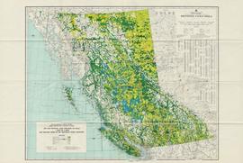
Item is a map of British Columbia and is a key map showing: maps published on scale 1 inch to 2 miles and summary zones of the provincial forest inventory. Map includes index of post offices correct to October 22, 1956.
Audio recording consists of individual taped interviews conducted by Bridget Moran with a number of early Fort George residents recalling the early years of white settlement in Prince George c.1910-c.1915. Interviews were conducted with the following individuals: Arnold Davis; J.A.F. Campbell; Alec Moffat; Claude Foot; George Henry; Nellie Law; John McInnis; Georgina [McInnis] Williams and Peter Wilson. These interviews were incorporated into the publication: Bridget Moran, Prince George Remembered…from Bridget Moran, Marsh Publishing, Prince George, 1996.
Audiocassette Summary
Scope and Content:Recording consists of individual taped interviews conducted by Bridget Moran in a number of locations with Arnold Davis; J.A.F. Campbell; Alec Moffat; Claude Foot; George Henry; Nellie Law; John McInnis; Georgina [McInnis] Williams; Peter Wilson
Subjects include:
- Arnold Davis – former Sherriff in Prince George (born in 1882) arrived in Quesnel in 1909 and worked on the BX sternwheeler. Davis discusses his family roots from Ireland as a 6th generation Canadian. Recalls how his family arrived in South Fort George in 1917 and how his father worked on boats that went up and down Fraser River
- Claude Foot recalls coming from New Zealand to Fort George [Prince George] in 1906 and how there were ‘very few white men’; his father was Irish, mother was English
- Alex Moffat – describes how his parents provided a ‘stopping place’ for stage coaches in the Cariboo region
- George Henry recalls working on the boats that plied the Fraser River between Prince George and Soda Creek, near Quesnel
- Nellie Law – describes arriving from England in 1917 to Ashcroft and then Quesnel in 1917
- Peter Wilson – Barrister and Solicitor; the prosecutor for Prince George since 1916 describes arriving by train from Edmonton and arriving on a scow in South Fort George
- Mr. John McInnis – from Prince Edward Island, who sat twice in provincial legislature – in constituency of Grand Forks as socialist and later for constituency of Fort George recalls arriving in 1910 by rail to Kamloops and then by sleigh to South Fort George; describes the Indian Reserve at Fort George “[…don’t think there were a dozen white people…when I arrived […]”
- J.A. ‘Doc’ Campbell recalls being part of a survey crew in Fort George in 1908
- George Henry – also recalls cruising down the [Fraser] river by way of sternwheeler and losing men overboard
- Peter Wilson recalls experiences as practicing lawyer; there was no assize court in the region until 1919; recalls some of his early cases [murder case]
- Nellie Law describes working as a desk clerk at first The Alexandra Hotel and later The Prince George Hotel from 1918 to 1952
Law describes the hotel patrons and how she met the Duke and Duchess of Devonshire in 1922. Recalls stoking furnace with logs in the hotel to keep it warm and working as a bouncer - Alex Moffat – recalls workers and hauling freight via the old Cariboo Road; existence of one policeman only (BC Provincial Police); and describes in detail a stopping place for horses / crew on the Cariboo Road and the pack trains.
- Mr. Moffat – Describes the luxury experienced on the sternwheeler, The BX that “could carry seventy saloon passengers” and “staterooms were all equipped with push buttons, electric lights, hot and cold water, steam heat, and everything modern”
- Claude Foot – Recounts a dance in Quesnel at the hotel barroom and describes ordering drinks at the Al Johnson Hotel that had a bar which boasted to be “ the biggest bar in Canada, if not the world” 100 ft + bar with “six or seven bartenders behind this long bar, and the customers would be lined up two or three deep […]”
- J.A. [F.] [Campbell] – post-1910 changes with the use of scows on the Fraser River; describes the BC Provincial Police “in those days [they] just wore ordinary civilian clothes, but they were a tough bunch….[…]” and rowdiness in the bars in South Fort George
- Campbell describes the first bank in Fort George was the Bank of British North America that was housed in a tent and he recalls needing money while playing poker - ‘about eleven o’clock that night, the vault was open, and the till was open, and if you wanted money you’d walk up to the bank till and put an IOU in and take money out and go on playing [poker]
- Peter Wilson – comments about how lax the enforcement of law and order was in the early years including among the police themselves: “that the “Old Blind Nick [who] ran a bootlegging joint, went broke because he said he couldn’t afford to supply the police with any more liquor.”
- Claude Foot – recalls a fire in Quesnel in 1916 that burned a large part of the business section and the firemen were as Nellie Law notes “ a bucket brigade of Chinamen, filling buckets from a water hole in the Fraser River that the horses drank in…”
- John McInnis recalls political meetings and the election in 1916 when he was a candidate for the Fort George riding and being defeated by 7 votes; that the investigation of the election “was a whitewash”
- Georgina McInnis, who was the first White Child born in the community – she tells of the meeting that decided her name – as Fort Georgina McInnis
- Arnold Davis recalls his father working on boats that went up and down Fraser River and being on the boat with him and “watching the connecting rods go in and out and concentrate on pie…[served by the Chinese cook]” Davis also recalls The Yukoners who emigrated to PG after the Gold Rush
- George Henry recalls with lament the coming of the railway as he lost his job plying the River - preferred voyages on the Fraser River – and refers to those who worked the River and himself as “river rats”
This original film footage clip depicts a Pacific Great Eastern Railway (PGE) Open Passenger Car riding along Seton and Anderson Lakes in British Columbia.
This original film footage clip depicts a Pacific Great Eastern Railway (PGE) train trip in winter from Lake District to Alta Lake.
This original film footage clip depicts a Pacific Great Eastern Railway (PGE) Trip with Premier Bennett from Vancouver to Prince George in 1958. This is believed to be the beginning part of the inaugural train run of the Pacific Great Eastern (PGE) Railway line into Fort St. John in Oct. 1958. The second part of this clip is believed to be "2017.5.2.5 - Pacific Great Eastern Railway (PGE) "Peace River Special" inaugural train to Fort St. John, 1958".
This original film footage clip depicts the inaugural train run of the Pacific Great Eastern (PGE) Railway line into Fort St. John in Oct. 1958. W.A.C. Bennett stops to speak at communities along the route, including Prince George and Dawson Creek. Other personalities, such as "Ma" Murray were also in attendance. The train was called the "Peace River Special". BC centennial flags are visible at the events. This film clip is believed to be a continuation of film clip 2017.5.2.3 "Pacific Great Eastern Railway (PGE) Trip with Premier Bennett from Vancouver to Prince George".
A VHS tape containing "The Mark of Progress" film created by the British Columbia Forest Service and first played for a live audience in 1959 in Prince George, BC.
Audio recording is of an interview by Bridget Moran with both Mr. George Henry and Mr. Arnold Davis to discuss their memories of the early town site development of South Fort George and Central Fort George c.1910-c.1917. Mr. Henry was born in 1882 and his family arrived in Quesnel in 1909. Mr. Henry’s interview is primarily about his work as a captain on the BX Sternwheeler up until the time of the railroad arriving in Prince George in 1914. Mr. Davis, who was a Sherriff in Prince George, recalls his childhood memories of Fort George and Central Fort George c.1917. Mr. Davis also discusses his family roots from Ireland, the family’s arrival in Fort George from Ashcroft in 1917 and memories of his father who worked on the sternwheelers on the Fraser River.
Audiocassette Summary
Scope and Content:
Interview with Mr. George Henry
Mr. Henry was born in 1882 in Northern California and his family came to the Cariboo in 1909. He recalls riding his bicycle from Ashcroft to Quesnel in 3 days to find work with the BC Express Company.
Mr. Henry recalls working on the BX and describes the sternwheeler trip from Quesnel to South Fort George; it was a 3 hour trip from Quesnel and included two mail stops ;
Henry recalls an accident onboard the sternwheeler going through the Fraser Canyon (see p.p.11-12 of
Prince George Remembered)
Mr. Henry describes his homestead at South Fort George
Mr. Henry describes the BX sternwheeler being aground at South Fort George c.1920
Mr. Henry recalls spending winters in South Fort George in his log cabin; that work was “plentiful” in 1910 and the population at “about 700”
Mr. Henry notes that the “Indian reserve was at the Hudson’s Bay company” and that the native population was at “about 50”
Mr. Henry recalls the early commercial businesses in South Fort George c.1910 including the Northern Hotel; the candy store and ice cream store and theatre.
Mr. Henry describes the start of the town site of Central Fort George as a “viable little town” which started once the Grand Trunk Railway arrived and recalls the change in population between South Fort George & Central Fort George.
Henry recalls how all the workers came and lived in tents in Central Fort George.
Mr. Henry was not happy about the arrival of the railway as it meant he lost his job on the sternwheeler – he recalls that “us old river rats were just lost” (see p.p.34 of Prince George Remembered)
Bridget then asks Mr. Arnold Davis to recall his memories of early South Fort George
But first asks him to describe his family’s roots (See p.p. 1-2 of Prince George Remembered)
Scope and Content:
Interview with Mr. Arnold Davis
Davis notes he is 6th generation Canadian; family came from Ireland and his grandfather’s brother Jeff Davis became the President of the Confederate States of America.
Davis refers to his mother’s family being on the Prairies at time of the trial of Louis Riel
Davis explains that his grandfather first homesteaded at Banff; then Kamloops; then Ashcroft and on to South Fort George in 1917.
Davis’ father worked for the BC Express Company and he recalls being on the sternwheeler as a child during same time that George Henry worked the boats. Recalls workers on the boat; eating pie on the boat baked by the Chinese cook; (See p. 33 of Prince George Remembered)
Davis recalls the town site of South Fort George. He notes it had a population by 1917 of only “about 300” and that the “boom was over”
Davis describes location of various businesses in South Fort George including the Rex Theatre, George St. Poole Room, McKay Bros. Grocery store, Drugstore, Bairds, Peters Butcher Shop.
Davis recalls that there were many “Yukoners” here at the time and recalls a tale about an old Yukoner
Mr. Davis recalls other people who worked on the BX with his father including Margaret “Granny” Seymour’s father;
Mr. Davis recalls riding up and down the river to Foley’s Cache on the sternwheeler as a child
Mr. Henry then speaks up and recalls trips on the sternwheeler with Arnold Davis on the boat as a child
Tape ends
