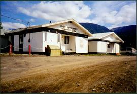
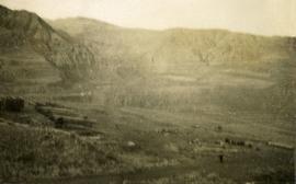
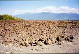
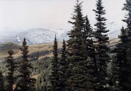
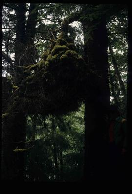
Image depicts a cutbank on the Nechako River in Prince George, B.C.
Image depicts the cutbanks on the other side of the Nechako, taken from the nature trail at Island Cache. Map coordinates 53°55'34.6"N 122°45'52.4"W
Photograph depicts a view from the front of a canoe. A man is paddling from the stern, the river in the midground, rolling treed hills in the background.
Image depicts what is possibly a small section of the Nechako River on Cottonwood Island.
Image depicts a body of water in Island Cache. It is possibly a small section of the Nechako River.
Image depicts the Nechako River on Cottonwood Island.
Image depicts the Nechako River from Cottonwood Island.
Photograph depicts a view from a high hill, looking down on the Nechako river. There is forest and low rolling hills in the background.
Photograph depicts a view from a high hill looking down on the Nechako river. There is forest and low rolling hills in the background.
Image depicts the bank of the Nechako River at Island Cache.
Photograph depicts a view of the Nechako River, BC.
Image depicts New Aiyansh.
Photograph depicts eighteen or more canvas tents scattered on the river shore next to rough cabins and an outhouse.
Image depicts what is possibly the community of Newlands, B.C.
Image depicts an old building that was possibly once a gas station in the community of Newlands, B.C.
Image depicts an old shack buried in snow, possibly in Newlands, B.C.
Photograph depicts a view of Squamish, which was named Newport between 1911-1914. This photograph was taken from the Squamish Smoke Bluffs, looking south. Mamquam River blind channel visible in foreground.
Photograph depicts two white buildings, one with the sign "Nisga'a Government Administration building". Road in foreground, vehicles and hills in background.
Photograph depicts what appears to be a lava bed, see item 2008.3.1.22.33.
Image depicts Noralee, B.C.
Photograph depicts a close up view of the range grass.
Photograph depicts an open field with a fence. There is a house in the midground and low sparsely treed hills in the background.
Photograph depicts a view of a barn, house, fences and cattle on Norman Lee's ranch.
Photograph depicts a view of open range land in the foreground and rocky bluffs in the background.
Photograph depicts looking north and south in North Fork from above Boulder creek.
Item is a hand drawn and coloured map by the City of Prince George Planning Department depicting North Nechako neighbourhood area existing land use in 1976.
Item is a hand drawn and coloured map by the City of Prince George Planning Department depicting the North Nechako and Hart neighbourhood area proposed land use in 1976.
Image depicts a field north of Dog Creek in the upper Fraser Canyon.
Image depicts numerous power lines and a road somewhere north of Squamish.
Image depicts phyllite, a type of metamorphic rock, on the north shore of Takla Lake.
Photograph depicts a landscape scene in northern British Columbia in an unknown location.
Photograph depicts a small coastal village in northern British Columbia.
Photograph depicts the view to the northwest from the site of the terminal building at the Rainbow Lake Ski Club.
Image depicts the Northwood Pulpmill in Prince George, B.C. taken from above the Nechako River looking east. Map coordinates 53°56'00.0"N 122°44'29.7"W
Image depicts the office at the Northwood Upper Fraser Saw Mill and a sign which reads "Have a safe, quality day." Map coordinates 54.117916, -121.943351
Image depicts the Oblates of Mary Immaculate Catholic Church in Aleza Lake, B.C. Map coordinates 54°07'08.2"N 122°02'00.0"W
Image depicts an oddly shaped tree branch that appears to have grown downwards, and is covered in green, mossy growths. Located somewhere on Haida Gwaii.
Image depicts an old abandoned cabin at an uncertain location.
Image depicts an old, abandoned church located somewhere in Seton Portage, B.C.