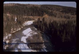
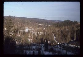
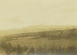
Image depicts numerous trees in the coastal forest of Haida Gwaii, B.C.
Image depicts a collapsed cabin in Quesnelle Forks, B.C.
Image depicts an old, collapsing cabin somewhere in the Fort George Canyon Provincial Park, B.C.
Image depicts a collapsing shack somewhere in the Seton Portage area.
Members of the Collison family casually fishing from a large dock. Handwritten annotation on verso reads: "Collison family fishing from dock (Portland[?] Canal) {Max Elsie Henry Will Arthur Herbert}."
Photograph of a bridge along a rocky shoreline. Printed annotation reads: "Colloway Rapids Bridge Prince Rupert Highway W.W.W." Handwritten annotation on verso is heavily obscured by residual album paper and reads: "PO Box 777 Prince Rupert BC. [Illegible] Lal. This[??] is a piece of our new bridge which [obscured] neats our Island with the mainland. We have had picnics on the other side & [illegible] is open for [illegible] to [illegible]ve ours this side of the [obscured] our stuff to the little [obscured] patronize[??]. Mrs. [illegible] are back again in Rupert [obscured] Kamloops office closed down [obscured] was no chance of transfer. Have not."
Photograph depicts a Chevrolet pickup truck on highway to right of Mud Lake, at Km 632 on the Stewart-Cassiar Highway. Forest on hillside in background.
Photograph depicts two unidentified individuals in canoe on Boya Lake, B.C. (formerly known as Chain Lakes). Foliage silhouetted in foreground; forest and hills on opposite shore in background.
Photograph depicts mobile home modified for Cassiar winters (steeply sloped roof added). Yellow suburban parked in driveway in left foreground. Forest trees and mountainside visible in background. Sign reading "686" posted on tree in left foreground. Believed to be the home of Gerry Cooper.
Photograph depicts group of men and women on rocky shore, pile of fish in foreground. Photo speculated to have been taken in the Telegraph Creek area, possibly at the Tahltan or Stikine River, B.C.
Photograph depicts Joseph wearing safety gear while standing at testing equipment on raised sampling station. Sign below Joseph reads "DO NOT DISTURB / SAMPLING IN PROGRESS / PROPERTY OF ENVIRONMENTAL CONTROL DEPT. / CASSIAR ASBESTOS LTD." Helen Joseph took air quality tests in the working areas and town (see item 2000.1.1.3.19.135). Power lines, unidentified building, and mountain base visible in background. Photo was taken during winter.
Photograph depicts woman wearing safety gear in second floor of mill building, holding unidentified instruments. Helen Joseph took air quality tests in the working areas and town (see item 2000.1.1.3.19.147).
Photograph depicts palletizer machinery, where bags of asbestos fibre were shrink-wrapped and made ready for shipping pallets. Palletizer was located near shipping (believed to be in mill building). Unidentified man visible in machinery on far left.
Photograph depicts shovel in excavation area of mine, loading ore haulage truck believed to be a Wabco "haul pak".
Photograph depicts machinery in snowy area of mine. Euclid ore haulage truck in foreground, cassiar pickup truck visible in lower area in midground. Blasthole drill in front of track shovel in left background, Wabco ore haulage truck visible behind other machinery in right background.
Photograph depicts mine area. Switchback road and higher benches in background. Blasthole drills, track shovels, and ore haulage trucks can be seen on level in foreground and higher bench in background. Mountains visible in distance. Benches in background speculated to be located on the mine's West Peak.
Photograph depicts three women wearing white aprons while conducting tests on asbestos fibre in lab area, miscellaneous equipment throughout room.
Photograph depicts wheel bulldozer in snowy unknown area of mine.
Photograph depicts part of the vacuum dust control and removal system in the Cassiar mill building. Unidentified man can be seen at rotary air-lock, in which heavy blown dust would collect before dropping to plenum conveyor resting just above floor. From here, the dust would eventually be expelled at the tailings pile outside of the mill. Second unidentified man can be seen climbing steps in background. This section of the mill was located above the lab.
Photograph depicts Zora Ivanovska in safety gear, vaccuming asbestos dust from "hall screen" in mill (slanted vibrating tables with varying mesh sizes, used to separate different lengths of fibre). Mill General Foreman Tony Pinto is visible on far right, with unidentified man.
Image depicts what appears to be a small community on the shore of a lake. The location is uncertain.
Image depicts a construction area somewhere in Tumbler Ridge, B.C.
Slide depicts a detonation in an area of cleared ground in a forested area, likely the Aleza Lake Experiment Station. Work may have been undertaken for roadbuilding activities at the Experiment Station.
Photograph depicts yellow conveyor belt in foreground over gravel pit, dump truck behind in midground. Mountains visible in background. Photo speculated to have been taken at the plant or near the Cassiar airstrip. Stamped annotation on recto of photograph: "JUN. 1987".
Handwritten caption beside this photo reads: "Cookhouse in Winter". Photograph depicts top of building semi-visible behind large snow pile. Treetops can be seen in background.
Image depicts a view of a river from the Cottonwood Bridge.
Image depicts a forest; the image is possibly taken from somewhere near the Cottonwood Rail Road Bridge.
Image depicts the Cottonwood Canyon.
Image depicts a section of the Heritage Trail on Cottonwood Island in Prince George, B.C.
Image depicts the Cottonwood House Historic Site along Barkerville Highway, east of Quesnel, B.C. A sign posted by the fence reads: "For over half a century the Boyd family operated this haven for man and beast. Here weary travellers found lodging, food, and drink. Here fresh horses were hitched to stage-coaches and miners bought supplies. This historic road-house, built in 1864, stood as an oasis of civilization on the frontier of a rich new land."
Image depicts Cottonwood Island.
Image depicts a nature trail in Cottonwood Island Park by a beehive burner. Map coordinates 53°55'23.6"N 122°43'53.8"W
Image depicts a couple walking through a nature trail in Cottonwood Island Park. Map coordinates 53°55'23.6"N 122°43'53.8"W
Image depicts a crowd of people in Cottonwood Park in Prince George, B.C.
Image depicts a the Cottonwood Island Nature Park sign and map in Prince George, B.C.
Photograph depicts large bridge and dam over a wide river, industrial structures throughout. Hills on opposite shore in background. Handwritten annotation on recto of photograph: "Coulee Dam, This is were[sic] I went this fall. Wished you had of been with me."
Photograph depicts open field with dark clouds overhead. Cow grazing in left, forest in background.
Photograph of the SS "Princess Charlotte" on the open ocean. Metallic annotation on recto reads: "C.P.R.SS Princess Charlotte entered according to act of the parliament of Canada, in the year 1908[?]. by A. Shaw, at the Department of Agriculture." Printed annotation on verso reads "Shaw & Co., Photo. Victoria. B.C. (Empire Series)"
Photograph depicts a craggy mountain peak covered with coniferous trees and snow.
Photograph depicts lumber and brush piles, forest in background. Crane semi-visible on left, small boat semi-visible on right.
Photograph depicts the load and main hook block of a dragline crane operating in excavation area of forest.
Image depicts a creek near Quesnelle Forks, B.C.
Image depicts a creek near Iron Road North, north of Woodpecker, B.C.
Photograph depicts an unidentified creek with a bush covered shoreline on either side. In the background a densely forested area is visible.
Photograph depicts an unidentified creek running through a forested plateau with mountains visible in the distance.
Photograph depicts a creek running through a forested, hilly landscape.