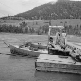
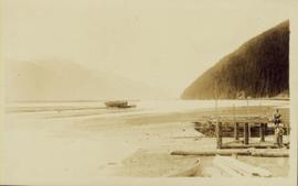
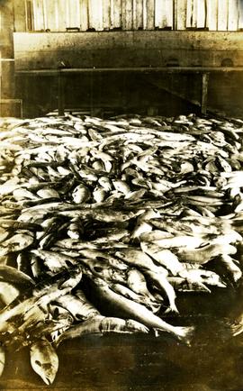
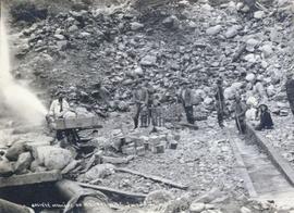
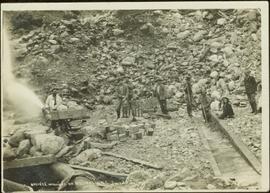
Photograph of a vessel filled with lumber just off the coast of a shore also littered with lumber. Mountains are barely visible in the background.
Photograph depicts a large number of soldiers bearing packs walking in a line through a rancher's field, possibly somewhere between Bella Coola and Anahim Lake during the WWII Polar Bear training exercise.
Photograph depicts a soldiers with packs walking over a wooden log bridge, possibly somewhere between Bella Coola and Anahim Lake during the WWII Polar Bear training exercise.
Photograph depicts soldiers walking along road with children watching nearby, possibly somewhere between Bella Coola and Anahim Lake during the WWII Polar Bear training exercise.
Photograph depicts soldiers unloading an American military jeep from a military truck, possibly somewhere between Bella Coola and Anahim Lake during the WWII Polar Bear training exercise.
Photograph depicts soldiers trekking uphill with pack horses in mountainous terrain between Bella Coola and Anahim Lake during the WWII Polar Bear training exercise.
Photograph depicts soldiers trekking uphill in mountainous terrain between Bella Coola and Anahim Lake during the WWII Polar Bear training exercise.
Photograph depicts soldiers trekking through mountainous terrain between Bella Coola and Anahim Lake during the WWII Polar Bear training exercise.
Photograph depicts a line of soldiers hiking up switchbacks on a steep rocky slope between Bella Coola and Anahim Lake during the WWII Polar Bear training exercise.
Photograph depicts a soldiers transferring water from military truck water bag to a large water bag on the ground, possibly somewhere between Bella Coola and Anahim Lake during the WWII Polar Bear training exercise.
Photograph depicts a line of soldiers hiking up switchbacks on a steep rocky slope between Bella Coola and Anahim Lake during the WWII Polar Bear training exercise.
Photograph depicts a number of soldiers wearing packs near a military truck, likely somewhere between Bella Coola and Anahim Lake during the WWII Polar Bear training exercise.
Photograph depicts a military band near the parliament buildings in Victoria, BC.
Photograph depicts a solider mending his uniform likely somewhere between Bella Coola and Anahim Lake during the WWII Polar Bear training exercise.
Photograph depicts a soldier cooking over a campfire, likely somewhere between Bella Coola and Anahim Lake during the WWII Polar Bear training exercise.
Photograph inscription on verso: "This is a picture of my mother and I taken when I returned from the west before I joined the R.G.O.G. (Motul) the dress in which we returned. Bob."
Caption describing photograph: "Soil (sod) development over lacustrine deposits. Depth to carbonated layer (1922 fire) 2.5", depth to parent material 6". Note blocky structure of deposit (clay). Root penetration to 1'. Root penetration of willow and aspen to 1.5'. Blocky structure from fluctuating water table, gentle slope to land form."
Photograph depicts the Soda Creek reaction ferry.
Photograph depicts the Soda Creek reaction ferry. A ferry was sited between Soda Creek and Marguerite. The reaction ferry in Soda Creek itself had been abandoned for some time.
Photograph depicts a view of a small village near a river, a narrow dirt road boarders the river.
Image depicts the cutbanks of the Fraser River at Soda Creek, B.C.
Image depicts a section of land, with a few houses, in Soda Creek, B.C.
Image depicts what appears to be a Ranch at Soda Creek, B.C.
Image depicts an old building located somewhere are the Pickard farm north of Soda Creek, B.C.
Image depicts the old jail house in Soda Creek, B.C.
Image depicts the old community hall in Soda Creek, B.C.
Image depicts a house in Soda Creek, B.C.
Image depicts the ferry at Soda Creek, B.C.
Image depicts the cemetery in Soda Creek, B.C.
Image depicts the old BX Sternwheeler office building in Soda Creek, B.C.
Image depicts a bridge at Soda Creek, B.C. There are numerous unknown individuals present.
Image depicts rail road tracks through a forest, as well as a river; located in Soda Creek, B.C.
Image depicts a forest and river in Soda Creek, B.C.
Photograph depicts a pile of fish on a floor. Handwritten annotation below photograph reads, "Mostly Sockeye".
Group of five miners stand in mining area on left. Woman, man, and young girl sit and stand on far right in more formal attire. Mining tools and equipment throughout.
Printed annotation on recto of photograph: "Société Minière de B.C., Atlin B.C. July 28th, 1901, A.C. Hirschfeld, No. 707".
Item is a photograph of a cake in honour of the Social Credit Party on July 31, 1971.
Item is a photograph of the Cabinet taken in late February 1956 days before the resignation of Lands & Forests Minister Robert Sommers. From left: Highways Minister P.A. Gaglardi; Education Minister Ray Williston; Trade, Industry & Fisheries Minister R. Chetwynd; Health Minister Eric Martin; Agriculture Minister Ken Kiernan; Premier Bennett; Attorney-General R. Bonner; Provincial Secretary W. Black; Mr. Sommers; Labour Minister L. Wicks and Public Works Minister W. Chant.
Photograph depicts a snowy vista from the Canadian Rockies.
Photograph depicts a 1920's model car on a snowy unploughed street.