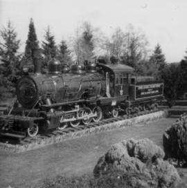
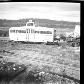
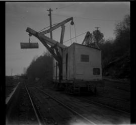
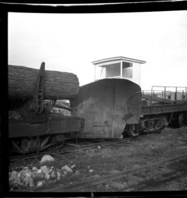
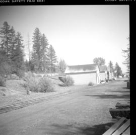
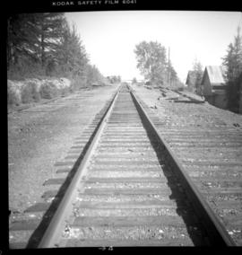
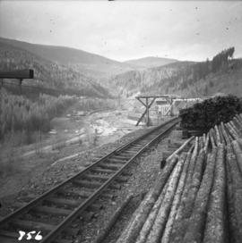
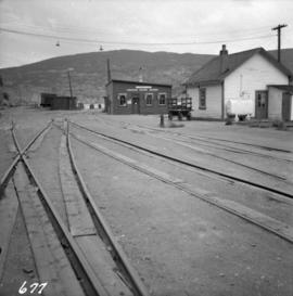
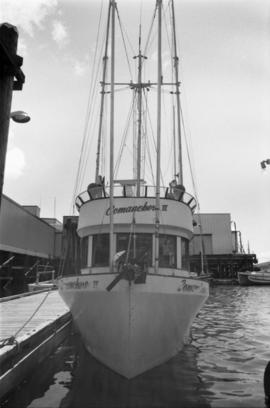
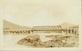
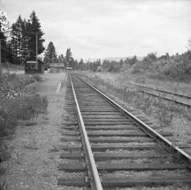
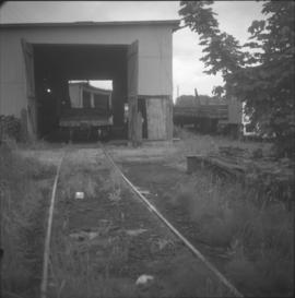
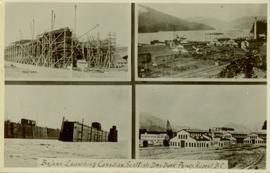
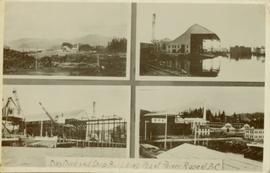
Photograph depicts a former steam locomotive shed.
Photograph depicts a view of the Ladysmith yard, looking north, about 300 yards east of the city centre.
Photograph depicts a daily log train from Nanaimo Lakes. About 20 cars were being unloaded at a rather fast rate of 30-60 seconds per car using a mechanical prodder mounted on the frames of an old shay locomotive.
Photograph depicts a deisel switcher #107.
Photograph depicts a grand view of the Ladysmith yards. There had been no steam operations on this line for about 2 years.
Photograph depicts the lower part of the Ladysmith yard, adjacent to a log pond. A semaphore signal was activated by the tide and indicated to the engineer of the log train the suitable depth for offloading logs from the cars.
Photograph depicts the outside of the Comox Logging head office in Ladysmith.
Photograph depicts a log car repair shop. Visible is one car being repaired as well as another awaiting attention on a switch spur on the right.
Photograph taken about half a mile north of the diamond crossing, looking southeast at the point where the Esquimalt & Nanaimo Railway closely follows the Comox Railway for about 300 yards. The Comox Railway used one every week for log trains.
Photograph depicts sidings for empty log cars about a quarter of a mile south of the diamond crossing. Image captured looking south, towards the Ladysmith yards. The running line is visible on the right side of the photograph and was used week by a daily log train, consisting of a deisel locomotive and 20 cars.
Photograph depicts deisel switcher #108.
Photograph depicts a mobile crane used to offload log trains into a pond.
Photograph depicts a snow plough in the Ladysmith yards.
Photograph depicts wheel bulldozer in snowy unknown area of mine.
Photograph depicts ore cars on cables running between tramline towers. Flowers in foreground, mine valley and McDame mountain in background. Tramline ran through mine valley, between loading station (2000.1.13.19.197) in mine and dump station at mill on plantsite (2000.1.1.3.19.124)
Photograph depicts mine area. Switchback road and higher benches in background. Blasthole drills, track shovels, and ore haulage trucks can be seen on level in foreground and higher bench in background. Mountains visible in distance. Benches in background speculated to be located on the mine's West Peak.
Photograph depicts machinery in snowy area of mine. Euclid ore haulage truck in foreground, cassiar pickup truck visible in lower area in midground. Blasthole drill in front of track shovel in left background, Wabco ore haulage truck visible behind other machinery in right background.
Photograph depicts shovel in excavation area of mine, loading ore haulage truck believed to be a Wabco "haul pak".
Photograph depicts passengers exiting CP Air plane on runway. Unknown man and air traffic controller in foreground.
Photograph depicts palletizer machinery, where bags of asbestos fibre were shrink-wrapped and made ready for shipping pallets. Palletizer was located near shipping (believed to be in mill building). Unidentified man visible in machinery on far left.
Photograph depicts long building with blue siding. Security was located at corner of building in centre foreground, behind stop sign. Single red door on left was main entrance into mine dry, where individuals were checked through security. Two larger windows on left indicate the location of the mine store where work apparel could be purchased. Building also housed change house (see item 2000.1.1.3.19.121) and offices of the mine department supervisory staff. Employee parking lot located out of frame to right. Mill building stands in background, tramline dump station on left. Ore car visible, about to enter dump station. Unidentified man and child can be seen in foreground.
Photograph depicts group of unidentified men seated in bus seats, wearing work clothes and hard hats. Believed to be taken on mine bus which ran between the plant and mine (see also item 2000.1.1.3.19.70).
Photograph depicts the new mine garage behind machinery, mountains in background. Mobile blast hole drill can be seen in left foreground (manufactured by Robbins with Caterpillar undercarriage). Two 50-tonne Wabco "haul paks" in right foreground (ore haulage trucks).
Photograph depicts unidentified young man at clothes dryers. Wall of cubby compartments in background; washing machines and piles of laundry in foreground. Clothes in pile appear to be all coveralls or denim, possibly work clothes.
Photograph depicts DeCecco wearing helmet and snowsuit while seated on Arctic Cat "Pantera".
Photograph depicts two fire trucks semi-visible in garage with the sign "FIRE HALL". House and snowmobile can be seen in left midground, truck and power pole in right foreground. Mountains in background. Warning visible on front of trucks: "KEEP BACK 500m".
Photograph depicts two unidentified individuals in canoe on Boya Lake, B.C. (formerly known as Chain Lakes). Foliage silhouetted in foreground; forest and hills on opposite shore in background.
Photograph depicts a Chevrolet pickup truck on highway to right of Mud Lake, at Km 632 on the Stewart-Cassiar Highway. Forest on hillside in background.
Photograph depicts the commencement of the B.C. Electric Railway right-of-way at Commercial Dr. and near 22nd Ave. in Vancouver. It was built in 1891. The view is looking southeast towards New Westminster.
Photograph depicts 40 miles of trackage, of which 90% was located underground. It was owned by the Cominco Mine Railway of the private Sullivan Mine. The surface main line ran from the portal of the mine to a concentrator.
Photograph depicts the surface main line of the Cominco Mine Railway of the private Sullivan Mine. The line ran from the mine's portal to a concentrator. Visible locomotives dated from 1923 to 1952.
Photograph depicts stationed gauge trackage that was owned privately and laid near a concentrator that connected the CPR Kimberley branch. Visible are various spurs to wharehouses and sheds.
Photograph depicts the Cominco Mine Railway and the private Sullivan Mine. This section was near a concentrator as well as Chapman Camp. Davies suggested that it could a stationed gauge connector between the CPR Kimberley branch line and the concentrator that was used for incoming supplies and machinery.
Photograph depicts the Cominco Ltd. In Kimberley, near Cranbrook. There is a 3' gauge overhead electric railway serving the underground workings of Sullivan mine. The view shows the C.P.R. access in the valley and the old mine portal, still used for in-going materials and supplies, at the right center of the photo.
Photograph depicts the combined Canadian National Railway (CN) and C.P.R. wharf at Summerland on Okanagan Lake. The trackage extends behind the camera for about 150 yards. It is used mainly for summer fruit traffic.
Photograph depicts the "Comanchero II" boat in the Prince Rupert Marina. Another building and boat are visible in the background.
Photograph of a bridge along a rocky shoreline. Printed annotation reads: "Colloway Rapids Bridge Prince Rupert Highway W.W.W." Handwritten annotation on verso is heavily obscured by residual album paper and reads: "PO Box 777 Prince Rupert BC. [Illegible] Lal. This[??] is a piece of our new bridge which [obscured] neats our Island with the mainland. We have had picnics on the other side & [illegible] is open for [illegible] to [illegible]ve ours this side of the [obscured] our stuff to the little [obscured] patronize[??]. Mrs. [illegible] are back again in Rupert [obscured] Kamloops office closed down [obscured] was no chance of transfer. Have not."
Group can be seen in distance by canoe close to trees and cliff on opposite shore. Rocky shore of river in foreground.
Handwritten annotation on verso reads: " 'The Place of Echoes' The Big Creek at Kincolith. Dad, Jack, Joyce & Bob Stewart". Believed to be present in image are the son, grandson, and granddaughter of Archdeacon W.H. Collison, respectively: Rev. W.E. Collison, John (Jack) Macdonald and Joyce Collison.
Photograph depicts a collision between two freights (visible is the head of one and the tail of the other) at this switch. The signal was knocked down, but a replacement was erected. It was being tested while the photograph was being taken. Switch blade movements were remotely controlled.
Photograph depicts a collision that occurred at the west switch of the crossing in Savona. At some point, freight was derailed by huge pipes that rolled on the track in November 1991.
Image depicts a collapsing shack somewhere in the Seton Portage area.
Collection of four photographs of the Prince Rupert dry dock. Two images are the finished dry dock buildings. One image is of construction. Printed annotation on recto reads: "Before Launching Canadian Scottish Dry Dock, Prince Rupert BC."
Collection of four photographs of the Prince Rupert dry dock. Printed annotation on recto reads: "Dry Dock and Ship Building Plant, Prince Rupert BC."
Captions below images on recto read: “H.M.C.S. Thiepval. Capt Beech.; In surf Recks and Fog. Wikelski Island; The Aeroplane; Major Stuart MacLaren, and party, at Prince Rupert. B.C.; British Around –the –World, Wrecked Aeroplane”.
Printed captions below images on recto read: “Souvenir of Prince Rupert BC; Prince Rupert June 1st, 1909; Prince Rupert Sept 1st, 1913; Public School; Water Front; City Hall; Haye Cove; Margaeto Fleet; Harbour Scene; SS Prince Marquitta at Prince Georg; Sunrise Prince Rupert Harbour; General Hospital; Gold Storage Place; Prince Rupert from Summit”.
Water level photograph of several small vessels gathered around a large cold storage building. Printed annotation on recto reads: "Cold Storage, Prince Rupert B.C. 66."
Item is a photograph of the coffer dam built to isolate the construction site for the W.A.C. Bennett Dam.
Photograph depicts the Cobble Hill Station on the Esquimalt and Nanaimo Railway on Vancouver Island. The view is looking south.
Photograph depicts the coasting vessel "Hecate Prince" owned by the Northland Navigation Co. Ltd. at their wharf on the southeast side of Vancouver Harbour.
Photograph depicts a Coastgaurd ship, "Narwhal," at the Department of Transport wharf in Seal Cove.