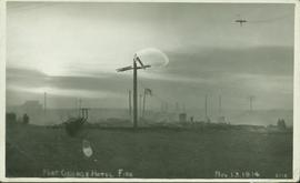
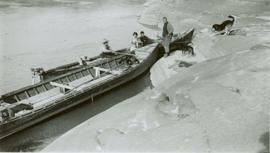
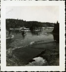
Showing 20453 results

Archival description
2009.5.3.28 · Item · [ca. 1912]
Part of Taylor-Baxter Family Photograph Collection

Photograph depicts the early settlement of Fort George. The buildings to the left of the fence are believed to be owned by the Hudson's Bay Company. The land to the right of the fence belonged to the Fort George Reserve, the home of today's Lheidli T'enneh Band who relocated to a reserve at Shelley when this reserve was sold in 1912. Handwritten annotation on verso and recto of this photograph reads: "Fort George from opposite side of Fraser River".

2002.7.1.58 · Item · 13 Nov. 1914
Part of H.G.T. (Harry) Perry fonds

Fire at the Fort George Hotel devastated the entire block. Harry Perry's Tailor shop was right across the street from the fire. Handwritten annotations on recto: "Fort George Hotel Fire; Nov. 13, 1914"

Fort George Park
2012.13.1.3.113 · Item · 12 Oct. 1989
Part of J. Kent Sedgwick fonds

Image depicts the Fort George Par, which was renamed Lheidli T'enneh Memorial Park in 2015. Map coordinates 53°54'30.2"N 122°43'57.4"W

Fort George Regional Museum
2012.13.1.3.071 · Item · Oct. 1983
Part of J. Kent Sedgwick fonds

Image depicts the Fort George Regional Museum (now known as The Exploration Place) in Prince George, B.C. Map coordinates 53°54'18.6"N 122°44'09.8"W

Fort Grahame mail boat
2004.1.2.4.6 · Item · ca. 1929
Part of Phipps-Mackenzie Collection

Annotation on verso: "Fort Grahame mail boat at 20 mile". Photo depicts a mailboat pulling along side another boat along a rocky shoreline. Two men, a woman and a child are on board while one man and two dogs are on the shore.

2012.13.1.93.29 · Item · 1978
Part of J. Kent Sedgwick fonds

Image depicts numerous pieces of what appears to be old farming equipment. There is also an unidentified individual sitting aginst the side of a building. The location is possibly Fort St. John, B.C.