Advertisement reads:
A FORTUNE IS WITHIN YOUR REACH
The Natural Center for a Great Metropolis in Central British Columbia
50,000 people have written to this company in the past few months for information on Fort George and Central British Columbia. This spring this section will see its real awakening--of course the shrewd investor of small capital appreciates what it means to buy land or town lots in the path of great industrial development, which development is not merely contemplated, but is actually in progress. The person who sees Fort George and its wonderfully rich tributary country today and invests a small sum there and revisits it again in 1915 would find himself financially independent, and the whole face of things so completely changed that he could not realize it as the same spot where his small investment had been made in 1911.
These statements are not dreams, but real existing facts based on the solid foundation of an immense virgin country, marvelously rich in natural resources being opened to the world by the greatest transcontinental railway system on the American continent, 1,100 miles, of navigable waterways radiate from Fort George.
Fort George is on the line of seven railroads projected and under construction. We issue a monthly periodical, The British Columbia Bulletin of Information--full of intensely interesting reading and pictures of British Columbia, which we will mail to you every month if you will ask.
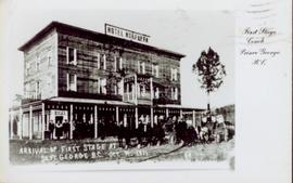
Postcard featuring a photograph of a photograph of the arrival of the first stage coach at the Hotel Northern in South Fort George, BC on 19 October 1911. Handwritten annotation on recto of photograph reads: “Arrival of first stage at So. Ft. George B.C. Oct. 19, 1911. 28” Printed caption on the recto of the postcard reads: “First stage coach Prince George, B.C.” Handwritten annotation in pen on verso of postcard reads: “Mrs. C. Morris, Box 925, Penticton, BC. Thurs. 6pm, Dear Mother. Arr. Safely, good trip (bad pen!) Lovely weather. Hope all are well. Bia (?) Mary & Ed”
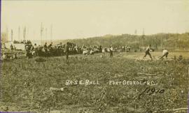
Photograph depicts crowd gathered to watch a baseball game in rustic field. Handwritten annotation on recto reads: “BASE-BALL FORT GEORGE BC” added annotation in ink reads: “1910”.
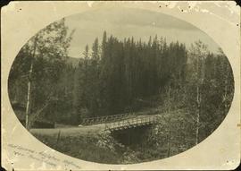
Photograph depicts a log bridge interrupting a wide dirt road in forest. Distant hills in background. Image has been cropped to an oval shape. Handwritten annotation on verso of photograph: "Fort George - Hazleton Highway Near Burn's Lake".
Item is issue Vol. 2 No. 4 from February 1912 of the "British Columbia Bulletin of Information", a promotional mouthpiece of the Natural Resources Security Company. The publication is self-described as "About the vast natural resources and commercial, agricultural and mining progress, together with a synopsis of the laws regulating public lands, timber, coal and other minerals, and current record of development in British Columbia, Alberta and Saskatchewan for the business man, the farmer and the investor". The headline of this issue is "B.C. Government Guarantees Bonds of Railway to connect Fort George with Vancouver". The Natural Resources Security Company was a development company that sold a significant amount of land in Fort George.
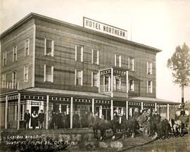
Photograph depicts two, four-horse stagecoaches laden with passengers parked outside the Hotel Northern in South Fort George. A group comprised of primarily men watch the stagecoaches from the veranda of the hotel. Handwritten annotation in bottom right corner of photograph reads: "Cariboo Stage at South Ft. George, BC. Oct 19-1911."
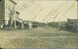
Printed annotation on recto reads: “Central Avenue Fort George B.C. Copyright Canada June 25th 1913”. Handwritten annotation in ink on recto reads: “Hotel Fort George; Pool room; Men’s furnishing; General store; Bank Vancouver; Telephone office; Temperance House; Trust-company; Grand stand & fair grounds; Hospital; Ware house and general store.” Cancelled 1 cent Canadian stamp on verso is dated: "Fort George BC Jul 14 13". Handwritten message in ink on verso is addressed to Mr. Chas H Wilson 94 Gould St Toronto: "Fort George. B.C> Box 65, July 13/ 13. Dear Father, This is a 'bird's eye view' of our main street - ha! ha! some class alright. We live right behind the bakery lunch room on the right hand side of the picture, on 1st avenue, some people eh? Will be moving to Cassiar Ave soon. How are all the folks. Mae is writing. Peace. M."
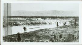
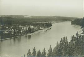
Photograph depicts landscape with cleared land in foreground, river in middle, building and trees in background.
Handwritten annotation on verso: "Central Fort George 1911".
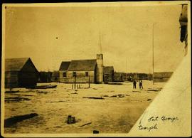
Photograph depicts two men standing in street at the Fort George Reserve. A church with steeple stands in midground, on left side of street. Forest in background. Handwritten annotation on verso and recto of this photograph reads: "Fort George Temple." See item 2009.5.3.28 for photograph depicting this reserve which belonged to the Lheidli T'enneh Band.
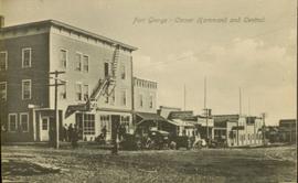
Street view of some vehicles parked in front of commercial buildings in Prince/Fort George. Businesses include "J.P. Robertson 'The Men's Store'" and "James & Co. Clothing and Shoes." Printed annotation on recto reads: "Fort George- Corner Hammond and Central."
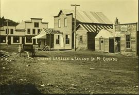
Photograph depicts a street scent at the corner of Laselle and Second St. in Fort George. A wagon is visible in the dirt road and wooden buildings cross the mid ground. Three unidentified men sit on the boardwalk outside Rigg's Restaurant while one man stands in the doorway of The White Laundry.
File consists of three business letters and one telegram sent by W.F. Smith in 1914 from Smithers, Prince George, and Fort George.
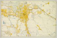
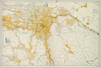
Colour-coded map depicting surveyed lands alienated, available for purchase or lease under Land Act, and available for pre-emption. Depicts land districts, land recording districts, provincial forests, parks, game reserves, communities, bodies of water, transport routes, communication lines, and triangulation stations.
Colour-coded map depicts surveyed lands alienated, available for purchase or lease under Land Act, or available for pre-emption. Depicts land districts, land recording districts, provincial forests, parks, game reserves, communities, bodies of water, transport routes, communication lines, triangulation stations, and government reserves.
This item is believed to be the program for the first agricultural fair in Fort George. This annual fair evolved to become what is now Prince George's British Columbia Northern Exhibition (BCNE).
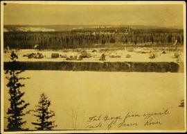
Photograph depicts the early settlement of Fort George. The buildings to the left of the fence are believed to be owned by the Hudson's Bay Company. The land to the right of the fence belonged to the Fort George Reserve, the home of today's Lheidli T'enneh Band who relocated to a reserve at Shelley when this reserve was sold in 1912. Handwritten annotation on verso and recto of this photograph reads: "Fort George from opposite side of Fraser River".
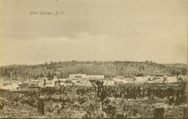
Wide angle photograph of a sparsely forested area with Prince/Fort George in the background. Printed annotation on recto reads: "Fort George, B.C."
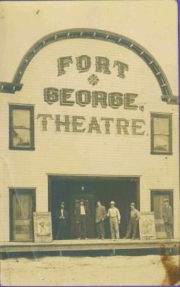
Six men stand on boardwalk in front of theatre.
Two duplicate booklets for the "Government auction sale of property at Prince George, Fort George, and South Fort George". Both booklets are variously annotated with different numbers (bid prices? final sale amounts?) next to listed lots to be sold.
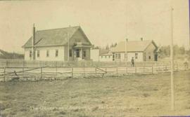
Photo of buildings behind street, fenced on either side. Man and horse can be seen on street. Printed annotation on verso reads: “The Government buildings Fort George B. C.” Handwritten annotation on recto reads: “This is the place I receive my patent from next June.”
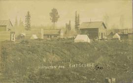
View of 5 buildings and 4 tents on land that has been cleared to stumps. Printed annotation on verso reads: “HAMILTON AVE. FORT GEORGE”, added handwritten annotation in ink reads: “1910”.
Collection consists of materials related to Fort George surveying and preemption, including both legal and personal correspondence, legal documents and records, plans of lots, photographs, and a map. Includes records from the Cariboo Investment Company, Ltd., J.B. Henderson-Roe and C.H. Henderson Roe.
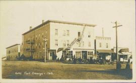
Photograph depicts Hotel Fort George with people, cars and power pole in foreground. Handwritten annotation on verso reads: “Hotel Fort George - 1913”.
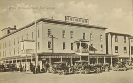
Street view of many vehicles parked in front of the Hotel Northern. Printed annotation on recto reads: "Hotel Northern, South Fort George."
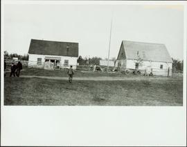
Photograph depicts two buildings behind fence, sheds visible in background. Unidentified men can be seen walking in foreground. Small structures believed to be teepees can be seen behind fence.
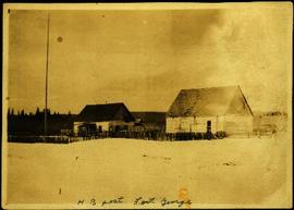
Photograph depicts four buildings behind wood fence. Cleared area in foreground, forest in background. Handwritten annotation on verso and recto of this photograph reads: "H. B. Post - Fort George".
This document is a contemporary transcription of a Hudson's Bay Company Fort George (New Caledonia) post journal. The accuracy and completeness of this transcription is not verified.
This document is a contemporary transcription of a Hudson's Bay Company Fort George (New Caledonia) post journal. The accuracy and completeness of this transcription is not verified.
This document is a contemporary transcription of a Hudson's Bay Company Fort George (New Caledonia) post journal. The accuracy and completeness of this transcription is not verified.
This document is a contemporary transcription of a Hudson's Bay Company Fort George (New Caledonia) post journal. The accuracy and completeness of this transcription is not verified.
This document is a contemporary transcription of a Hudson's Bay Company Fort George (New Caledonia) post journal. The accuracy and completeness of this transcription is not verified.
This document is a contemporary transcription of a Hudson's Bay Company Fort George (New Caledonia) post journal. The accuracy and completeness of this transcription is not verified.
This document is a contemporary transcription of a Hudson's Bay Company Fort George (New Caledonia) post journal. The accuracy and completeness of this transcription is not verified.
These documents are contemporary transcriptions of Hudson's Bay Company Fort George (New Caledonia) post journals. The accuracy and completeness of these transcriptions are not verified. Some post journal transcriptions are missing.
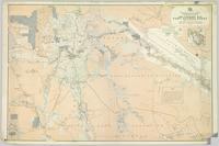
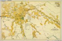
Map is entitled "Latest Map of Fort George District" and published 1912. Includes Peace River Recording Land District, Fort George Land Recording District, and Cariboo Land Recording District. Several sections are marked with red pencil.
Consists of 3 notes sent by Blunt & Brocklehurst, Solicitors, Macclesfield, to C.H. Henderson-Roe, Esq. concerning financial matters.
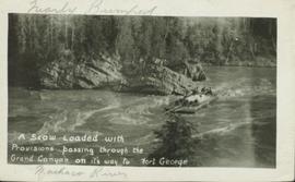
View of a scow loaded with provisions and several people passing through rapids of the Grand Canyon. Printed annotation on recto reads: “A scow loaded with provisions passing through the Grand Canyon on it’s way to Fort George.” Handwritten annotation in pencil on recto reads: “Nearly Bumped, Nachaco River” Handwritten annotation in pencil on verso reads: “My address will be Fort George BC. Dear Mrs. Cooper, I am up in the wild part of BC now where men horses and everything get drowned every day, sometimes automobiles get drowned also. This is the way we travel up where I am now. I saw a boat upside down in this Canyon it had a bundle of blankets tied on it and one oar was dancing in the whirlpool. This made my hair stand straight up and down.”
A collection of postcard photographs of Port Essington BC, Port Simpson BC, Atlin, Quesnel, McBride, Hagwilget Village, Giscome, Likely, Kitwanga, Smithers, Prince Rupert BC, Prince (Fort) George BC Images depict street scenes, water scenes, community events, businesses, buildings, and aerials of the towns. Collection also depicts a number of Northern BC paddle wheelers.
Part of a set of 41 original black & white photographs [1908-1933-?]) of the Grand Trunk Pacific Railway line in BC depicting surveying crews, town sites (Prince Rupert and its port, Hazelton and Fort George), and First Nations Peoples.
Consists of 6 letters written by Jack Henderson-Roe, of Fort George, to his father, C.H. Henderson-Roe, of England, regarding proposed land acquisitions in Fort George.
Consists of 5 letters written by Jack Henderson-Roe, of Fort George, to his father, C.H. Henderson-Roe, of England, regarding investments and proposed land acquisitions in Fort George.
Photographs consist of 16 black & white photographs depicting Fort George land and surveying, including 3 photographs of Jack Henderson-Roe in front of his log cabin that he constructed in Fort George in 1913.
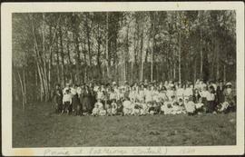
Photograph depicts a large group of women, men, and children standing and sitting on grass. Stand of trees crosses midground, forest visible in background. Handwritten annotation on verso of photograph: "Picnic at Fort George (Central) 1920." Photograph believed to have been taken at current location of Spruceland Shopping Center.
Consists of 1 plan entitled "Plan of Subdivision of S.W. 1/4, D.L. 4041 : Cariboo District," surveyed and signed by P.A. Landry, of South Fort George.
Consists of legal records and documents related to the holdings and activities of J. B. Henderson-Roe and his father, C.H. Henderson-Roe, including a hand-drawn map of Prince George, Fort George, and South Fort George, as well as a surveyor's plan for a subdivision.
File contains postcards portraying life in Prince George, B.C. Images depict street scenes (George Street, Central Avenue, and Hamilton Avenue), government buildings, Hotels, a theatre, a baseball game, and construction of a pier.
Colour-coded map depicting lands open for pre-emption, lands in “University Reserve,” and lands reserved for public auction. Depicts land recording divisions, communities, bodies of water, transport routes, and game reserves.
Colour-coded map depicting lands surveyed as alienated, reserved, Statutory Timber Lands, B.C. Land Settlement Board Area, or open for pre-emption. Depicts land districts, land recording divisions, communities, game reserves, bodies of water, transport routes, and communication lines.
