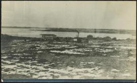
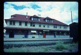
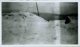
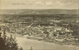
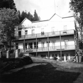
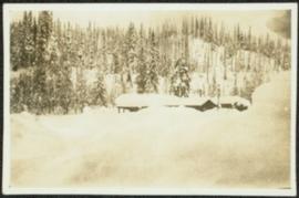
Unidentified building stands in midground, water and hill on opposite shore visible in background.
Crowd stands in background.
Handwritten annotation on verso reads: “Fall 1978, Kispiox, 2 Poles by Walter Harris”.
Photograph depicts crowd of people in foreground near log fence. More crowds can be seen in distance at base of ski jump on either sides of the run. Jump visible at top of tree-covered hill in background. It is believed that this photograph was taken near the current location of City Hall.
Image depicts two unidentified individuals examining a tractor meant to delimb trees. It is located in Prince George, B.C.
Image depicts the community of Skidegate on Haida Gwaii.
Image depicts a skier in a costume with a fake sword, somewhere on the Birchleg Ski route on Tabor Mountain in Prince George, B.C.
Photograph depicts the Silver Ledge Hotel, Ainsworth Hot Springs, on the west side of Kootenay Lake, north of Nelson.
Photograph depicts the sluice gates off the Nicola River, on a ranch at Nicola village, 7 miles northeast of Merritt.
Photograph depicts sluice trunk in mining area, men on tall structure in background.
Photograph depicts a small barn that had just been built within the last 12 months.
Photograph depicts small building speculated to be a house in a farm yard. Frozen water crosses midground, opposite shore in distance.
Child stands in distance beside tall totem pole. Tree stumps in foreground, forest and mountains in background.
Handwritten annotation on verso reads: "[Sanabati near Upper Queen?] Kasaan Alaska".
Image depicts an aerial view of what appears to be a small farm, possibly in the McGregor Canyon.
Image depicts a small, abandoned house in Woodpecker, B.C.
Image depicts a view of what appears to be a small town at an uncertain location.
Image depicts the CN rail station in Smithers B.C.
Image depicts a snow gauge at an uncertain location.
Photo displays the height of the snow on the front porch of the Giscome teacherage after a blizzard.
Item is a photograph of a building with trees in front covered with snow.
Image depicts the restored White Pass Snow Plow No.1 in Skagway, Alaska.
Photograph depicts the interior of a snow shed at about mile 29.0 using CPR mileages commencing at Brookmere, which is 4 miles east of Brookmere. It is on the ex CPR Coquihalla Line from Hope to Brodie Junction.
Street view photograph of two individuals watching the snow slide down one of the mountains surrounding Stewart, BC. Printed annotation on recto reads: "Snow Slide Stewart B.C. July 7/11."
Winter landscape scene featuring a small barn barely visible under snow. Trees in background and snow-plowed area in foreground. Handwritten caption beside this photo reads: "Lakeside Barn in Winter".
Photograph depicts an unidentified building in snowy area, trees on hill in background.
Image depicts a snow-covered road at an uncertain location.
Photograph depicts very large snow pile in plowed yard. A small building with a log roof is semi-visible behind snow on far right.
Image depicts the Buckhorn Snowmobile Club, though it was formerly the Buckhorn school.
Image depicts the annex for the Buckhorn Snowmobile club.
Image depicts a snow-covered road with vehicle tracks, and several houses. The location is uncertain.
File consists of notes and booklets relating to the Society for the Study of Architecture in Canada. Includes: "Architecture of the Great In-Between" spiral bound booklet of a conference schedule (June 2005); "Lethbridge Historical Walking tour" pamphlet prepared by the Alberta Community Development and Sir Alexander Galt Museum and Archives (2000); "Expressions Magazine" edition of the Expressions magazine (2005); and "Gallery" a quarterly publication of the Southern Alberta Art Gallery summer edition (2005).
Image depicts a bridge at Soda Creek, B.C. There are numerous unknown individuals present.
File consists of photographs depicting Soda Creek Cemetery and presumably the general Soda Creek area. Also includes photographs of a personal residence and Kent Sedgwick with a dog.
Image depicts the old BX Sternwheeler office building in Soda Creek, B.C.
Image depicts the cemetery in Soda Creek, B.C.
Image depicts a house in Soda Creek, B.C.
Image depicts the old community hall in Soda Creek, B.C.
Image depicts the old jail house in Soda Creek, B.C.
Image depicts an old building located somewhere are the Pickard farm north of Soda Creek, B.C.
Image depicts what appears to be a Ranch at Soda Creek, B.C.
Image depicts a section of land, with a few houses, in Soda Creek, B.C.
File consists of notes, clippings, and reproductions relating to South Fort George. Includes: "South Fort George - A trip to the past" heritage brochure produced by South Fort George Community Association (1987) and "B.C. Express Co. Heritage Site" typed document prepared by the Heritage Advisory Committee (Feb. 1994). Also includes photographs depicting various buildings from old South Fort George.
File consists of notes, typescript documents, and clippings relating to the heritage potential of South Fort George. Includes: "Heritage Potential of South Fort George" typescript document by the Heritage Advisory Committee (Feb. 1982) and "Fort George Area - Historical and Heritage Opportunities Study" letter to the Mayor and Council of Prince George from Mark B. Stagg, City Planner (5 Feb. 1982).
Image depicts a house somewhere in the South Fort George subdivision of Prince George, B.C.
Overhead view of downtown Prince George with a forested area in the background. Printed annotation on recto reads: "South Fort George- 1914."