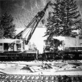
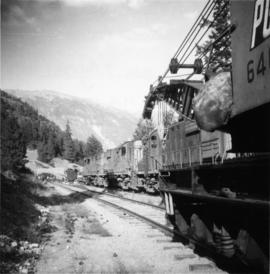
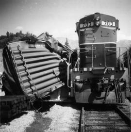
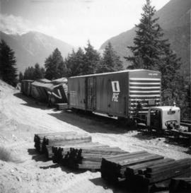
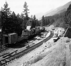
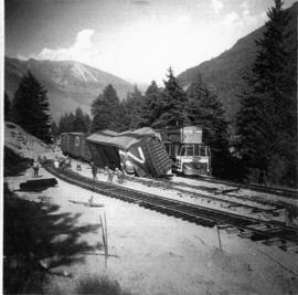
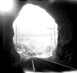
Photograph depicts an the eastern portal of a Pacific Great Eastern tunnel on the west side of the Bridge River Hydro project in Shalalth. Penstocks of the hydro plants are clearly visible on the hill side.
Photograph depicts the depot in Shalalth that faces Seton Lake.
Photograph depicts a wrecked steel box car used by a farmer as some kind of shed with some of the side panels removed.
Photograph taken from the depot in Squamish that runs a half a mile spur down to a dumping site beside the Squamish River. Image displays the log dump looking towards the east with the depot in the background, towards the right.
Photograph depicts loading logs on the Pacific Great Eastern, north of Squamish.
Photograph depicts a Pacific Great Eastern bridge over the Capilano River in northwest Vancouver. Also visible is a switching locomotive.
Photograph depicts a caboose and flanger car #1823.
Photograph depicts the Pacific Great Eastern line through Williams Lake.
Photograph depicts a caboose and flanger car #6016
Photograph depicts horses beside track about 300 yards south of the passenger depot in Williams Lake.
Photo depicts the interchange of passengers of a northbound dayliner around the wreckage of a derailment. Two budd car units from Vancouver can been seen in the background. Passengers were being transferred to a "scratch" train assembled at Lillooet and consisting of a budd car, caboose and a diesal switcher.
Photo depicts the transfer of a Vancouveer to Lillooet dayliner to the unit made up at Lillooet wich consisted of a budd car, caboose and switcher. The scene of the Seton Portage derailment was found 100 yards behind the photo.
Photo depicts the largest crane on the Pacific Great Eastern and is stationed in Prince George.
Photo depicts a crane #6501 in position to lift locomotive #703. It was about to re-rail one end of the locomotive. Image captured looking towards the south with the shoo-fly in the immediate foreground and Setan Lake in the background.
Photo depicts a distant view of the Seton Portage wreck,. Squamish Shops crane was standing on the minor line of the loop. The crane was self-propelled and after its launch it had broken its drive axle. This was replaced by a standard axle and, therefore, was propelled by a switcher.
Photo depicts a close up view of the rear of the locomotive #703. It was stopped at the head of a freight onn the main line portion of the loop awaiting a southbound loaded freight. Its tracks were derailed, fuel tranks ruptures and a sliver of steel from the box car was forced into its forward tracks. The left side of the cab was also sheared.
Photo depicts the general view of a derailment, looking eastward. The derailed locomotive #703 was found beside a squashed box car. By this time, a PGE bulldozer had prepared a road bed for the wreck.
Photo depicts a shoo-fly that had been built around the Seton Portage wreck. locomotive #703 had stood at this spot just before the switch when the cars of the southbound freight piled into it.
Photo depicts a Pacific Great Eastern working train approaching Seton Portage. It had been diverted from the derailment to fill in a burnt out wooden culvert on the edge of Anderson Lake.
Photo depicts the removal of about 70 bales from a box car.
Photo depicts a derailment in Seton Portage at the Pacific Great Eastern broken switch on mile 139.8.
Photo depicts the general view of the clean up of the derailment in Seton Portage. The track in which a speeder stands a gondola car with rolls were the two tracks of the loop. They were both severed and respliced in making the "second edition" of the shoo-fly.
Photographs in this series document Perry's political career, his business enterprises and his familial connection with relatives in England. Other featured subjects include various transportation modes (ca. 1913) used in the BC Interior, as well as railroad and bridge construction in the same era.
Consists of photographs depicting the Grand Trunk Pacific Railway, the Pacific Great Eastern Railway, the British Columbia Railway, the Canadian Pacific Railway, and the Canadian National Railway. Also includes photographs of various forestry-related scenes.
Series consists of images pertaining the Collison family, North Coastal First Nations communities, means of transportation along North Coastal British Columbia, and various church structures and religious events.
The images consists primarily of 130+ photographs taken by or belonging to Reverend R.W. Large, MD which depict communities on the Northwest Coast between approximately 1898 and 1920 including Bella Bella, Rivers Inlet, and Port Simpson, including native villages in which Reverend Large worked. Images show scenes of native fishing, canneries, mission hospitals, churches, girls schools, portraits of native families, and Northwest Coast totems. Other images include 25+ photographs and postcards from the Large family depicting ships and boats on the North Coast.
Series consists of graphic material depicting railways in British Columbia. Includes prints, negatives, and postcards.
Series consists of photographs relating to Ray Williston's life from childhood to recent times, air photographs of Prince George, photographs of Bangladesh, and a listing of photographs slated for use in Mr. Williston's biography "Forests, power and policy: the legacy of Ray Williston" written by Eileen Williston and Betty Keller.
Photograph depicts a piece of abandoned track leading to the peat plant at #8 road on Lulu Island on the Westminster Highway. The track runs parallel to the Westminster Highway, which is at the left beyond the photo. The rail is undated and marked, "Rlymney Steel" (South Wales). The photo is looking west and the Canadian National Railway (CN) spur lies a quarter mile behind the camera.
Map depicts the Shuswap Lakes, Rogers Pass, Kamloops, Yellowhead Pass, Thompson Valley, and the Nicola Valley. Also includes the first clues to a treasure hunt.
Perspective of pier and wharf as seen from the water. Port Simpson and hill in background. Sternwheeler can be seen on shore.
Photograph depicts Pier #2 in Vancouver at the north end of Columbia St. It shows disconnected trackage on the east side of the pier that was formerly serviced by the CPR. It has not been in use for some years. The switch fittings were made by the Nelson Iron Works in Seattle.
Photograph depicts Pier B in Burrard Harbour, Vancouver. The photo shows the inside the main roadway and the CPR trackage.
Photograph depicts a pipe yard of West Coast Gas Transmission. Two large pipes had gotten away and rolled onto the railway.
Photograph depicts view of pit mine, taken facing east. Town of Cassiar can be seen in distance at foot of south mountain range. Photograph was taken from the air, portion of plane visible in top left of image.
Plan depicts the CNR rail yard in Kamloops. The plan was originally drafted on March 6, 1928 and updated to July 1937.
Plan depicts the Canadian Pacific Railway yards in Kamloops and the proposed connection between CPR and CNR. Includes a CPR track profile, profiles of street crossing, and enlargements.
Plan depicts the proposed CNR rail yard layout in Kelowna. A later plan, dated May 30th 1925, shows drastically reduced trackage and no barge slip.
Plan depicts a proposed location for a CNR station and crossing in Kelowna.
Plan depicts the proposed location and layout for the Canadian Northern Pacific terminal at Kamloops on the Kamloops-Lumby branch.
Map depicts the growth of Vancouver's street car system as from the laying of the first tracks in 1889 to the last section laid (Clark Dr., Hastings to Venables).
Handwritten caption above this photo reads: "Plane on Sumit Lake." Logs can be seen floating on water in foreground, as well as trees on opposite shore in background. The seaplane has the letters "CF-ATF" on its side.
Two men stand on the ice of Pinchi Lake beside a small plane that appears to have crashed into the icy lake. Handwritten annotation in ink on the verso reads: "Plane on the ice at Pinchi".
Handwritten photo album caption below this photo reads: “Fort St John Apron. F/Rideouts 'Norseman'^" Arrow is pointed at plane on far right with the number "2466" on its side and unidentified equipment below. Runway in foreground, approximately four military planes in background surrounded with unidentified people and equipment.
Royal Canadian Air ForceSubseries contains plans of BC Rail sites, yards and industrial parks.
Photograph depicts a plaque attached to the east side girder of bascule section of the Second Narrows railway bridge in Vancouver, BC
Front view of tractor plow clearing snow-covered road site, trees on either side. Operator of plow is visible, but not identifiable.
Photograph depicts a pole yard of Gorman Bros Ltd. Loading methods and quality were checked by CN inspectors in Kamloops, then on the main trans-continental line. These particular lines were destined for Ontario.
Three Indigenous men stand in a canoe poling their craft along a shoreline while one man sits and steers. An unidentified village is visible along the opposite shore.