Photograph depicts two men standing on mining bench in mountainside, three boxes and what appears to be a long hose to the left. Third man and tractor plow can be seen in distance at end of bench. Photo caption next to printed copy of image in 1953 Annual Report: "Benches being prepared for mining."
Photograph depicts two men working with air track drill in mine area. Hose and dynamite box in foreground, mountains in background. Handwritten annotation on verso of photograph: "Sept. 1954." This photograph was originally stored inside duotang labeled "CASSIAR ASBESTOS CORPORATION LIMITED PHOTOGRAPHS 1954"; photo caption beneath this image: "Starting New Bench at South end of Deposit."
Undated 2-page memo to Dave [Carter?] [from Scott Smith?] with review comments on a draft manuscript; attached to a draft table with basic characterization data for 3 paleosol sequences at the Lost Chicken mine (profile numbers 91010, 91011, & 91013)
Item is "Memorandum regarding Future Logging at Aleza Lake" by F.S. McKinnon.
File consists of a scientific memorandum from Harold Mundie to Forbes Boyd regarding "Preparation for Nechako River Court Action". Document primarily discusses the flow regime required in the Nechako River to protect the salmon.
File consists of a copy of a memorandum from Fretwell to Levings, Healey and Shirvell regarding "Nechako Court Action - Possible Remedial Measures to Maintain Productivity at Low Flows". Includes two attached documents entitled "Proposed Nechako River Monitoring and Remedial Measures" and "Summary of Remedial Measures Options".
File consists of a memorandum from T.M. Apsey, Deputy Minister, October 1, 1981.
File consists of membership addresses and correspondence, 1956-1957.
File includes:
- Minutes of the 48th Annual Meeting of the members of the Canadian Institute of Forestry (October 3 & 5, 1956) and related correspondence
- "Canadian Institute of Forestry Statement" 1956 read by W.A.E. Pepler
- "Forestry and Canadians" by Lowell Besley September 17, 1956
- correspondence too and from members of C.I.F.
- Minutes of Meeting Canadian Institute of Forestry (Cariboo Section) Jan. 21, 1956 and related correspondence
- other C.I.F. correspondence 1955-1956.
Photograph depicts a visit between Governor General of Canada, Ray Hnatyshyn, and Adam Zimmerman.
Photograph depicts a visit between Governor General of Canada, Ray Hnatyshyn, and Adam Zimmerman.
Photograph depicts a visit between Governor General of Canada, Ray Hnatyshyn, and Adam Zimmerman.
Photograph depicts a visit between Governor General of Canada, Ray Hnatyshyn, and Adam Zimmerman.
Photograph depicts a visit between Governor General of Canada, Ray Hnatyshyn, and Adam Zimmerman.
Item is a photograph of a copy print, resulting in a low quality photographic reproduction. Reproduced as a print, slide, and a negative. Location of original photograph is unknown.
File consists of a report entitled "Evaluation of World Supply and Demand for Wood Pulp, Newsprint, and Lumber and Factors of Location in British Columbia" by the Mead Market Research Department.
Mead CorporationSubseries consists of records regarding the Mead Corporation that were created or accumulated by Adam Zimmerman during his tenures as President of Northwood Pulp and its successor, Northwood Pulp & Timber. Mead Corporation formed an agreement with Noranda Mines to create Northwood Pulp Ltd.; each company had a 50% stake in the newly formed venture. Primarily includes records relating to the pulp agreements between Northwood Pulp and Mead Corporation. Also includes sales records, financial records, and correspondence.
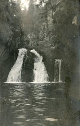
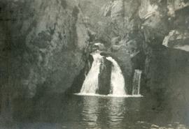
Mead CorporationPhotograph depicts McRae Creek Falls.
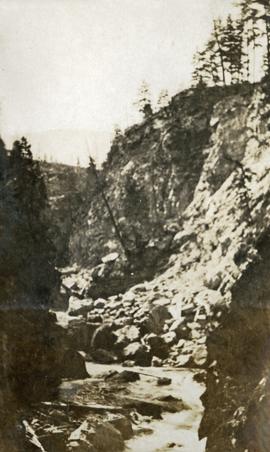
Photograph depicts McRae creek canyon.
Photograph depicts McRae Creek Falls.
During the 1980s, Agriculture Canada pedologists Scott Smith (retired from Summerland Research Station, formerly based in Whitehorse) and Charles Tarnocai (retired from Central Experimental Farm, Ottawa) had a large field program which addressed the trends in soil development in the central Yukon. Across this region, particularly between Whitehorse and Dawson City, the land surfaces and surficial deposits vary greatly in age due to the differing extents of glaciations over the past ~2 million years.
Tarnocai and Smith shared the unpublished data and soil samples from this work with Dr. Paul Sanborn, and this resulted in a student project published as:
Daviel, E., P. Sanborn, C. Tarnocai, and C.A.A. Smith. 2011. Clay mineralogy and chemical properties of argillic horizons in central Yukon paleosols. Canadian Journal of Soil Science 91: 83-93. https://doi.org/10.4141/cjss10067
This data set consists of transcribed data from lab data sheets, showing McQuesten-Dawson City paleosol data from the Tarnocai and Smith 1983 AAFC Yukon Paleosol Study. The data set includes chemical and particle size data for Tarnocai & Smith samples, as determined by the Ag Canada lab. Note that the “Site” column indicates the NTS topographic map sheet (e.g. 115P/13) for the sampling locations.
Item is McNaughton Lake, B.C. Map 83D and Part of 83C Second Status Edition (1975) from "Classification and Interpretation of some Ecosystems of the Rocky Mountain Trench, Prince George Forest Region, British Columbia: First Approximation" (1984).
File consists of printed power point slides for the "McGregor's Role Supporting Communities: NCMA Conference."
Forest cover map showing a crossing area of the McGregor River is annotated with a road and ferry crossing.
File consists of a large poster about the McGregor Model Forest. Information about the Association's development and partnerships within the community are presented.
File consists of a number of issues from the McGregor Model Forest Network: Advances Newsletter ranging from 1994 to 2005 regarding model forest projects. File contains the following issues: October 1994, July 1995, Third Quarter 1996, Spring 2000 and December 2005. File also includes an information sheet titled "McGregor Model Forest-Backgrounder" and a page from the Canadian Model Forest Network titled "The McGregor Approach to Sustainable Forest Management."
File consists of a number of MMFA Advances in Sustainable Forest Management newsletter issues ranging from 1995 to 2004 regarding model forest projects. Included issues: January 1995, April-June 1995, October 1995, First Quarter 1996, Second Quarter 1996, Fall 2000, Fall/Winter 2001, Fall 2002, Spring 2003, Fall 2003, and Spring 2004.
File consists of a large 24" x 12" magnet with the McGregor Model Forest logo.
File consists of "McGregor Model Forest: First Nation Youth Programs in the Natural Resource Sector of British Columbia" by Brandon W. Prince. Includes case studies of Adams Lake Indian Band (Sexqeltqi'n), Duke Energy: Gas Transmission, the Aboriginal Human Resources Development Strategy, Nicola Valley Institute of Technology - Natural Resources Technology Program, and UBC Summer Forestry Camp for First Nation Youth.
File consists of the "McGregor Model Forest Association Request for Proposal-Social Valuation of Prince George Urban Forests: Assessing Public Opinion of Forest Values and Forest Management." File includes an insert titled "RFP Revisions" and "City of Prince George B.C.'s Northern Capital: Park & Trail Guide" pamphlet.
File consists of the Association's reference guide. The table of contents lists:Vision Statement/Concept Paper & Five Year PlanMap of the McGregor Model ForestNews Articles/Press ReleasesOrganizational ChartCommittee Lists including: Partnership Committee, Board of Directors, Technical Steering Committee and Model Forest Network CommitteeAssociation Officers and StaffAssociation Agreements including Model Forest Agreement, Contribution Agreement, McGregor Model Forest Bylaws, British Columbia Society ActTerms of Reference including: Technical Steering Committee and Program TeamsCompendium of ProjectsMinutes including: Board of Directors and Technical Steering Committee*Policies and Guidelines including: Contract Tending Policy, Expense Reimbursement Policy, Conflict of Interest Guidelines, Membership Criteria, In-Kind Contribution Policy, Annual Reports for the years 1992/93, 1993/94 and 1994/95, and the Gassinski Model Forest Twinning Project. File includes various memos, contact information, and correspondence.
File consists of presentation transparencies for the McGregor Model Forest Association. The slides detail various components, goals, structures and hierarchies of the association and include maps, images, charts, and graphs. Slides include information on: "Technology and Sustainable Forest Management" by Carey Lockwood, elements of SFM, evaluations indicators, criteria for reporting on forest values, forest models for the future, maps of forest areas, provincial planning hierarchy, seral stage table, case study objectives, proposal as submitted FEN table and a document on Public Policy and Forests in Canada. File includes a few pages of paper printouts of graphs and map.
File consists of the "McGregor Model Forest Association Master Direction March 1999" approved by the MMFA Board of Directors.
Fonds consists of the McGregor Model Forest records documenting the operational history of the model forest from 1992 through 2007. These records document the various functions of the McGregor Model Forest reflected in the four series:
- 1) Projects and Research consisting of reports, proposals, and project and research materials ranging from 1994 to 2006
- 2) McGregor Model Forest Association Administration records largely consisting of Board of Directors Meeting Minutes from 1993 - 1997; work plans from 1994 - 1997, 2002 - 2003; annual reports from 1995 - 2006; Technical Steering Committee Meeting Minutes from 1993 - 1997
- 3) Publications by the McGregor Model Forest Association, the Canadian Model Forest Network, Natural Resources Canada, or other forest research organizations
- 4) Promotional Materials including materials from outreach events such as posters, presentation slides, and ephemera.
File consists of the "McGregor Model Forest Association: Annual Report 2005-2006."
File consists of the "McGregor Model Forest Association: Annual Report 2004-2005."
File consists of the "McGregor Model Forest Association: Annual Report 2003-2004."
File consists of the "McGregor Model Forest Association: Annual Report 2001-2002."
File consists of the "McGregor Model Forest Association: Annual Report 2000-2001."
Series consists of administrative records of the McGregor Model Forest Association (MMFA) including: Board of Directors Meeting Minutes from 1993 to 1997; work plans from 1994 to 1997 and 2002 to 2003; annual reports from 1995 to 2006; Technical Steering Committee Meeting Minutes from 1993 to 1997. Series also includes MMFA Master Direction document and Defining Document as well as a reference guide for the MMFA.
File consists of the "McGregor Model Forest: Annual Report 97/98."
File consists of the "McGregor Model Forest: Annual Report 96/97."
File consists of the "McGregor Model Forest: Annual Report 95/96."
File consists of the "McGregor Model Forest: Annual Report 1999-2000."
This file includes two major photographic collections concerning the construction and development of the underground mine at Cassiar, title the McDame Project.
The first collection includes fifteen monthly progress reports documenting the development from July 1988 to December 1989. The progress reports are authored by G. Verret, and were distributed to the executives of Cassiar Asbestos in Vancouver as well officials of the B.C. Government and other creditors of the Corporation. Most images are annotated and dated. Many of the loose photographs are accompanied by an inventory sheet.
Subjects depicted include: the staging area prior to mine development, the initial development of the “Vent Portal”, a jumbo drill working on the mine face, the working face marked for drilling and wired with fuses, a Caterpillar dozer clearing snow after an avalanche, scene of a fire in winter time, complete conveyor sump decline, mining vehicle parked on the “Lay-Down Area” presumably near the portal, the working face of the mine at various stages of development, 1563 portal being slashed, the removal of the overburden for the tramline loading station site, the construction of the transfer tower(s), construction of the stockpile area, the construction of a sedimentation pond, a presumed cave in, construction of footings for the conveyor, construction of the tramline loading terminal station, construction of the crusher building, a slash titled “Breakthrough in Access Ramp”, storage of powder and fuses, a washout in conveyor decline, fog at the portal in -30 degrees Celsius, the 1290 junction flooded, a slab of shotcrete which fell on and injured a miner while shotcreting, shotcrete blasted off walls for repairs, images of the “Hilti-test”, shots showing grade of drift, and structural failures in the 1350 adit.
Locations and structure within the underground mine depicted include: yellow ventilation ducting, ground support including steel screen and shotcrete, steel cables bolted unto ground support, puddles in the adits, the access road to the lay-down area, the exhaust drift, “Fans and Heaters in the 1415 adit”, the 1350 sump, the access ramp to the 1320, the exhaust ramp safety bay, the conveyor decline, the ventilation adit, the 1563 portal, the temporary repair shop at the 1415 portal, junctions of various drifts, the ”Fresh Water Pump & Pumphouse on lower Creek”, the “Ventilation Raise/1563 Platform”, a “Diamond Drill Station” at 6066 North in the underground mine, the “Bridge to the Gravel Pit”, the “Crushing and Screening Plant” in the gravel pit, the ventilation bulkhead in the conveyor decline, and the “Powder Magazine”.
People depicted include Rose Gay and R. Tyne on a tour of the underground mine, a geologist with a rockhammer, a miner identified as A. Jacobs working, contract miners Bruno and Marbel from Canadian Mine Development, and unidentified miners rockbolting, shotcreting, and drilling using jackleg drills.
Vehicle and mining equipment depicted include jeeps, pickup trucks, a front end loader, an unidentified a small unmanned tracked machine with a long arm, scoop trams, a land cruiser, an ore truck with a flat tire, the cone crusher, a “scissor lift”, a mobile shotcrete machine, a new grout pump, a new Boart Jumbo Drill, and a detached bucket half of a 413 ore truck.
The second collection depicts the McDame Project construction in 1986 and 1987.
Content of these photographs includes: various machinery used for excavating and drilling, underground progress of tunneling, supports, wire meshing, rock formations in mine, and exposed asbestos. There are no annotations regarding this photographs.
Item is McBride, B.C. Sheet 93H and Part of 83E Second Status Edition (1971) from "Classification and Interpretation of some Ecosystems of the Rocky Mountain Trench, Prince George Forest Region, British Columbia: First Approximation" (1984).
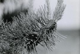
Caption describing photograph: "Maturing 2nd year cones on right, mature non-serrotinous cone with seed dispersed on left."
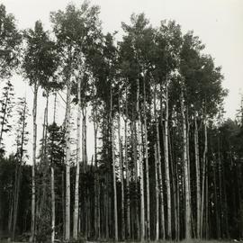
Caption describing photograph: "Frames 8, 9, and 10. Mature stand of Aspen growing on moderately drained Bednesti silt (Sandy silt). Ht 95', 22" DBH. Age 110 years. Excellent form. Mile 11 Hart Highway. Adjacent field has excellent crop of potatoes and timothy."
Item is a copyprint reproduced from the British Columbia Forest Service photographic records held at BC Archives.
Item is a copyprint reproduced from the British Columbia Forest Service photographic records held at BC Archives.

