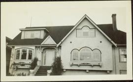
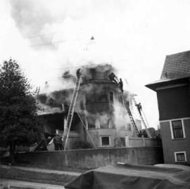
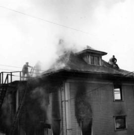
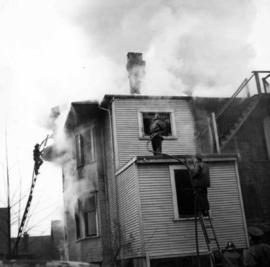
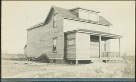
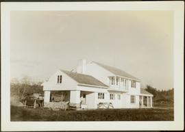
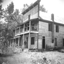
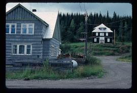
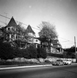
Photograph depicts a house on 10th Ave., Vancouver.
The item is a photograph depicting a house on 12th Avenue before demolition to make room for the Parkwood commercial area. Annotation on back of picture states, "demolished July / 91 for Parkwood expansion. 1734(?) 12th ave."
The item is a photograph depicting a house on 12th Avenue before demolition to make room for the Parkwood commercial area. Annotation on back of picture states, "removed July / 91 2 blue spruce + 12th ave."
Image depicts the interior of an old house, possibly the Cottonwood House, and most likely in or near Barkerville, B.C.
Image depicts and old house and vehicle in Upper Fraser, B.C. Map coordinates 54°07'05.7"N 121°56'38.9"W
Photograph depicts house with arched windows. Neighbouring house partially visible on left.
The item is a photograph depicting the back of a four-level stucco house in South Fort George. Various appliances are being kept by the house. The house is likely located in the Hazelton Street area, Prince George.
Image depicts a small house with brightly coloured door and window frames in Penny, B.C.
Photograph depicts the house opposite an 1876 church in Nicola village, 7 miles northeast of Merritt. It may be the manse.
Photograph depicts the Moha "ghost" vilage, 20 miles west of Lillooet, at the fork of Bridge and Yalako Rivers. It used to be a gold mining village. About 8 houses/cabins were left standing, but none were occupied. Displayed is one that had 2 ft. thick walss to waist height, as shown.
Image depicts a house in Giscome, B.C. Map coordinates 54°04'17.6"N 122°22'06.1"W
The item is a photograph slide reproduction depicting a blue house surrounded by flood waters in Prince George.
Unidentified house with veranda stands in field, hills in background.
Photograph depicts a house on Ladner Trunk Rd. in Delta, B.C. It is in the northeast corner of an intersection with the road leading to the Canadian Army Signal Station.
Photograph depicts an Independent Order of Foresters 1895 house.
Image depicts a blue house for sale on Upper Fraser Rd. Location is likely Upper Fraser, B.C.
Photograph depicts a house fire on 1000 Beach Block and Thurlow St. on December 18, 1964. A wrecking gang accidently set fire to the house and it took one hour to get the fire under control.
Photograph depicts a house fire possibly on 1000 Beach Block and Thurlow St. , caused by a wrecking gang.
Photograph depicts large house in cleared area featuring a covered front porch. This is speculated to be the home in which A.K. Bourchier once lived. A second building is semi-visible in background.
Image depicts a house with a vehicle in a garage and the number 40 on it; location is uncertain.
Photograph depicts the ongoing wrecking of house #1053 on Beach Ave.
Photograph depicts house at #1053 Beach Ave. in Vancouver, B.C. Dan Davies was a resident at one time.
Photograph depicts car and shed behind white home with open garage, balcony and porch. Trees and power lines in background.
Image depicts a house, most likely on Thompson Drive in Prince George, B.C.
File contains images depicting room by room view of a house in Cassiar identified as house 288. Handwritten annotation on verso of photographs: "288 June-9-1992". Photographs originally found in file labeled "TOWN ADMINISTRATION Small Business 1981"; it is likely that these images form part of the process documentation for a small business license.
Image depicts a house with the main floor and entrance high off the ground. The location is uncertain, likely Giscome, B.C.
Image depicts a house in 127 Mile House, B.C.
Photograph depicts Mrs. Houghtaling standing with four small children near doorway of tent building (Gertrude, Mary, Henry, and Charlie). This photograph is believed to have been taken at Sand Creek, BC. Forest trees in background. Handwritten annotation on recto of photograph reads: "Tete Jaune 1912".
Photograph depicts three small children (Henry, Charlie and Mary) standing at Sand Creek settlement. A dog stands beside them pulling a small wagon of firewood. Tent and wood buildings in background, including a cafe on far right. Hillside can be seen in distance. Handwritten annotation on recto of photograph reads: "Houghtaling Sand Creek Bourchier 1912".
File consists of notes, clippings, and reproductions relating to hotels and motels in Prince George, including material on the former Prince George Hotel, which was on the corner of Fifth Avenue and George Street; the Alexandra Hotel which was built in Central Fort George at the corner of Third Avenue and Brunswick Street; The Europe Hotel on Third Avenue; The National Hotel at 1201 First Avenue; the London Hotel at 1479 Third Avenue; Astoria Hotel at 233 George Street; The Canada Hotel at 206 George Street; The Columbus Hotel which was at 1250 Third Avenue; and the Northern Hotel in South Fort George. File primarily includes various clipped articles from the Prince George Citizen newspaper and printed photographs from The Exploration Place Museum database and The Royal BC Museum and Archives.
Photograph of Prince George Hotel with several early model cars and a few people. Printed annotation on recto reads: “Hotel Prince George, Prince George, B. C.”
Street view of many vehicles parked in front of the Hotel Northern. Printed annotation on recto reads: "Hotel Northern, South Fort George."
Photograph depicts an old hotel in the center of Keremeos. It once had been a thriving staging post. The village now only contained 2 building which included this hotel and a dance hall that had been converted to a barn.
Photograph taken at Carmi, an old village between Rock Creek and Kelowna. Visible is an old hotel that was up for sale.
Photograph depicts street corner view of Hotel Fort George with people and utility pole in foreground.
Handwritten annotation on verso “Hotel Fort George Central Fort George 1913".
Photograph depicts Hotel Fort George with people, cars and power pole in foreground. Handwritten annotation on verso reads: “Hotel Fort George - 1913”.
Photograph depicts the Hospital Cottage on Main St. in Sechelt, B.C. which also appears to have been home to the Magistrates and Small Debts Court at one point. A large central hospital for the whole of the Sechelt Peninsula was opened in 1965 at Sechelt.
Image depicts the hospital building and another building in Wells, B.C.
Image depicts what is possibly Hospital Beach in Kitimat, B.C. The facility in the background is possibly the Alcan smelter.
File contains photographs of a report completed in 1980 depicting the ambulance garage, as well as the interior and exterior of the hospital building in Cassiar, B.C. Each room is captured, as well as medical equipment such as the X-ray, audiometer, lung function apparatus, and autoclave. A doctor, two nurses, and several patients are shown. Accompanying report contains a description of the medical facilities in Cassiar including a detailed budget, description of staffing and utility requirements, and a floor plan of the facilities.
In addition there are two albums of Cassiar Hospital and Pharmacy Staff engaging in social functions. These photographs appear to be informal and depict staff parties, people at work and some of the patients, including their thank you notes to the Cassiar Hospital staff.
Photograph depicts a team of Clydesdale horses pulling a decorated wagon. Printed annotation on recto reads: “Dominion Day Prince Rupert BC 1914” Handwritten annotation in pencil on verso reads: “1914 Dominion Day Prince Rupert.” Handwritten annotation in ink on verso is addressed to “Mrs. Herbert Hampton New Harvey House Niagara Falls New York” Cancelation mark on Canadian 1 cent stamp is dated: July 22, 14
Photograph depicts two men seated in horse-drawn sled. Horses stand in front of short picket fence in foreground, large log building and shed in midground. Trees on hill visible in background. It is speculated that the man seated behind the white horse may be Mr. A. K. Bourchier. Handwritten annotation on recto of photograph: "Alexandria road house".
Image depicts several horses near a camper somewhere in Quesnelle Forks, B.C.
Image depicts the town of Horsefly, B.C.
Photograph depicts a horse drawn hay rack in a field on the north slopes of Vedder Mountain, near Yarrow.
Photograph depicts the Hong Kong Inn and restaurant at 1210 3rd Avenue. Annotation on verso: "Dredaute Bldg c. 1948".
Image depicts several unidentified individuals standing in front of a store selling honey.
Photograph depicts the 1000 Beach Ave. block with dogwood rose tree in bloom at the left of the photo.