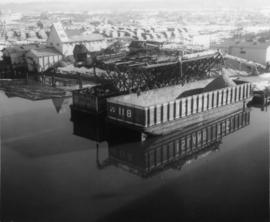
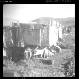
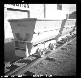
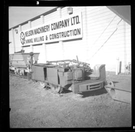
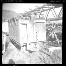
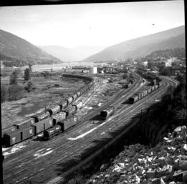
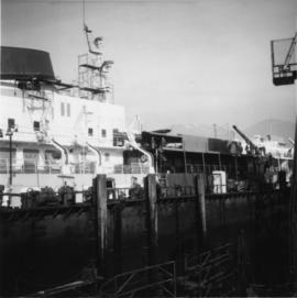
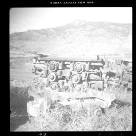
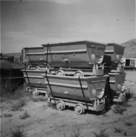
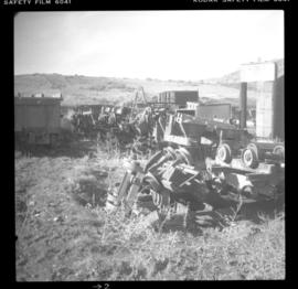
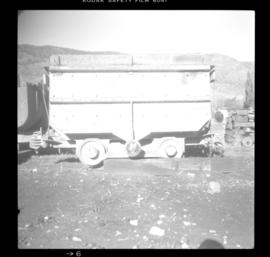
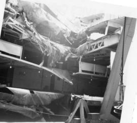
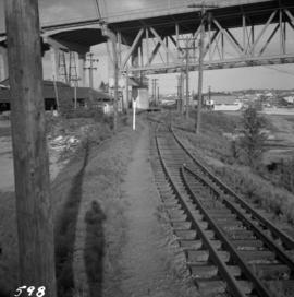
Photograph depicts the north end of the False Creek trestle, looking east towards the C.P.R. yards in Vancouver.
Photograph taken on the north arm of the Fraser River. Looking southeast from Queensborough Bridge to the north end of Wood Street.
Subseries contains newspaper articles and clippings pertaining to Canadian Pacific Railway. Excerpts from the railway’s paper, CP Rail News, are also included.
Plan depicts architectural drawings of the Canadian National Railway station in Kamloops. Includes an elevation of the building and floor plans.
Photograph of a long bridge spanning two rock faces. A small settlement is visible on the lower right.
Photograph depicts a new Canadian Navy Oceanographic vessel at C.P.R. B Pier (east side) in Vancouver.
Publication contains report entitled "General Description of Ridley Island Coal Terminal Facilities, Prince Rupert, B.C." for Neptune Bulk Terminals Ltd.
Photograph depicts the details of a mine electric locomotive.
Photograph depicts a mining equipment depot of the Nelson Machinery Company in Savona.
Photograph depicts a consignment of refurbished ore cars that were for a client in Saskatchewan. They were made by Wabi Iron Works.
Photograph depicts a mining equipment depot of the Nelson Machinery Company in Savona.
Photograph depicts the depot of the company of second-hand mine machinery, the Nelson Machinery Company.
Photograph depicts a mining equipment depot of the Nelson Machinery Company in Savona.
Photograph depicts tubs owned by Nelso Machinery Company Ltd. that were on display for re-sale.
Photograph depicts an old mine electric locomotive that was on display, not for sale.
Photograph depicts a mining equipment depot of the Nelson Machinery Company in Savona.
Photograph depicts a mine car body awaiting a buyer.
Photograph depicts a mining equipment depot of the Nelson Machinery Company in Savona.
Photograph depicts a general view of the Nelson CPR yards. An icehouse shown in another photograph appears on the right edge of the photograph at about 1 3/4" above the right hand bottom corner. The main depot building is just beyond the icehouse at the "10 o'clock" position.
Photograph depicts the Nelson CPR depot, built in 1899. Since there are no passenger trains, freights used the front line, adjacent to the depot. The photograph was taken from the platform and shows a view looking east.
Photograph depicts the Nelson CPR depot, built in 1899 and still well-maintained. Streetcars had a terminal in this yard from 1899-1949, for what was probable the shortest street car system in Canada. The view is looking north and shows the rear view.
Photograph depicts the Nelson CPR depot . All the freight traffic work is handled at this office for a wide area. The view is looking west.
Handwritten caption beside this photo reads: "Ned got a Moose". Photograph depicts a man named Ned holding the antlers on the head of a bull moose protruding from the fender of a car. Buildings and trees in background.
Photograph depicts bridge over Nechako River. Sloped cutbanks on opposite shore in background. Buildings and railroad tracks can be seen on town shore in right foreground.
Photograph depicts bridge over Nechako River. Sloped cutbanks on opposite shore in background. Railroad tracks can be seen on town shore in right foreground. Handwritten annotation on verso of photograph: "NECHAKO RIVER NEAR PRINCE GEORGE B.C. N.H.D."
Handwritten annotation on verso of photograph: "Grand Canyon, Nechaco, B.C.", on recto: "Steamer Nechacco in the Grand Canyon 1909." River rapids in foreground, opposite shore in background.
Postcard depicts the Great Divide between Alberta and British Columbia, along the CPR line.
Postcard depicts Spences Bridge "overlooking the scenic beauty of the Thompson River as it flows past the entrance to the Nicola River and Valley, downstream from Kamloops-the Heart of Funland."
Postcard depicts a reproduction of a photograph from 1880s/1890s. "The Canadian Pacific Railway (C.P.R.) was officially completed to the Pacific Coast in 1885 but upgrading was continually being carried out as seen here near Spence's bridge in 1905."
Photograph depicts a wooden boat run aground on a sandy beach. Annotation on verso of photograph states: "near Port Simpson"
Image depicts Highway 99 north of Squamish and near Pemberton, B.C.
Image depicts Highway 99 north of Squamish, near Pemberton, B.C.
Image depicts Highway 99 near Pemberton, B.C.
Image depicts a road and field somewhere near Grassy Plains, B.C.
Image depicts a camper parked on the shore of Nation Lakes, south of Manson Creek, B.C.
Photograph depicts the Nanaimo River yards and camp probably belonging to the MacMillan, Bloedel, & Powell River Ltd. It is about 16 miles west of Ladysmith. Being steamed on a Sunday afternoon for Monday.
Photograph depicts the "Nanaimo Chief" at Granville Island, False Creek, Vancouver.
Photograph depicts Myra depot on the CPR Kettle Valley line. The depot is at mile 83.8 and is only 8 miles from Kelowna but 2800 ft. above it. Trevor Davies, aged 8 3/4, is in the foreground.
Photograph depicts a ship named "M.V. Uchuck III" approaching the Gold River wharf on the west coast of Vancouver Island.
Photograph depicts "Uchuck III" at its base in Gold River. It was operated by Nootka Sound Service, Ltd. It ran commercially to Zeballos and Tahsis. It also brought summer tourists to Friendly Cove, a historical site, as it held capacity for 100 passengers.
Photograph depicts the "Queen of Victoria" 24 hours after it had collided with a freighter. Visible is damage that was caused by the freight's bow. Taken looking outwards from the main car dock.
Photograph depicts the "Queen of Victoria" that had been damaged after it had collided with Russian freights in an Active Pass. Damage displayed imprints of the freight's bow. 3 were declared dead. Photograph taken from a floating steam crane at the Burrard Dock that was used to remove mangled automobile through the gaping whole, as shown.
Photograph depicts the "Queen of Victoria" of B.C. Ferries at the Burrard Dry Dock after it had been spit in half and had an extra section insterted. The section unpainted contrasts with the white portions of the original slip.
Photograph depicts the "Queen of Victoria" at Burrard Dock, 24 hours after it had collided with a freighter. Imprints of the latter's bows were clearly seen on the main deck of the ferry.
Photograph depicts the "Queen of Prince Rupert" of B.C. Ferries in the Burrard Dry Dock during its annual 1970 refitting that was to last 5 days. Its props and rudder were removed at the time the photograph was taken.
Photograph depicts the M.V. Ferry, "Needles," that was believed to be built in North Vancouver in 1968.
Photograph depicts M.V. "Atrevida" at Westview Harbour, Powell River. It connects Westview with Blubber Bay on Texada Island. It is one of the very few ferries not run by the B.C. Ferry Authority. It carries about 6 to 8 cars.
Photograph depicts a hand truck that was found outside a museum in Ashcroft.