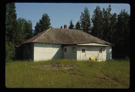
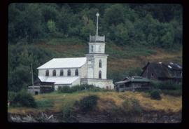
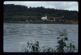
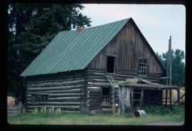
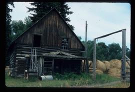
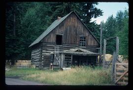
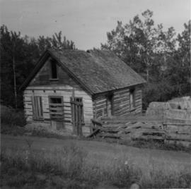
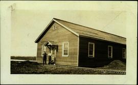
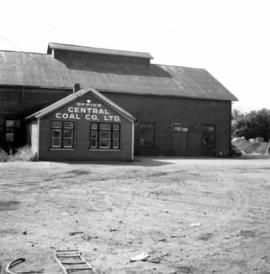
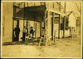
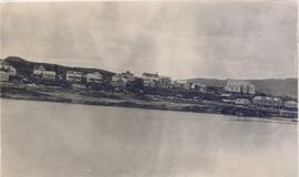
Image depicts several old buildings. The location is uncertain.
Photograph depicts an old building at 119 Water St. in Vancouver, B.C.
Image depicts an old, boarded-up school building at an uncertain location.
Image depicts an old beehive burner at an uncertain location.
Photograph depicts a weathered barn along a body of water, presumed to be in the North Thompson area.
Image depicts an Anglican church in Old Aiyansh.
Image depicts a view of Old Aiyansh.
Image depicts an old, abandoned log house somewhere in Quesnelle Forks, B.C.
Image depicts an old, abandoned church located somewhere in Seton Portage, B.C.
Image depicts an old abandoned cabin at an uncertain location.
Photograph taken at Okangan Lake, on Alexis Beach. O'Keefe Ranch is located at the head of the lake. Visible is an old house that was used as a hay barn.
File contains slides depicting the Okanagan Kettle Valley.
File contains photographs depicting four different tours that took place at the mine, plant, and towns owned by Cassiar Asbestos Corporation Ltd. Tours include Prime Minister Pierre Trudeau's visit to Clinton Creek in 1968 and Member of Parliament Iona Campagnolo's visit to Cassiar in 1978. Photographs also depict a party of ambassadors touring Cassiar in 1970, and the dedication of a building in the Cassiar plant in the late 1970s.
Handwritten photo album caption below this photo reads: “Officers' Quarters, Ft St John.” Photograph depicts two men standing in distance at doorway of officers' quarters, wood slat sidewalk in foreground. Fence and trees on horizon in background, dirt pile to right of building. The two men are believed to be Captain Read (2006.20.12.17) and the man in charge of general duties (item 2006.20.12.15).
Royal Canadian Air ForcePhotograph depicts group of 12 men standing on steps at back of main office. Front row: Jack Berry, Mickey Dopson, Andre Beguin, Fred Murray. 2nd row: Dick Stevens, Rene Pasiaud. Third row: Craigie Hood, Alex Powell. Back row: Dr. Charles Cobb MD, Peter Davies, Chuck Caron (holding paper), Bill Johnston. Berry and Dopson are wearing hard hats. Windows and doors of office building in background. Stamped annotation on recto of photograph: "Munshaw Colour Service Ltd. OCT 24 1958".
Photograph depicts the office of the Central Coal Co. Ltd., located on the south outskirts of Nanaimo, B.C. beside the Esquimalt and Nanaimo Railway. The building is one of the last pieces of evidence of coal distribution in Nanaimo.
The photograph depicts a metal office door in the interior of the CN roundhouse in Prince George, BC. Door states, "Locomotive Foreman & General Office." Reproduction of photograph from 1984.
Photograph depicts four men standing under balcony of hotel near other buildings on street. Trees line the street, with protective structures built around their trunks. It is speculated that one of these men may be Mr. A. K. Bourchier. Handwritten annotation on recto of photograph: "As you were".
Image depicts a group of unidentified individuals look through an observatory window at an uncertain location, possibly in Fort St. John, B.C.
Image depicts the Oblates of Mary Immaculate Catholic Church in Aleza Lake, B.C. Map coordinates 54°07'08.2"N 122°02'00.0"W
Photograph depicts numerous buildings along a shoreline with water in the foreground.
The photograph depicts an airplane hangar at the Prince George airport. The sign on the hangar states, "nt air."
The photograph depicts an airplane hangar at the Prince George airport. The sign on the building reads, "nt air." A white building and beige building are shown at a distance in front of the hangar.
Image depicts the office at the Northwood Upper Fraser Saw Mill and a sign which reads "Have a safe, quality day." Map coordinates 54.117916, -121.943351
Image depicts the Northwood pulpmill in Prince George B.C.
Image depicts the Northwood Pulpmill in Prince George, B.C. taken from above the Nechako River looking east. Map coordinates 53°56'00.0"N 122°44'29.7"W
Image depicts the Northwood pulpmill in Prince George B.C.
Image depicts the Northwood Bridge in Prince George, B.C.
Image depicts what appears to be a saw mill belonging to Northwood. The location is uncertain.
The item is a photograph depicting an NT Air hanger in Prince George.
The item is a 35 mm slide photograph depicting an NT Air airport hanger in Prince George.
The item is a photograph depicting the exterior view of the front of the BMO Bank of Montreal at 1310 3rd Avenue and the adjacent building including the business Northern Ski. Photograph originally taken between 1978 and 1979.
The item is a photograph depicting the exterior view of the front of the BMO Bank of Montreal at 1310 3rd Avenue and the adjacent building including the business Northern Ski. A man is walking in front of the businesses. Photograph originally taken between 1978 and 1979.