This map depicts the pit layout and estimated waste extraction areas for 5840 bench for the end of September to November. Extraction dates, approximate extraction tonnages and ore, waste and talus locations are included throughout the plan. Annotated details include numerical bench markers, extraction dates, approximate total tonnages as well as waste and ore tonnage calculations for October. The hand drawn plan consists of solid and broken lines drawn with red, blue, orange and lead pencils as well as black ink.
This map depicts the generalized pit layout and estimated waste extraction areas for benches 5840 and 5870. Annotated details include numerical bench markers as well as extraction dates. The hand drawn plan consists of solid and dotted lines drawn with green and red pencil.
This map depicts the generalized pit layout and estimated waste extraction areas for 5810 bench. Annotated details include numerical bench markers, extraction dates and approximate ore extraction amounts. The hand drawn plan consists of solid and dotted lines drawn with green, orange and lead pencil.
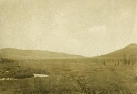
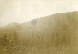
Photograph depicts dense undergrowth near the Bulkley River, mountains in the distance.
Photograph depicts dense undergrowth near the Bulkley River, mountains in the distance.
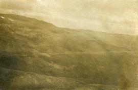
Photograph depicts bare mountain ridges near the Bulkley River and 55th parallel.
The topographic map shows mine and campsite holdings within the proposed mine site. Asbestos deposits, the tramline and water bodies, such as Troutline Creek, are also included.
Annotations include certain lot titles being crossed out as well as as indication of missing survey information.
File consists of reproductions relating to the 4th Duke of Sutherland, Cromartie Sutherland-Leveson-Gower (1851-27 June 1913).
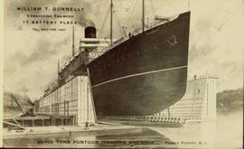
Illustration of a large ocean liner in dry dock. The name "Minnesota" is inscribed on the top right side of vessel. Annotation on recto reads: "William T. Donnelly Consulting Engineer 17 Battery Place Tel. Rector 1491 20000 tons pontoon floating dry dock Prince Rupert, BC"
File consists of notes and reproductions relating a 1913 amendment to the Land Act, which is the British Columbia legislation used by the government to transfer land to the public for community, industrial, or business use. The 1913 amendment stated that land would be free to settlers with proof of three years residence or pre-empting unsurveyed or crown land after March 1913. File primarily consists of photocopied newspaper articles discussing the amendment.


