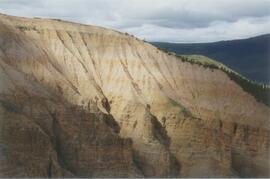
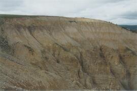
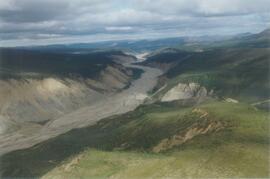
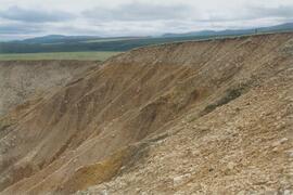
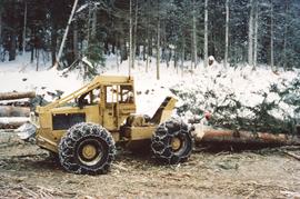
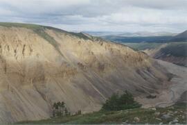
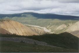
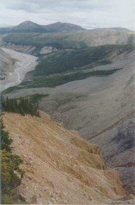
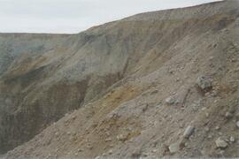
Annotation on slide: "Log skidding on main haul road, Fleet Creek Trial SS054, Jan. 1995"
Document is a research installation layout map for the Kenneth Creek site of the Sulphur stable isotope tracer study (E.P. 886.15).
Document is a research installation layout map for the Holy Cross Creek site of the Sulphur stable isotope tracer study (E.P. 886.15).
Photograph depicts a man in work clothes and hard hat standing with hands placed on the first of many tram buckets hanging in a line. Steel beam framework of station building rises above him. Handwritten annotation on recto of photograph: "[F1?] LOADING STATION EL. 5800". Photograph was glued to cardboard backing with the annotation: "1962".
Subseries consists of
Shirvell, ColeFile contains material relating to "Re-explorations: new perspectives on gender, environment and the transfer of knowledge in 19th and 20th century Canada and Australia." It consists of lists of contacts for research; teaching notes for women's studies courses; a list of material available at the Penticton Archives; notes from an article; and a timesheet for Ainley's research assistant, Anna-Stina Kjellstrom.
File consists of lists of contact information about potential interviewees, some of which contain short biographies; correspondence relating to interviews; notes; a budget report for "Critical Turning Points"; and a blank copy of the questionnaire sent to female engineering graduates from Queen's University by Alison Bowe.
File consists of lists of potential interviewees with graduation dates circled; census data on women in engineering in Canada from 1941-1991; statistical data from the Canadian Council of Professional Engineers (CCPE) on women in different engineering fields; and a copy of the "Critical Turning Points" project description with Ainley's notes on it.
File consists of lists of female scientists, divided according to discipline and arranged into categories based on generation, with an indication of whether or not they have been interviewed; a list of women who worked in the sciences at the University of Toronto; handwritten notes; and a photocopy request form.
File consists of and handwritten notes and lists of female scientists, divided according to discipline and arranged into categories based on generation, with an indication of whether or not they had been interviewed.
File consists of a list of documents from the Department of Fisheries and Oceans that were created between 1977 and 1994 and released to the public through Access to Information Act requests or other means. The list includes requested records that were not made available because they are exempt from the Access to Information Act.
File consists of a typed list of recipients from Canada probably concerning Ainley's re-exploration project.
File consists of a list of documents sent to the Department of Fisheries and Oceans from the B.C. provincial government ("Attorney General of British Columbia") for the Nechako River court action. Includes accompanying memoranda regarding the list of documents in regards to preparing for the trial.
File consists of research materials on Lillian Eva Dyck. File includes Dyck's CV, an overhead transparency, and articles about her.
File consists of documents related to library research including an interlibrary loan request form, lists of call numbers, and related correspondence.
File consists of a copy of letter from J. Harold Mundie to George Baker, the Chair of the Standing Committee on Fisheries and Oceans in the House of Commons. Includes a post-it note from Harold to Don regarding the letter.
File consists of annotated drafts and a final draft of the letter Gordon Hartman sent to Prime Minister Chretien. Includes a reply to the letter from the Office of the Prime Minister.
File consists of a fax cover sheet and original lecture notes created by Cole Shirvell for a workshop on Instream Flow Incremental Methodology.
File consists of a photocopy of a Canadian Journal of Fisheries and Aquatic Sciences (vol. 50) article by Ray Hilborn and John Winton entitled "Learning to Enhance Salmon Production: Lessons from the Salmonid Enhancement Program".
File consists of a consent form, transcript and audio recording from an interview with Laura McCormack conducted for Ainley's "Critical Turning Points" research. File also contains McCormack's resume.
File consists of email correspondence and handwritten note concerning Ainley's research on Laura Chalk Rowles.
Image depicts a piece of machinery shaped like a large metal cylinder. It is possibly located somewhere in Fort St. John, B.C.
File consists of notes and reproductions relating to land exploration and surveying in British Columbia by Alfred R.C. Selwyn, who was a British geologist and public servant, director of the Geological Survey of Victoria from 1852 to 1869, director of the Geological Survey of Canada from 1869 to 1894, and President of the Royal Society of Canada from 1895 to 1896. Includes: "Photography: Mirror of the Past" American History magazine special edition (Sept. 1989) and a photocopied article "Ninety Years Later" by F.C. Swannell from The Beaver magazine (1956). File also includes reproduced photographs depicting scenes from Selwyn's exploration around British Columbia (1989).
File consists of scientific data, chemical analysis reports, and correspondence regarding the soil and water analysis for sediment and dissolved metals in and around Lake Babine.
File consists of a final draft report entitled "Lake Babine Nation Community Health Issues and the Noranda-Bell Mine Closure" released in 1997 by Lake Babine Nation, Health Canada, and the UNBC Environmental Health Group.
Image depicts the Lajoie hydroelectric generating station at the Lajoie Dam on the Bridge River (view of powerhouse and tailrace from top of dam).
Image depicts the Lajoie Dam on the Bridge River from the upstream side.
Image depicts the Lajoie Dam on the Bridge River, upstream side, showing part of Downton Lake and, in the foreground, the spillway intake.
This image is part of the outbound sequence of aerial images obtained on the helicopter flight to the Klutlan Glacier study site. The sequence starts from the base camp at the White River crossing on the Alaska Highway and heads south, to a point just upvalley of the debris-covered terminus (approx. 10-15 km from Alaska border), and turning back north to the landing spot on the Generc River floodplain close to the study site (see Fig. 1 in paper).