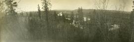
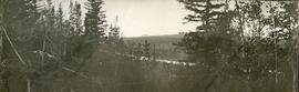
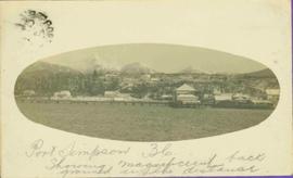
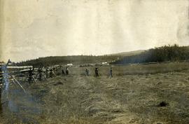
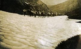
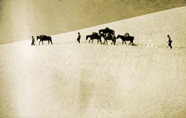
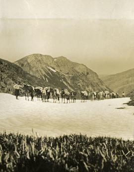
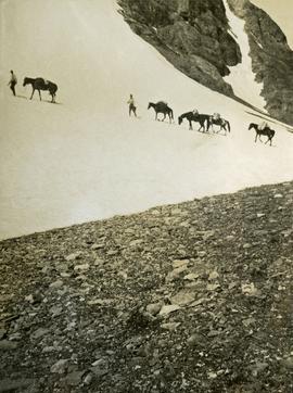
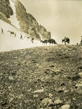
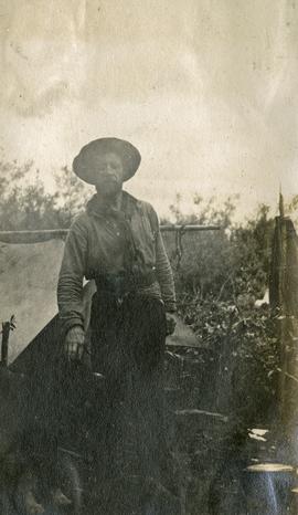
Photograph depicts a full length image of (presumably) one of Holland's survey crewmen.
Photograph depicts a lofty view of a winding river, forest in the foreground, rolling forested hills in the background.
Photograph depicts a looking through trees to a view of a river, forested low hills in the background.
Pier, house, and tress with snowcapped mountains in background. Image has been cropped to oval shape. Handwritten annotation in pencil on verso reads: “Port Simpson B. C. showing magnificent background in the distance”, on recto: "W. I. O'Neill Es. Aberdeen B.C. Hope you are well my dear D.D. - Have written to K. and are sending you and [?] Boy each a card. [?] will wish to saw we are all ok. Yours, M.", "Yours 10derly". Recto stamped "PORT SIMPSON B.C. MR 14 07".
Photograph depicts five men standing in a field of cut hay. Some men are holding scythes, buildings, forest and rolling hills in background.
Photograph depicts 5 men in a field using scythes to cut grain.
Photograph depicts landscape scene. Tree, bridge, and sign featuring cross country skier in foreground. Fence, hills, and forest in background.
Image depicts an unidentified man cross country skiing somewhere on Tabor Mountain in Prince George, B.C.
Image depicts a long line of people cross country skiing somewhere on Tabor Mountain in Prince George, B.C.
Photograph depicts two men navigating a small raft across the waters of Babine Lake, BC. Low mountains in the distance. [55th parallel]
Photograph depicts a snowy mountain slope with a rocky ridge in the background. Two men and five horses are traversing across the snowy slope.
Photograph depicts a long line of horses with packs traveling toward the photographer on a snowy mountain pass.
Photograph depicts three men and five horses traversing through the snow. The men are on foot leading the horses.
Photograph depicts four men pulling a long canoe across a clearing on a wheeled trailer.
File consists of notes and reproductions relating to Kent Sedgwick's article, "Crossing the Divide: Northern Approaches to New Caledonia", which was published in vol. 12 of the Western Geography journal in 2002.
Photograph depicts crossing summit between John Brown and Kitseucla creeks. Survey of 55th parallel.
Photograph of large crowd spanning the frame of the photograph. A large marching band is visible along the edges of a small clearing in the centre. Annotation on recto reads: "May 24th Prince Rupert BC."
Photograph of a large group of people gathered around a steam engine loaded with coal situated on a wooden bridge. Printed annotation on recto reads: "Stewart BC Aug 9th 1911."
Photograph of a boardwalk street with buildings on either side, several people visible in image. Trees can be seen on street, and mountains stand in background. Handwritten annotation in pencil on verso reads: “Port Essington, North Coast Commercial Coy”.
Image depicts a large crowd of people on a section of the Heritage Trail on Cottonwood Island in Prince George, B.C.
Image depicts a crowd of people on a section of the Heritage Trail on Cottonwood Island in Prince George, B.C.
Photograph depicts construction worker walking up mountain slope, possibly using rope safety gear. Wood framework for Crusher building in foreground; mine road, plant site, and mountain range in background.
Photograph is one of seven images orginally included within a diary dated 12-22 November 1987. Photos depict a day to day account of Canadian University Service Overseas (CUSO) mission to establish whether or not a Canadian presence is justified in the fight against Apartheid and for the liberation of Namibia within a Soviet Sphere Socialist State. See also items 2009.6.1.490 - 2009.6.1.496.
Photograph is one of seven images orginally included within a diary dated 12-22 November 1987. Photos depict a day to day account of Canadian University Service Overseas (CUSO) mission to establish whether or not a Canadian presence is justified in the fight against Apartheid and for the liberation of Namibia within a Soviet Sphere Socialist State. See also items 2009.6.1.490 - 2009.6.1.495.
Image depicts an area of cut trees at Island Cache.
Photograph depicts a steamship anchored near the shore of the river. Three or more people are working in a large pile of driftwood on the shore.
Image depicts two unidentified individuals and a van on a farm at an uncertain location, possibly a place called Cypress Hill, with an atmometer and a sunshine recorder.
Photograph depicts the Giscome Rapids. Opposite shore in background, rocky beach in foreground. Handwritten photo caption on verso and recto of this photo reads: "Point where G.T.P. [Grand Trunk Pacific] canoe capsized at Giscome Rapids & where 3 men were drowned."
Image depicts Danskin, B.C.
Image depicts light from an unidentified light-source shining on a long, vertical object of an uncertain nature, though it is possibly a tree. The rest of the image is too dark to make out.
Photograph depicts a lake in the foreground with a possible island in the center of the photograph, low treed hills in the background.
Photograph depicts lake water in the foreground, low treed hills in the background.
Photograph depicts the bow of a boat in the foreground, lake water and low treed hills in the background.
Image depicts a road with a guardrail and open fields somewhere near Dawson Creek, B.C.
Image depicts a street of businesses in Dawson Creek, B.C.
Image depicts a large building which is labelled "Alberta Pool Elevators Ltd. Dawson Creek," located in Dawson Creek, B.C.
Image depicts a street of businesses and Mile "0" of the Alaskan Highway in Dawson Creek, B.C.
Image depicts Mile "0" of the Alaskan Highway in Dawson Creek, B.C.
File contains slides depicting old geological maps of the Central Interior.
File contains slides depicting images of areas around Dease Lake, B.C.
Image depicts Upper Fraser residential area during demolition of town site. Map coordinates 54°06'51.6"N 121°56'26.3"W
Image depicts debris left in residential area on Giscome, B.C. townsite. Map coordinates 54°04'16.7"N 122°21'55.1"W
Image depicts a deer on a path somewhere near Bralorne, B.C.
Image depicts an aerial view of Diamond Island, near Quesnel, B.C.
Image depicts a dilapidated house in Sinclair Mills, B.C.