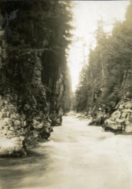
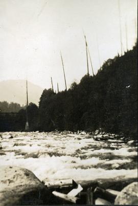
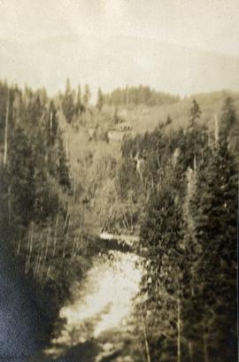
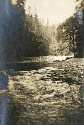
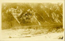
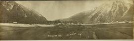
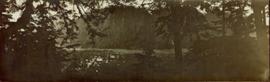
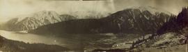
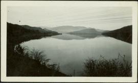
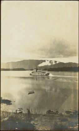
Typed annotation on recto: "Stuart Lake - British Columbia." The hills on left, cliff on right, and two small islands on horizon are reflected in the lake.
Colour-coded topographic map depicting lands surveyed as alienated, available for purchase or lease under Land Act, or reserved. Depicts land district boundaries, land recording divisions, provincial forest boundaries, HBC posts, triangulation stations, telephone lines, communities, bodies of water, and transport routes.
Photograph depicts ten men aboard a scow on a river or lake. The scow is equipped with long poles and may be propelled by steam.
Photograph depicts benches from strip mining operations at the Cassiar mine. Haul trucks and equipment believed to be used for explosive purposes can be seen in mine. Shop and mountain range visible in background. Handwritten annotation on recto of photograph: "Cassiar, BC / June 1970 / by Tom Kiefer". Image consists of three photographic prints adhered together to form one comprehensive panoramic.
Street view down Centre Street in Prince Rupert, BC. Printed annotation on recto reads: "Centre Street, Prince Rupert, B.C. 1664." Handwritten annotation on verso reads: "Minnie sent a parcel to you by express to-day- some things you left behind you. I hope you and Bertie had a good trip up. Florrie and the children will leave on the morning train. All are pretty well and send their love to you. Harrie." Postcard is addressed to: "Miss M.V. Beattie Enderby, B.C." Verso is affixed with a two cent Canadian stamp. Postmarkson recto and verso are illegible.
Item is an original 1988 street map of Greater Vancouver in British Columbia published by Alco Maps Ltd. in North Vancouver.
Photograph depicts four men and small cart standing in street, lines of log buildings on either side. Tents can be seen at end of left side of street. First building on left is larger, with the sign "STOPPING PLACE". Trees cross midground, mountains stand in background. Handwritten annotation on verso of photograph reads: "Tete Jaune Cache. B.C."
Image depicts a street in Giscome B.C. The Giscome Store is located on the left side of the image with the church in the background. Map coordinates 54°04'18.5"N 122°21'57.7"W
Image depicts a street in Giscome. The store was previously located on the left. The church is in the background. Map coordinates 54°04'18.5"N 122°21'57.7"W
Photograph depicts view of street showing that a large hill of rock has been cut through to allow for construction of roadway.
Photograph depicts a stream, forest and buildings. Location is not named.
Image depicts a small stream running through a cluster of trees somewhere in or around Seton Portage, B.C.
Image depicts a small stream somewhere on Cottonwood Island.
Photograph depicts a stream bed surrounded by forest. One person is walking on the stream bed.
Photograph depicts a stream and forest.
Photograph depicts a view from above, looking down on a stream with forest on both sides.
Photograph depicts a stream with a rocky bank surrounded by forest.
Image depicts a stream somewhere along the White Pass railway.
Image depicts a downhill stream somewhere in the area surrounding Stewart, B.C.
File consists of notes, clippings, and reproductions relating to Strathnaver, BC. Also includes maps depicting Cottonwood River and Hixon areas of the Cariboo Land District (1972 and 1980).
Image depicts a view of the Dunkley Lumber Mill in Strathnaver, B.C.
Image depicts the BCR, as well as the Dunkley Lumber Mill, in Strathnaver, B.C.
Image depicts what is likely the Dunkley Lumber Mill in Strathnaver, B.C.
Image depicts an aerial view of Strathnaver, B.C.
Image depicts a group of people stopped in the middle of the Fraser River in the Grand Canyon, B.C.
Image depicts a stone marker in Lamming Mills, B.C.
Photograph depicts unidentified river or lake. Bushes in foreground, hills in distance.
Topographic map depicting regions, communities, government posts. bodies of water, transport routes, surveyed areas, and reserves.
Colour-coded geological topographic map. Geological Survey produced for the Bureau of Economic Geology, Department of Mines, Bureau of Economic Geology, Canada. Scale 1:126,720. Includes overview of "General Geology" and "Economic Geology."
File consists of material relating to the Stikine River, predominantly consisting of newspaper clippings. Includes a photocopied 1976 annotated bibliography by Thomas Buri entitled "Of the Stikine River Country and its People".
Elevated, wide angle photograph of Stewart, BC with mountains visible in the background.
Slightly elevated photograph of commercial and residential buildings in Stewart, BC. Printed annotation on recto reads: "Hughes #11 Stewart Looking N.W."
Wide angle photograph of a forested mountain. The town of Stewart, BC is visible at the mountain's foot.
File contains slides depicting places in and around Stewart, B.C.
Image depicts the Robert Stewart house, built in 1910 and inhabited by the Stewart family until 1945. It is located in Stewart, B.C.
Image depicts Stewart Harbour in Stewart, B.C.
Wide angle view of mountains and small residential buildings. A large dock is visible in the foreground. Annotation on recto reads: "Stewart, BC., from Government Wharf."
Photograph depicts view a panoramic view of Stewart B.C taken from the valley bottom.
Photograph depicts view a panoramic view of Stewart B.C. taken from an elevated view.
Photograph depicts view a panoramic view of Stewart B.C.
Image depicts an unknown individual leaning against a sign at the Stewart Access Road which warns travellers to pack several days of food. Located in Hazelton, B.C.
Image depicts a man, possibly Kent Sedgwick, leaning against a sign forbidding public traffic on the Stewart Access Road from between 5 am to 8 pm. Located in Hazelton, B.C.
File contains slides depicting places in and around Stewart, B.C.
Image depicts Stewart, with a section of Mt. Shorty Stevenson dominating the background.
Image depicts several houses in Stewart, B.C. A section of Mt. Shorty Stevenson is visible in the background.
3 Sternwheelers tied to a river bank. Printed annotation on recto reads: “Stern Wheelers 1910 Quesnel B.C.” Handwritten annotation on verso in pencil reads: “BX, B.C. Express, Charlotte”
Unidentified man can be seen standing by small boat on shore in foreground, a second boat visible in water behind. Hills on opposite shore can be seen in background.
Handwritten annotation on verso reads: "Metlakathla B.C. 'Stern-wheeler' passing village."