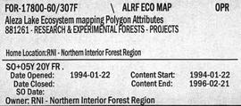
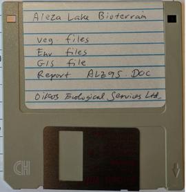
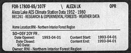
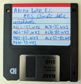
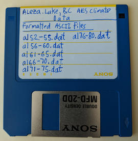
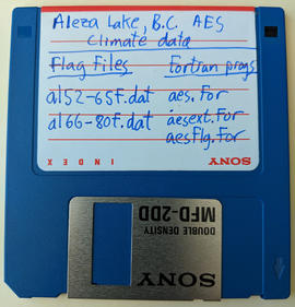
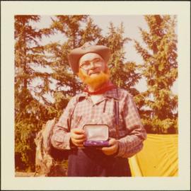
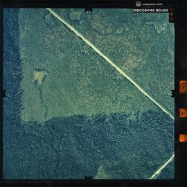
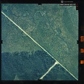
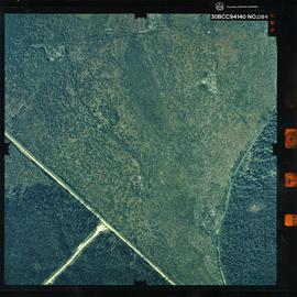
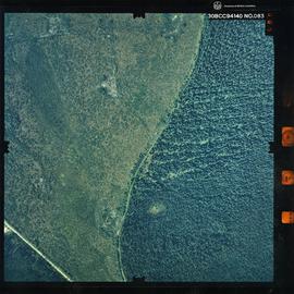
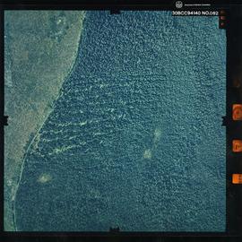
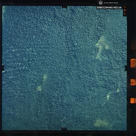
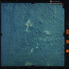
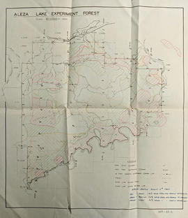
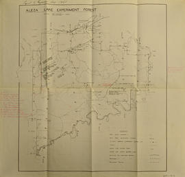
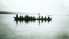
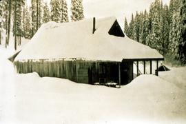
Map is a photocopy reproduction of the Aleza Lake Experiment Forest map that was included in the appendix to the 1957 Aleza working plan.
Map reflects reserve boundary, roads, trails, 20 feet contour intervals, air photo centre, declination, swamps, and mile post at the Aleza Lake Experiment Forest.
Map is an original linen Aleza Lake Experiment Forest map that reflects the reserve boundary, roads, trails, 20 feet contour intervals, air photo centre, declination, swamps, and mile posts.
Map reflects reserve boundary, roads, trails, 20 feet contour intervals, air photo centre, declination, swamps, and mile post at the Aleza Lake Experiment Forest.
Map is a photocopy reproduction of the "Aleza Lake Experiment Forest" map that was included in the appendix to the 1957 Aleza working plan.
File consists of working copies of aerial photos, vegetation tables printed from computer disk, photocopies of plot sheets, and lists identifying species.
Item is a photograph of a copy print, resulting in a low quality photographic reproduction. Reproduced as a print, slide, and a negative. Location of original photograph is unknown.
Item is a photograph of a copy print that has been reproduced as a slide, resulting in low photographic quality. Location of original photograph unknown.
Floppy contains the following files: AL94ENV.DAT, AL94VEG.DAT, ALZZ95.DOC, GISDAT.XLS.
File contains Aleza Lake Experiment Station Climate Station data from 1952 to 1980 and three accompanying floppies with weather data and Fortran programs.
Floppy contains the following files: AL52-55.wk1, AL56-60.wk1, AL61-65.wk1, AL66-70.wk1, AL71-75.wk1, AL76-80.wk1, ALX52-80.wk1
Floppy contains the following files: AL52-55.dat, AL56-60.dat, AL61-65.dat, AL66-70.dat, AL71-75.dat, AL76-80.dat
Floppy contains flag files (AL52-65F.dat, AL66-80F.dat) and Fortran programs (AES.for, AESEXT.for, AESFLG.for).
Photograph depicts an open field with a fence, house and shed in the midground, low treed hills in the background.
The Alexander Manson Mining Collection consists of 133 loose photographs documenting various aspects of the mining industry in Northern British Columbia between 1930-1940. Photographs show images of Manson Creek and Germansen Landing.
Manson, AlexanderItem is a photograph of Alex Moffat dressed as a prospector holding gold nuggets he salted into a gravel bed and later panned out and gave to Princess Margaret.
File consists of Alderdice's handwritten notes regarding various aspects of the Alcan-Nechako River controversy.
File consists of a faxed copy of a part of an Alcan Bulletin responding to the BC Liberal Party Caucus Background Paper on Kemano Completion.
File consists of Alcan's "Outline of Evidence" for Technical Hearing Phase Two: Hydrology for the British Columbia Utilities Commission Kemano Completion Project Review.
File consists of Alcan's "Outline of Evidence" for Technical Hearing Phase Three: Fisheries (Volume 2) for the British Columbia Utilities Commission Kemano Completion Project Review.
File consists of Alcan's "Outline of Evidence" for Technical Hearing Phase Three: Fisheries (Volume 1) for the British Columbia Utilities Commission Kemano Completion Project Review.
File consists of Alcan's "Outline of Evidence" for Technical Hearing Phase One: KCP Facilities and Operation for the British Columbia Utilities Commission Kemano Completion Project Review.
File consists of Rankin and Finlay report entitled "Alcan's Kemano Project: Options and Recommendations". Annotated by Dr. Gordon Hartman and/or John Hummel, Cheslatta Band researcher.
File consists of a copy of the "Alcan Smelters and Chemicals Ltd. Reply to Final Submissions of Intervenors" for the BCUC public review of the Kemano Completion Project.
File consists of an accumulation of rebuttals from Alcan employees to expert reports submitted by Department of Fisheries and Oceans scientists for the 1987 Nechako River court action. Includes an index to the thirteen rebuttals by authors Bruce Jenkins, A.C. Mitchell, D.W. Chapman, and Rolf Kellerhals.
File consists of various promotional materials produced by Alcan regarding the Kemano Completion Project. Includes "Alcan in British Columbia" newsletter (vol. 5, no. 4), a transcript of an alcan press conference, an Alcan Special Report entitled "Flows Designed to Protect Salmon: Comprehensive Report on Nechako River Flows After Kemano Completion Project", an article entitled "Kemano: Energy for the Future", "The Kemano Completion Project" pamphlet, and a May 1994 newsletter "Kemano Completion Project Information".
File consists of photocopies of promotional material produced by Alcan. Includes Alcan Special Reports, "Kemano: Energy for the Future", pamphlets, news releases, and a "Statement by William J. Rich, Vice President for British Columbia Alcan, at Press Conference, 9 July 1993". Also includes an original "Kemano Completion Project Information" newsletter.
File consists of promotional material produced by Alcan. Includes "Notes for an Address by W.J. Rich, Vice President for British Columbia, Aluminum Company of Canada, Ltd." given in Smithers in March 1983; a March 13, 1983 Alcan Bulletin entitled "Most Nanika Diversion Water to Come from High Summer Flows--Winter Flows Increased"; a March 1983 issues of Alcan's "Update" newsletter on the Kemano Completion Project; and an Alcan promotional brochure for the Kemano Completion Project.
File consists of a paper written by W.G. Hazelwood entitled "Alcan Environmental Baseline Studies: A Critique".
File consists of outgoing correspondence from BCUC (and others) to Alcan as well as incoming correspondence to BCUC from Alcan and their solicitors. Prominent correspondents include Bill Rich, Vice President for British Columbia for Alcan, and their solicitors, Lawson Lundell Lawson & McIntosh.
File consists of photocopies of Alcan Bulletins released while the BCUC Kemano Completion Project review hearings were ongoing (1993-1994).
Fonds consists of original, silent 16mm reels that portray the natural, social and land use history of the Bella Coola and Chilcotin regions named the "Natural and Guiding History of the Bella Coola and Chilcotin Regions".
Possible locations that Al Elsey filmed include: Bella Coola, Bella Bella, Anahim Lake, Alert Bay, Nimpo Lake, Bulkey Valley, the Rainbow Mountains, Tweedsmuir Provincial Park, Dean River, Bella Coola River, Tchaha Lake, the Chilcotin region, the Ulkatcho Mountains, Lassard Lake, Fenton Lake, Atnarko River, Wells Gray Park, and Holt Homestead.
File consists of Air photos BC85019 no. 141-143, 197-198 and BC5249 no. 10, 12, and 29.
File consists of 10 air photos: BC85019 No. 111, 112, 140, 199 (CFS McGregor written on reverse), 200; BC77004 No. 199 (comment on reverse re location of tie point, 200; and 3 higher altitude air photos with no obvious label. Note that BC77004 No. 199 and 200 have MOF stamps on the reverse.
In July 2009, Dr. Paul Sanborn undertook the first soils field research at the Fort Selkirk volcanic field in central Yukon, with helicopter support and funding from the Yukon Geological Survey. This file consists of prints of aerial photographs that depict the area accessed for the study, upstream from the confluence of the Yukon River and the Pelly River.
Air photographs include:
Flight line A17210, Photo Nos. 54-60 (taken 1960)
Flight line A22354, Photo Nos. 43-45, 47-48 (taken 1971)
Flight line A27516, Photo Nos. 48-52 (taken 1989)
Photograph is a remote-sensing image of the Aleza Lake Research Forest from 1994.