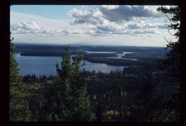
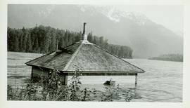
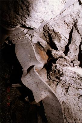
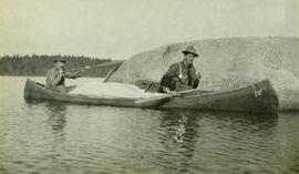
A Journey into the Upper Peace River Country
Image depicts Summit Lake.
Photograph depicts a view of a lake from a row boat. The back of one male boat passenger and oars are in the foreground.
Photograph depicts a train spotted at the Summerland depot.
Photograph depicts what is believed to be the only remaining "summer cottage" on Beach Ave. in English Bay.
Photograph depicts a view of the sun on the ocean with the ship's bow in the foreground. Handwritten annotation below photograph reads, "Summer at sea".
File contains handwritten tables and graphs of measurements of plots, photocopied reports, 9 black and white photos, and handwritten notes.
Photograph depicts the Sumas depot of the Northern Pacific Railway in the U.S. The Canadian border is at the grade crossing in the middle distance.
Unpublished results for the Sulphur stable isotope tracer study (E.P. 886.15) were presented in annual reports to the funding agencies, including this "Sulphur Fertilization of Lodgepole Pine: A Stable Isotope Tracer Study (Ministry of Forests E.P. 886.15) - Project Y051210 - Technical Report" from April 2005.
Unpublished results for the Sulphur stable isotope tracer study (E.P. 886.15) were presented in annual reports to the funding agencies, including this Final Technical Report from April 2007.
Image depicts Sue Sedgwick standing on the bank of a river.
Image depicts Sue Sedgwick standing next to a camper.
Fully submerged Pumpman's (?) house at Pacific Station before the flood took it down the river.
Photograph depicts the rocky cliffs of the Sturdee River Canyon with a low mountain range in the background.
Typed caption glued to album page directly below photograph reads: "16. Stump pulling and grading on Chamberlin Avenue, showing Fort Fraser Hotel in background." Photograph depicts men and a horse working at preparing the land along Chamberlin Avenue. Photographer: Dominion Stock & Bond Corporation.
Item is a photograph of a copy print, resulting in a low quality photographic reproduction. Reproduced as a print, slide, and a negative. Location of original photograph is unknown.
Image depicts Studio 2880 Arts Complex in Prince George, B.C. Map coordinates 53°54'36.9"N 122°46'30.3"W
Image depicts a building which is a part of the Studio 2880 Arts Complex on 15th Avenue in Prince George, B.C.
File contains handwritten messages, photocopied invitations to a field tour, and related correspondence.
Photograph depicts a small car and passengers on log ferry in foreground and one man on dock. Stuart River and forested banks in background. Handwritten photo caption below photograph reads: "Stuart River Ferry."
Typed annotation on recto: "Stuart Lake - British Columbia." The hills on left, cliff on right, and two small islands on horizon are reflected in the lake.
Colour-coded topographic map depicting lands surveyed as alienated, available for purchase or lease under Land Act, or reserved. Depicts land district boundaries, land recording divisions, provincial forest boundaries, HBC posts, triangulation stations, telephone lines, communities, bodies of water, and transport routes.
Photograph depicts ten men aboard a scow on a river or lake. The scow is equipped with long poles and may be propelled by steam.