2012.13.1.88.25
·
Item
·
1976
Part of J. Kent Sedgwick fonds
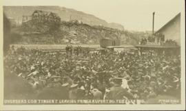
Image depicts an old cabin in the woods at an uncertain location.