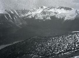
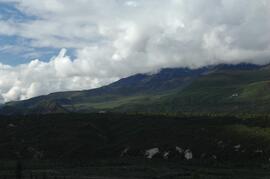
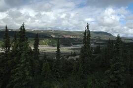
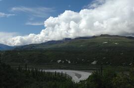
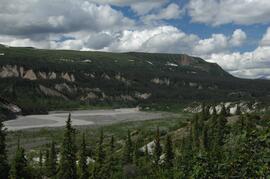
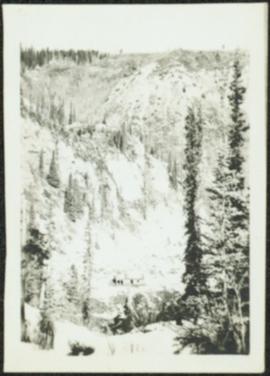
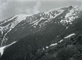
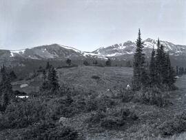
Photograph depicts three men sitting in a circle in a clear area near a sparsely forested area in front of a snowy mountain range. The location of the photograph is noted to be at Duck Creek at Copper Mountain; however, those names may no longer be in current use. Location is assumed to be approximately 55.979291, -125.208415 near what is currently named Wasi Peak.
Photograph depicts a wide view of the Omineca River with a man standing on a boat in the right corner of the image. In the background the river a forested shoreline and mountain range are visible.
Photograph depicts a view of of the tree-covered slope with Duncan Lake below.
Image depicts a view south, possibly of an abandoned grade for the BCR; possibly somewhere near Woodpecker, B.C.
Photograph depicts ditch constructed on the hill of a forested environment. Handwritten annotation on verso reads: "View showing part [of] new ditch - fully logged and braced, Germansen Placer Ltd."
Photograph depicts community buildings on shoreline, water in foreground.
Handwritten annotation on image reads: "Wrangle, Alaska."; on verso: "Fort Wrangle, Alaska Territory. visited by W.H.Collison, C.M.S. 1877. Prior to the establishment of any mission, [...? illegible] 1875 - 1876. Presbyterian. Insert this illustration of Wrangle on Page 77 as marked."
Photograph depicts a view of the community of Williams Lake, taken from the Chilcotin Road to the west.
Handwritten photo album caption below this photo reads: "Whitehorse, & Alaska Highway, from below R.C.A.F. Barracks." Photograph depicts the cityscape of Whitehorse in valley. Alaska Highway can be seen in left foreground behind road railings in mountainside.
Royal Canadian Air ForceHandwritten photo album caption below this photo reads: "Another view of Whitehorse Field from the Tower." Photograph depicts various unidentified buildings at what is believed to the Royal Canadian Air Force base in Whitehorse, YT. Small sign in foreground reads: "Taking Photographs Prohibited" (see also items 2006.20.12.1 & 2006.20.12.39). Mountains in background.
Royal Canadian Air ForcePhotograph depicts a view looking northeast towards Coal Harbour from Alberni St. (Chilco-Gilford block) with West Georgia St. in the middle distance.
Photograph depicts a view of Victoria from a ship in the Inner Harbour. Visible on the shore, from right to left, are: the Empress Hotel, the Belmont, the Customs Building, and other buildings along Douglas Street.
Photograph depicts a small building in low valley, tall hills in background, trees in foreground.
No caption provided with photograph. Similar photograph has the following caption: "View of transplant and seed bed areas, established Spring 1966. Buildings moved from Forest Service warehouse site on 15 Ave."
Caption describing photograph: "View of transplant and seed bed areas, established Spring 1966. Buildings moved from Forest Service warehouse site on 15 Ave."
Photograph depicts a view of four tracks at the McCulloch CPR depot, located at mile 76.6, on the Carmi Subdivision. The four tracks, west to east, are: a passing track, the mainline, a storage track, and a turning "Y". The rail on the passing track and mainline are date 1940, and the others are 1918 or 1919. The view is looking southwest.
Photograph depicts the extreme west of Coal Harbour. Looking south towards Georgia Street and the West End.
Photograph depicts a view of the southeast slope of Duncan Mountain near Thutade Lake.
Handwritten photo album caption below this photo reads: "Above the Rockies at 12 000 feet." Photograph depicts the Rocky Mountains from a distance. As the photograph was taken from the inside of an airplane, the plane's wing tip can be seen on the far right of the image. A sun circle is also visible in the top center.
Royal Canadian Air ForcePhotograph depicts a view of the snow-covered north slope of Duncan Mountain near Thutade Lake.
Photograph depicts the north shore of False Creek, looking west after a snowfall. Photo taken from the swing span of Cambie Bridge in Vancouver, B.C.
Photograph depicts the south tower and a segment of decking of the Lions Gate Bridge in Vancouver, BCPhotograph taken from the east side.
Photograph depicts the southern granite piers of the Lions Gate Bridge in Vancouver, BC
Photograph depicts the Lions Gate Bridge in Vancouver, BCfrom the southeast side.
Photograph depicts the Lions Gate Bridge on the east side looking south from the shore of North Vancouver, BC
Photograph depicts the decking and piers of the northern section of the Lions Gate Bridge, looking north from the shore of North Vancouver, BC
Photograph depicts the south tower of the Lions Gate Bridge looking east with the SS Prince George in the background.
Photograph depicts the piers of the south tower on the Lions Gate Bridge in Vancouver, BC
Photograph depicts the Lions Gate Bridge on west side looking south from the shore of North Vancouver, BC
Photograph depicts a view of the kitchen from the dining room at a sports centre in Friedrichshafen, Germany.
Photograph depicts a view of the Fraser River from the Albion Ferry from Haney to Fort Langley. The ferry is approaching the south bank of Fort Langley. Gulls sat on logs floating downstream; too heavy to rise after eating candlefish.
The CN Rail Bridge is a truss bridge over the Fraser River. It was built in 1914 by the Grand Trunk Pacific Railway and is therefore also known as the "GTP Bridge". The Canadian National (CN) Railway Company took over the Grand Trunk Pacific Railway in 1919.
Photograph depicts a sports field with running track behind a sports building in Friedrichshafen, Germany.
Photograph depicts the back of a sports building from the location of a sports field with running track in Friedrichshafen, Germany.
Photograph depicts the back of a sports building with trees in midground from the location of a sports field with running track in Friedrichshafen, Germany. The photograph was taken on Iona Campagnolo's European sports tour.
Photograph depicts the Agora center at the University of Northern British Columbia in Prince George, B.C. Library building can be seen in right background, cafeteria building on far left. Unidentified individuals can be seen walking on campus. Accompanying note from Maureen Faulkner: "The processional gathers on the upper walkway". Photo believed to have been taken on the day Bridget Moran received an Honourary Law Degree.
Photograph depicts the Agora center at the University of Northern British Columbia in Prince George, B.C. Sign in foreground reads "Agora/Student Centre". Unidentified individuals can be seen in red blankets on upper walkway in background, above the Winter Garden. Accompanying note from Maureen Faulkner: "The first nations people, in button blankets, gather". Photo believed to have been taken on the day Bridget Moran received an Honourary Law Degree.
Photograph depicts the rear and side view of the abandoned Sumas electrical substation on the B.C. Electric Railway at Vedder Mountain.
Photograph depicts a view of the town of Telkwa, BC from the perspective of the Telkwa water tower.
Image depicts a view of Tabor Mountain in Prince George, B.C.