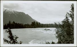
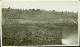
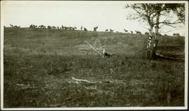
Image depicts the cemetery in Hazelton, B.C.
Image depicts the canoe group around a campfire at the head of Indianpoint Lake.
Image depicts the head of Lillooet Lake.
Slide depicts a man operating heavy equipment in a forest, likely at the Aleza Lake Experiment Station.
Image depicts a piece of heavy machinery lifting numerous logs off the back of a logging truck. It is likely located in Prince George, B.C.
Image depicts a piece of heavy machinery lifting numerous logs. It is likely located in Prince George, B.C.
Annotation on slide: "Heavy Residual Basal Area: Summit Lake".
Image depicts what is possibly either the Hecate Strait or Minette Bay from somewhere near Kitimat, B.C.
Image depicts the Hecate Strait near Prince Rupert, B.C.
Image depicts the waters of the Hecate Strait.
Image depicts the waters of the Hecate Strait, possibly on approach to Haida Gwaii, B.C.
Image depicts the Hecate Strait near Prince Rupert, B.C.
Image depicts what is possibly either the Hecate Strait or the Minette Bay from somewhere near Kitimat, B.C.
Image depicts a man standing in front of a helicopter; a waterfall is visible on the cliffs in the background. The slide itself is labelled "BC Parks Tour."
Photograph depicts crusher plant in centre foreground. Shifter shack and vehicles can be seen in front of pit area. West Peak semi-visible in right midground. Mine valley an northwestern mountain range in background.
Photograph depicts the West Peak of the Cassiar mine on McDame Mountain. Pit area visible between West Peak and road in foreground. Mine valley and north mountain range in background. Photo speculated to have been taken from a point on or near the South or North Peak.
Photograph depicts mine valley and road in foreground. Cassiar plant and tailings pile visible in left midground, townsite in right midground. Mountainside of McDame Mountain in foreground, southern mountain range in background.
Photograph depicts plant buildings in front of tailings pile in midground. Forest, power line, and tramline in foreground; south mountains in background.
Photograph depicts plant buildings below, tailings pile in foreground. Valley and mountains in background. Handwritten annotation on recto of photograph: "CASSIAR".
Image depicts numerous buildings in Hendrix Lake, B.C.
Field and bushes in foreground. It is believed that this photograph was given to Lillian & A.K. Bourchier by their niece Jean.
Field and tree in foreground. Handwritten annotation on recto of photograph: "These are the ones we took at the park. The ones of the antelope and yak didn't turn out plain enough to print." It is believed that this photograph was given to Lillian & A.K. Bourchier by their niece Jean.
Photograph depicts a distance perspective of a herd of mountain goats grazing across a rocky mountain slope.
Photograph depicts a herd of mountain goats grazing across a rocky mountain slope with the ridge of the mountain visible in the background.
Photograph depicts a distance perspective of a herd of mountain goats grazing across a rocky mountain slope.
Photograph depicts a distant perspective of a herd of mountain goats grazing across a rocky mountain slope.
Photograph depicts a distance perspective of a herd of mountain goats grazing across a rocky mountain slope.
Image depicts a section of the Heritage Trail in Cottonwood Park.
Hermina stands on shore close to water's edge at South Fort George. A power pole stands in water midground, in front of large white riverboat. Tree-covered hill on opposite shore in background. Handwritten annotation on verso of photograph: "Mother near the boats when the water was high."
Glassey stands with dog by tall pile of logs built for unknown purpose, hills and cliffs in background. Handwritten annotation on recto of photograph: "Hullat, B.C."
Photograph depicts two men in fenced garden, forest in background. Handwritten annotation on recto of photograph: "Yours truly and Jack [Chilmen?] picking turnips at 3rd [?] July 31 +- /[?]. Bert."
Glassey stands with three men in mine adit, rocky hillside and vegetation in background.
Photograph depicts Bert Glassey in winter gear standing with snowshoes and what appears to be a dogsled. Bushes and trees in background. Typed annotation on recto of photograph: "The Tribulations and privations of a Coroner in Northern British Columbia. April 18th, 1936. Taken in the Teslin Lake country of B.C."
Handwritten annotation on verso reads: "High water on the Nass River". Tree branches in foreground, forest and mountain visible on shore in background.
Image depicts the Skeena River alongside Highway 16 en route to Prince Rupert, B.C.
Image depicts an aerial view of Highway 97 just north of Williams Lake, B.C.
Image depicts an aerial view of the Williams Lake Airport along Highway 97, just north of Williams Lake, B.C.
Image depicts a van on a highway with mountains in the distance; the location is uncertain, though it is possibly along the Alaska Highway.
Image depicts a hiker with a camera taking pictures.
Image depicts a group of hikers and a dog walking down a hill.
Image depicts a group of hikers standing on a slope.
Image depicts four unknown individuals hiking along a path in the woods somewhere near Miworth, B.C.
Image depicts a group of people hiking up a mountain side, possibly Mt. Robson.
Image depicts a large group of individuals preparing to hike up Mt. Robson.
Image depicts a group of hikers somewhere in Mt. Robson Provincial Park.