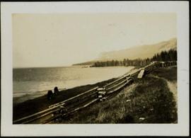
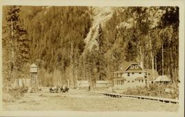
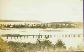
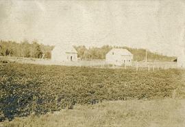
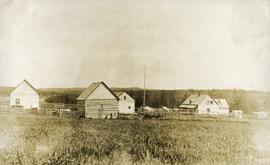
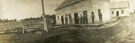
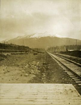
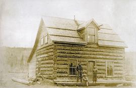
Photograph depicts three men standing and sitting on a porch deck in front of a log house, trees in the background.
Image depicts the town of Horsefly, B.C.
Photograph depicts a view looking across a small river. Two men stand on the shore of the photographer, several horses loaded with packs are on the opposite side of the river.
Photograph depicts two horses grazing behind log fence along the beach of Stuart Lake. Forested peninsula and distant hills are visible in background. Handwritten photo caption below photograph reads: "Stuart Lake, BC".
Photograph depicts approximately nine dark horses grazing in field to left of large coniferous tree. Wooded hillside in background. Handwritten annotation on recto of photograph: "Cottonwood river".
Image depicts what is possibly Hospital Beach in Kitimat, B.C. The facility in the background is possibly the Alcan smelter.
Street view of many vehicles parked in front of the Hotel Northern. Printed annotation on recto reads: "Hotel Northern, South Fort George."
Image depicts a house with the main floor and entrance high off the ground. The location is uncertain, likely Giscome, B.C.
Image depicts a house with a vehicle in a garage and the number 40 on it; location is uncertain.
Photograph of two horse driven carts driving past a house situated at the foot of a forested mountain.
Image depicts a blue house for sale on Upper Fraser Rd. Location is likely Upper Fraser, B.C.
Image depicts a house in Giscome, B.C. Map coordinates 54°04'17.6"N 122°22'06.1"W
Image depicts a small house with brightly coloured door and window frames in Penny, B.C.
Image depicts and old house and vehicle in Upper Fraser, B.C. Map coordinates 54°07'05.7"N 121°56'38.9"W
Image depicts a house on the shore somewhere on Haida Gwaii.
Image depicts a house being removed from Upper Fraser, B.C. during demolition of town site. A sign on the house reads: "Murray Blackwell House Raising & Moving." Map coordinates 54°06'51.6"N 121°56'26.3"W
Image depicts a house with some Firts Nations' art painted on the front, somewhere on Haida Gwaii, B.C.
Image depicts a house with ivy growing over it. The location is uncertain.
Image depicts a set of train tracks, a farmhouse, and some fields; possibly in Woodpecker, B.C.
Image depicts numerous houses, and an unknown child standing in a street at Island Cache.
Image depicts a few houses in Island Cache.
Image depicts a few houses and a dog on a porch at Island Cache.
Image depicts a view of numerous houses and a ballpark at an uncertain location. It is possibly located somewhere in the Peace River Region.
Image depicts several houses, and three goats standing on a narrow dirt road. The location is uncertain, likely Sinclair Mills, B.C.
Image depicts the Giscome B.C. townsite from across the railroad tracks looking southeast. Map coordinates 54°04'19.7"N 122°22'04.7"W
Image depicts a row of houses in Upper Fraser, B.C. Map coordinates 54°06'51.6"N 121°56'26.3"W
View of peninsula with houses and trees. Dock in mid ground, trees and grasses in foreground. Recto stamped “Port Simpson DE 17" and "Port Essington DE 18". Handwritten annotation on recto of photograph: "W. J. O'Neill Esq. Telegraph Point Via Pt. Essington B.C. Don't you think this pretty [Weggs & Mr. Byron?] was over last night - said he saw you and [Halie?]. Yours - BaBa".
Image depicts a number of houses built on stilts over a body of water in an uncertain location.
Image depicts Howe Sound.
Image depicts the Britannia Mine, which closed in 1974 and is now a museum. "Anaconda" was the last operating owner.
Image depicts a view of Howe Sound from the Stawamus Chief Nature Trail to the Stawamus Chief Mountain, which is often incorrectly referred to as "Squamish" Chief.
Photograph depicts buildings, field, and fenced areas with forest in the background.
Photograph depicts a cluster of seven or more buildings, fences and a flag pole. A grassy field in the foreground, rolling hills in the background.
Photograph depicts a large white building surrounded by a fence.
Photograph depicts ten men standing on a boardwalk outside a large building. Another building, boardwalks and fences nearby. Forest in the background. The buildings are constructed from lumber.
Photograph depicts view looking down railroad tracks toward a snow capped mountain. Survey of 55th parallel.
Postcard featuring the Fort St. James HBC Post. Printed annotation on recto reads: "H.B.C. Post Ft. St. James."
Image depicts a cabin and several other buildings, possibly located in Hudson's Hope, B.C.
Image depicts a road and numerous buildings in Hudson's Hope, B.C.
Image depicts a street in Hudson's Hope, B.C.
Image depicts what appears to be a Fire Hall in Hudson's Hope, B.C.
Image depicts an old, three-storey building beside a two-storey hotel in Hudson's Hope, B.C.
Image depicts two houses in Hudson's Hope, B.C.
Image depicts a street with a building which is labelled "MacKeigan Enterprises Ltd." in Hudson's Hope, B.C.
Image depicts what appears to be a motel in Hudson's Hope, B.C. The slide is labelled "camp HH."
Image depicts the log building that acts as the public library in Hudson's Hope, B.C.