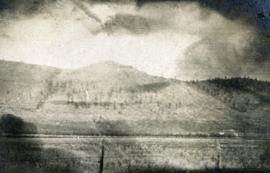
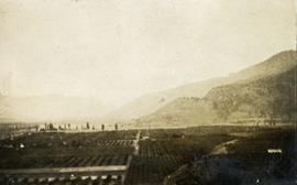
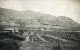
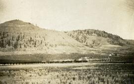
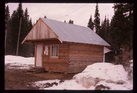
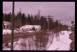
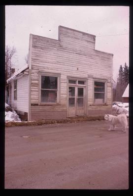
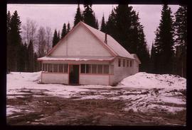
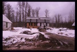
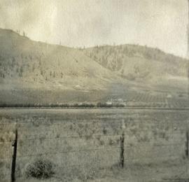
Photograph depicts farms and orchards, with sparsely forested hills in the background.
Photograph depicts a view of well kept buildings, orchard and mountains in the background.
Photograph depicts orchards with mountains in the background.
Photograph depicts a view of well kept buildings, orchard and mountains in the background.
Photograph depicts orchards with mountains in the background.
Image depicts a small farm located in Dome Creek, B.C.
Image depicts the school and teacherage located in Dome Creek, B.C.
Image depicts a strangely shaped orange vehicle somewhere in Dome Creek, B.C.
Image depicts an old, unused log cabin somewhere in Dome Creek, B.C.
Image depicts a log cabin somewhere in Dome Creek, B.C.
Image depicts a small shack that became the later post office in Dome Creek, B.C.
Image depicts several houses in Dome Creek, B.C.
Image depicts a horse and a barn in Dome Creek, B.C.
Image depicts a farmhouse in Dome Creek, B.C.
Image depicts an old building that used to be a store and post office in Dome Creek, B.C.
Image depicts the community hall in Dome Creek, B.C.
Image depicts what is possibly the CN Station in Dome Creek, B.C.
Image depicts the CN Station in Dome Creek, B.C.
Image depicts a Catholic Church in Dome Creek, B.C.
Image depicts a house somewhere in Dome Creek, B.C.
Photograph depicts a team of dogs pulling a sled and an unidentified person across a very flat area under heavy clouds. Mountains in background. Handwritten annotations on verso of photograph: "Unbroken Trails", "Taylor". Photograph speculated to have been taken near Atlin, B.C.
Photograph depicts a team of dogs and sled resting in a very flat snow-covered area. Hills in background. Handwritten annotation on recto of photograph: "ATLIN."
Image depicts a pair of dogs in a forest, possibly somewhere near Woodpecker, B.C.
3 dog teams pulling 3 sleds with 6 men attending. There is a large mountain in the background. Printed annotation on recto reads: “Mail team Skeena River B.C.” Handwritten message on verso is address to “Dear Alice and dated March 23, Easter Sunday 1913”.
A woman stands in distance on a road with high snowbanks and trees on either side. A dog can be seen in foreground, facing woman. A fence and other structures stand in midground. Tree-covered slope in background.
Image depicts an unknown individual and a dog on a bridge over what is possibly the Robson River.
Image depicts a dog standing on a path through the woods somewhere in Carp Lake Provincial Park.
Image depicts a dog in a forest, possibly somewhere near Woodpecker, B.C.
Image depicts a house and numerous rundown vehicles in Dog Creek, B.C.
Photograph depicts dog seated on grass in foreground. Unidentified individuals visible below with fishing nets in waterfall area at Moricetown Canyon.
Image depicts a ferry docked at Haida Gwaii, B.C.
Image depicts numerous docked boats in Prince Rupert, B.C.
Image depicts numerous docked boats somewhere in Prince Rupert, B.C.
Image depicts numerous boats docked in Prince Rupert, B.C.
View of dock full of rows of nets and a few workers. Sail boats are anchored near the dock and there are rows of bunkhouses in the mid ground, trees in the background. Handwritten annotation in pencil on recto reads: “Port Essington B. C.”
Image depicts a dock on a lake in Carp Lake Provincial Park, possibly War Lake.
Image depicts a dock in Prince Rupert, B.C.
Image depicts the "Divides Lake Waterfall" as well as a man in front of a helicopter in the foreground.
Image depicts the "Divides Lake Waterfall."
Image depicts Divide Lake.
Item is a photograph of the diversion tunnel as engineers plan to blast the plug to allow the Peace River to be diverted for construction of the W.A.C. Bennett Dam.
Image depicts a ditch of water at an uncertain location.
Image depicts a section of disturbed ground at an unknown location.
Image depicts an area of disturbed ground, most likely due to a landslide, at an unknown location.
Image depicts a large section of disturbed ground at an unknown location.
Image depicts an area of disturbed ground, most likely due to a landslide, at an unknown location.
Photograph depicts settlement across frozen lake. Trees cross midground, mountains stand in background. Handwritten annotation on verso of photograph reads: "Distant view of Tete Jaune B.C.", on recto of photograph: "I marked about where you loaded your boat the telephone pole is down the road toward 53. Tete Jaune Mile 52."
Photograph features Terrace Gardens.