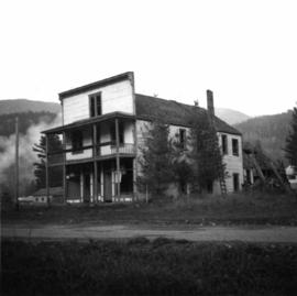
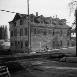
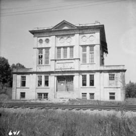
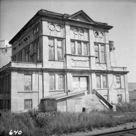
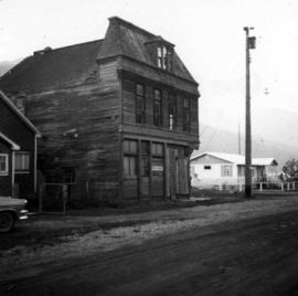
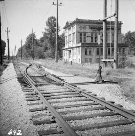
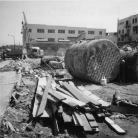
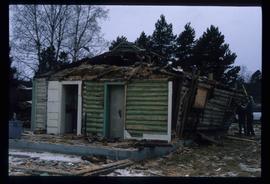
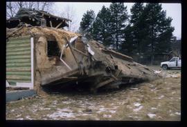
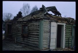
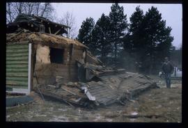
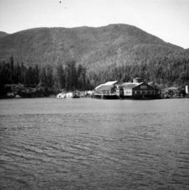
Photograph depicts a deserted cannery at Nootka, on west Vancouver Island.
Photograph depicts a deserted cabin on the Indian Reserve above the PGE track at the northwest corner of Seton Lake. It probably had been occupied up until the last 5 years.
Photograph depicts the Deroche post office that was well patronised for mail and newspaper distribution.
Photograph depicts a derelict shop on what was the Main St. of Slocan City.
Photograph depicts a derelict locomotive shed at Union Bay on Vancouver Island. It is a Canadian Colliery Resources Ltd. shed, last used 15 Aug. 1960. Operations finished that day and disposal of all the equipment followed.
Photograph depicts the derelict Langham Hotel at Kaslo, B.C. on Kootenay Lake.
Photograph depicts a derelict substation on the B.C. Electric Railway at Coghlan, 9 rail miles east of Langley. Though marked "Langley", the building is sited as stated.
Photograph depicts the derelict electricity station of the B.C. Electric Railway at Cloverdale.
Photograph depicts the derelict CPR depot at Hope, part of the former Kettle Valley line. A spur of about 3 miles still exists between the Odlum junction with the main line on the north side of the Fraser River and this depot, and continues southeast to a point near the CNR. It is not abandoned, but little used. The Hope yard has a 47 car capacity.
Photograph depicts a possibly derelict hotel in Slocan City, 25 miles northwest of Nelson. Slocan City was once famous for its silver, lead etc. mines.
Photograph depicts a derelict building on the old Main St in Slocan City, northwest of Nelson.
Photograph depicts a derelict building in Ladysmith on Vancouver Island built approximately between 1900 and 1905.
Photograph depicts a derelict barn displaying frame construction.
Photograph depicts a depot and derelict electricity substation at Coghlan, 9 rail miles east of Langley, looking west.
Photograph depicts the Department of National Defence Armoury headquarters of the British Columbia regiment.
Photograph depicts the demolition of a Great Northern Railway depot in Vancouver.
Image depicts the demolition of the Europe Hotel in Prince George, B.C.
Photograph depicts the demolished site of Nelson Laundries Ltd. The boiler in the foregorund was having tubes removed by a wrecker. The site was to be occupied by a Ford motor dealer.
Photograph depicts houses being demolished on Beach Ave, West End, Vancouver.
Image depicts the rubble of a demolished house at Island Cache, with several other buildings in the background.
Image depicts a house in the process of being demolished in Prince George, B.C.
Photograph depicts the Delta Municipal Hall on Main St. in Ladner, B.C.
Street view of Third Avenue in Prince Rupert. One horse drawn delivery cart and one delivery car are parked on the street. Printed annotation on recto reads: "3rd Ave. Prince Rupert. B.C." Handwritten annotation on verso reads: "Book & parcel find[??] received, love & many thanks, u.w. as you know, just what I needed. [Illegible] R.W." Postcard is addressed to: "Mrs. J.W. Cawfsious [??] 1136 Barclay St. Vancouver B.C." Verso is affixed with a 2 cent Canadian Stamp, and is postmarked: "Prince Rupert B.C. Sep 19 6-PM."
Image depicts debris left in residential area on Giscome, B.C. townsite. Map coordinates 54°04'16.7"N 122°21'55.1"W
Image depicts Upper Fraser residential area during demolition of town site. Map coordinates 54°06'51.6"N 121°56'26.3"W
Image depicts two children in front of an old log building on the Deadman Creek reserve, located west of Kamloops, B.C.
Image depicts the corner of an old log building in Deadman Creek, near Kamloops, B.C.
Image depicts several children and numerous adults inside a church in Deadman Creek, near Kamloops, B.C.
Image depicts a church in Deadman Creek, west of Kamloops, B.C.
Image depicts the Station Museum and the "Alberta Pool Elevators Ltd." building in Dawson Creek, B.C.
Image depicts stuffed wildlife exhibits inside the Station Museum in Dawson Creek, B.C.
Image depicts the interior of the Station Museum in Dawson Creek, B.C.
Image depicts the Station Museum in Dawson Creek, B.C.
Image depicts a street of businesses and Mile "0" of the Alaskan Highway in Dawson Creek, B.C.
Image depicts Mile "0" of the Alaskan Highway in Dawson Creek, B.C.
Image depicts the interior of what is possibly a heritage building in Dawson Creek, B.C.
Image depicts a large building which is labelled "Alberta Pool Elevators Ltd. Dawson Creek," located in Dawson Creek, B.C.
Image depicts a street of businesses in Dawson Creek, B.C.
Image depicts a sawmill in the Danson Industrial Park in Prince George, B.C.