2013.6.36.3.04.03
·
Item
·
1986
Part of David Davies Railway Collection
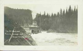
Postcard depicts "Canadian Pacific's eastbound, "The Canadian," crosing the Kicking Horse River between Golden and Field B.C. in October 1976. Some of the... trains power through some of North America's most spectacular scenery. The morning has brought the season's first snowfall."