2012.13.2.15.18.31
·
Item
·
2001
Part of J. Kent Sedgwick fonds
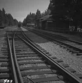
The photograph depicts the old train station in Prince George. The door reads CN. Photograph likely reproduction from 1984.