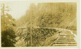
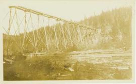
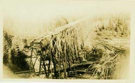
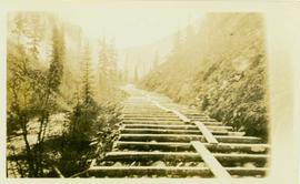
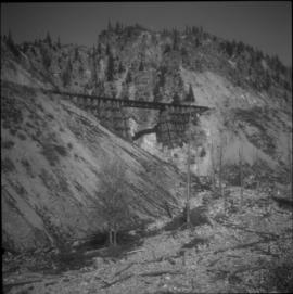
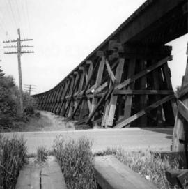
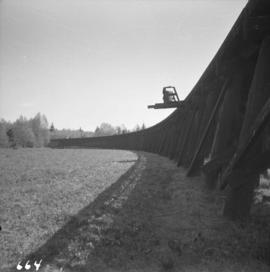
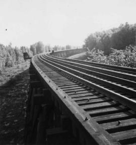
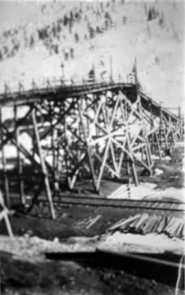
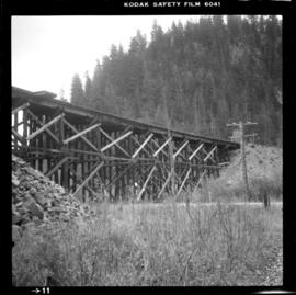
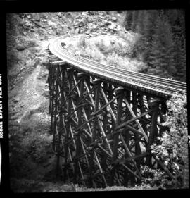
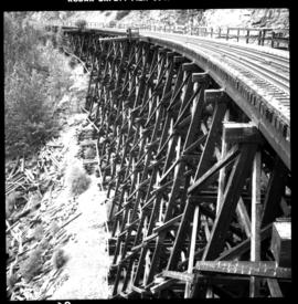
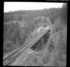
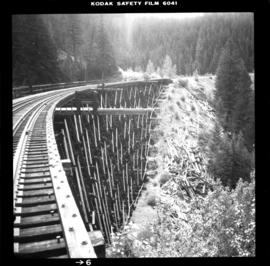
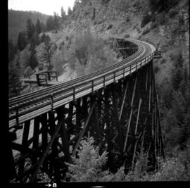
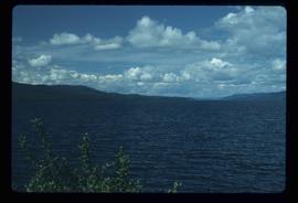
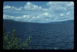
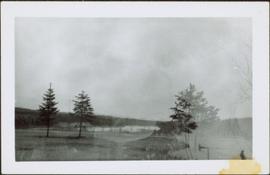
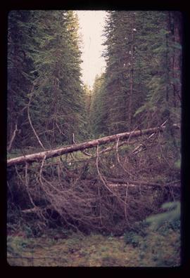
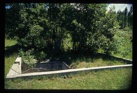
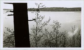
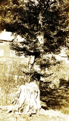
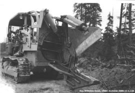
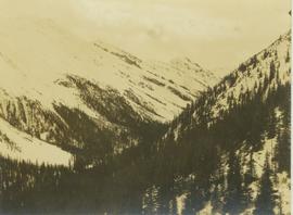
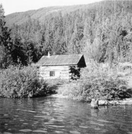
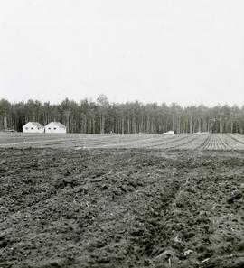
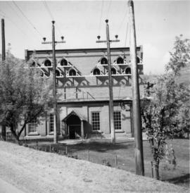
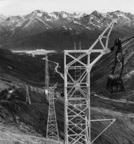
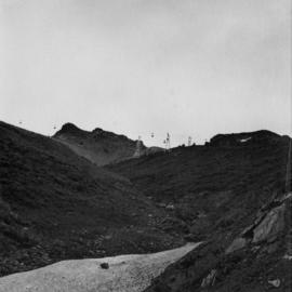
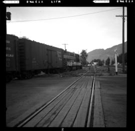
Photographs from Cassiar trip report to Brenda Mines in British Columbia. These photographs depict pit design, landscape of field and pit, cable stations, mine rescue truck, and equipment such as graders, trucks, drills and cats.
Photographs from Cassiar trip report to Afton Mines in British Columbia. This collection of photographs depicts the road maintenance by cat. and grader, the bench heights, levels, scaling, holes and maintenance, and equipment used such as drills, buckets, trucks, crusher for pit maintenance of walls, slopes and angles.
This collection of photograph is a Cassiar trip report to Weldotron Inc. Industrial Packaging Systems in Piscataway, New Jersey to look at the shrink wrap system. The ten photographs depict the wrap applicator, bag maker placer, feed side of wrap applicator, shroud wrap machine, and before and after packaged asbestos. One photograph is of the Kellogg Plant in Michigan depicting forklifts. There is also a commercial photograph of the "Weldotron Pallet Pak Shrouder & Shrink Tunnel for shrink wrapping pallet loads."
Image depicts a group of people preparing to depart on a trip. Location is uncertain, though it is possibly in Prince George, B.C.
Photograph depicts a wooden trestle constructed along a steep cliff through a wooded environment. Handwritten annotation on verso reads: "Trestle work through upper canyon 1/2 mile below intake, Germansen Placer Ltd."
Photograph depicts a wooden trestle designed for carrying water flumes. Annotation on verso of photograph states: "Trestle work for carrying water flume - Germansen Placer Ltd"
Photograph depicts a wood trestle constructed in a cleared forest area. Handwritten annotation on verso of photograph reads: "Trestle nearing completion across valley of south fork of Germansen Creek".
Photograph depicts a wooden trestle under construction along a hillside within a forested landscape. Handwritten annotation on verso of photograph reads: "Trestle work three (?) Upper Canyon 200 yards below intake, Germansen Placer Ltd."
Photograph depicts a trestle on the ex CPR Coquihalla line of the Kettle Valley Railway. It is a famous view spot because the trestle has a waterfall behind it. It is now the only intact trestle on the line because even the very small ones were demolished after the line closed on 23 November 1959. It is located about mile 21.7 from Brookmere. The grade here is about 1 in 53.
Photograph depicts a trestle of the Great Northern Railway, main line to Blaine, curving towards the southwest from the south end of the New Westminster rail bridge.
Photograph depicts the trestle leading to the Canadian National Railway (CN) swing bridge across the north arm of the Fraser River. The view was taken on Lulu Island, looking northeast. The ground on each side of the trestle is peaty and springy when walked on.
Photograph depicts a trestle on the south bank of the north arm of the Fraser River leading from the C.N.R. swing bridge, approximately 5 miles southeast of New Westminster, looking south.
Photograph depicts a trestle over railroad tracks in an unknown snowy location. (Possibly Mountain Park?)
Photograph depicts a trestle bridge on the old CPR Kettle Valley Railway. It is about 5 miles southeast of Brookmere, between Thalia and Spearing on the Princeton Subdivision.
Photograph depicts the CPR Kettle Valley Railway in Myra Canyon. This is one of the nine wooden trestles between mile 85 and mile 86.4
Photograph depicts the CPR Kettle Valley Railway in Myra Canyon. It shows the a wooden trestle fitted with a sidewalk, which at 434 ft. long is the longest one in the canyon. It is located at mile 85.9. The view is looking south.
Photograph depicts the CPR Kettle Valley Railway in Myra Canyon. The view is looking north at the trestle located at mile 85.4
Photograph depicts the CPR Kettle Valley Railway in Myra Canyon. It shows the a wooden trestle fitted with a sidewalk, which at 434 ft. long is the longest one in the canyon. It is located at mile 85.9. The view is looking south.
Photograph depicts the CPR Kettle Valley Railway in Myra Canyon. It shows the a wooden trestle fitted with a sidewalk, which at 434 ft. long is the longest one in the canyon. It is located at mile 85.9. The view is looking north.
Photograph depicts a trestle bridge for road traffic leading to the Second Narrows Bridge in Vancouver, BCThe shot is taken from the south bank.
Image depicts a west-looking view of Trembleur Lake.
Photograph depicts Trelle Morrow standing in the Soda Creek cemetery. Annotation on verso: "Trelle M. at cemetery, Soda Creek, 2010.'
Photograph depicts Trelle Morrow and Jim Rankin at the Soda Creek cemetery. Annotation on verso: "Trelle M. and Jim Rankin at Soda Creek cemetery, 2010."
Photograph depicts trees standing in foreground, river and hills visible in distance.
Image depicts a stand of trees and a shed at Island Cache.
Image depicts two old houses surrounded by numerous trees at an uncertain location.
Image depicts a green car among some trees on Cottonwood Island.
Bench visible in left foreground.
Image depicts numerous trees in an uncertain location; the slide itself is labelled "T.T. Cutting," possibly meaning "Telegraph Trail Cutting."
Image depicts a few trees, with what is possibly the Northwood Pulpmill in the background, in Prince George, B.C.
Image depicts a small copse of trees boxed in by very small concrete barriers somewhere in Kettle Valley, B.C.
Item is a photograph of a tree stump apparently eaten through by beavers.
Large tree trunk and smaller saplings silhouetted against Summit Lake, forest visible on opposite shore. Handwritten caption beside this photo reads: "Sumit Lake."
Photograph depicts a tree growing on a stump at Mill Bay Cannery on the Nass River. Handwritten annotation below photograph reads, "a tree growing on a stump, Mill Bay, BC".
Slide depicts cleared ground and felled trees in a forested area, likely at the Aleza Lake Experiment Station.
Item is a photograph of a large tree cutting machine.
Image depicts two unidentified individuals examining a thick log still attached to the machine that cut it down. It is located somewhere in Prince George, B.C.
Photograph depicts tree-covered mountain ranges in winter.
Photograph depicts a trappeers cabin on the northend of Trout Lake and Trout Lake City. It was maintained in good condition by present owners who valued its age.
Photographs within this file pertain to modes of transportation and transportation routes (including construction, surveying and traveling).
Subseries consists of material collected and created by Kent Sedgwick for research regarding transportation. Includes notes and research on airplanes, specifically Prince George aviation and the Junkers aircraft named "The City of Prince George"; highway transportation; the Grand Trunk Pacific Railway; ferry boat service including the Fraser River Fort George ferry, the Isle Pierre ferry, and the Miworth ferry; the Pacific Great Eastern Railway line; the British Columbia Railway; and the Canadian National Railway. Also includes essays and typed documents on railway history in Prince George.
Caption describing photograph: "Foreground cultivated in readiness for establishment of seed or transplant beds. Backgroun is transplant area est. Spring 1966."
File consists of 32 overhead transparencies depicting a variety of subjects and related photocopied materials. File also includes an archival photographic reprint of Clara Benson in 1899 from University of Toronto Archives.
Photograph depicts the Transformer Sub-Station of West Kootenay Power and Light Company, which is the only private power distribution company left in B.C. at the time. In was built in 1905 and was in operation by 1906. There were identical buildings made in Grand Forks and Phoenix, but they were demolished at the latter place.
Photograph depicts towers and bucket in foreground, plantsite midground in valley, opposite mountains in background. Handwritten annotation on recto of photograph: "GENERAL VIEW VISIBLE TOWERS ARE IN #1 SECTION PLANT IN BACKGROUND". Photograph was glued to cardboard backing with the annotation: "1962".
Photograph depicts towers and buckets in distance. Gravel road in foreground winding through hills of dirt. Handwritten annotation on recto of photograph: "#1 SECTION". Photograph was glued to cardboard backing with the annotation: "1962".
File contains photographs featuring the tramline at Cassiar which ran from the crushing plant at the mountain mine to the plantsite in the valley (a drop of 427 meters). The first ore was originally transported by truck to the plant until the gravity chute was built in 1953. This chute was replaced with the first aerial tramline model in 1956, which was succeeded by the second model in 1975. This file also includes one photo of the original gravity chute, and one photo depicting a tramline worker.
Additionally there is a collection of eighteen photographs of tramline cars that were being surveyed for damage and condition, and another collection of six photographs of tramline study. The results of this study determined that there was variances in load sizes of the buckets caused by extra material falling off the panfeeder.
Photograph depicts trains switching at Osoyoos, BC.