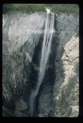
Photograph depicts an unidentified man standing to left of large puddle in gravel pit, mountain peaks in background. Photo speculated to have been taken on the plant, or near the Cassiar airstrip, facing south west. Stamped annotation on recto of photograph: "JUN. 1987".
Photograph depicts water pooled on the deck of a weather ship with rough water in the background.
Photograph depicts a stream of water running through mountainous terrain.
Photograph depicts a weather ship in rough water with water spilling onto the bow end of the ship.
Photograph depicts water from a wave spilling over the bow of a weather ship.
Photograph depicts a water swelling over the bow of a weather ship.
Image depicts a waterfall somewhere in South Tweedsmuir Provincial Park.
Image depicts a waterfall on a mountain side in Mt. Robson Provincial Park.
Image depicts a small waterfall at an uncertain location.
Image depicts an aerial view of a waterfall in South Tweedsmuir Provincial Park.
Image depicts a waterfall in what is possibly the Robson River.
Image depicts a waterfall with a mountain peak in the background; it is most likely Mt. Robson.
Photograph depicts piles of wood planks and log booms in the foreground with a waterfall in the background.
Photograph depicts a waterfall in a forested area with a riverbank in the foreground.
Wide angle view of Prince Rupert harbour taken from the water. Forest and mountains are visible in the background. Annotation on recto reads: "Prince Rupert BC '07."
Image depicts the Watson Mansion at Mile 108 of Highway 97. It was built by Captain Geoffrey Watson in 1904, and was burned down by a chimney fire in 1983.
Archdeacon W.H. Collison and an unidentified man on the "Dawn," Collison's boat. Forested hills and several buildings are visible in the background. Handwritten annotation on verso reads: "The 'Dawn' Archdeacon Collison's boat."
Photograph depicts a weather balloon ascending into the air with a clear sky in the background.
File consists of research material gathered in and/or concerning New Zealand. Research materials include handwritten notes and photocopies on a variety of topics including New Zealand women, environment, and the Maori people. File also includes promotional material for museums and galleries in Wellington, New Zealand.
Image depicts Wells, B.C.
Image depicts the Helmcken Falls in Wells Gray Provincial Park.
Image depicts the drainage area for the Helmcken Falls in Wells Gray Provincial Park.
Photograph depicts the old hospital building in Wells. At the time the photo was taken, 1978, it was being used as an apartment building, and that is still its current use.
Image depicts woods located west of Leo Creek, with mountains in the distance.
Photograph depicts the West peak of the Cassiar mine, pit partially visible below. Drill visible in left foreground at highest elevation of mine, north west mountain range in background.
Photograph depicts the West peak of the Cassiar mine, pit partially visible below. Mining equipment barely visible in foreground at highest elevation of mine, north west mountain range stands in background, and mine valley crosses midground.
Handwritten annotation on recto of photograph: "WEST WALL FOOTING AUG 8/64." Photograph depicts a construction worker standing on rebar in forms built for cement footings. A front end loader and backhoe tractor can be seen on wood platform above footings. Mountainside in background.
Image depicts a grave somewhere along the White Pass railway.
Image depicts a mountain side somewhere along the White Pass railway. The thin ridge along the mountain side is possibly either a highway or part of the railway.
File contains slides depicting locations along the White Pass railway through Alaska, British Columbia, and the Yukon Territories.
Image depicts the White Pass Train crossing over a railway bridge at an uncertain location.
Image depicts the White Pass Train crossing over a railway bridge at an uncertain location in the mountains.
Image depicts the White Pass Train crossing over a railway bridge at an uncertain location.
Image depicts an aerial view of Williams Lake, B.C.
File contains slides depicting places in the area around Williams Lake, Clinton, and the Fraser Canyon.
Image depicts the St. Joseph's Mission in Williams Lake, B.C.
Image depicts the cableway in Willow River, B.C.
Image depicts the cableway, stretching over a river, in Willow River, B.C.
Image depicts the cableway in Willow River, B.C.
Image depicts a group of people somewhere in Willow River, B.C. The man in the plaid shirt and beige cap is identified on the slide as being Lloyd Edwards.
Image depicts the Willow River General Store. Map coordinates 54°04'23.7"N 122°28'26.9"W