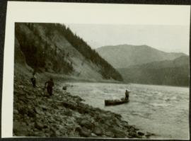
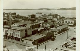
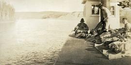
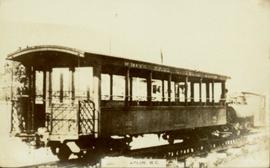
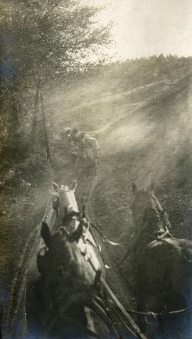
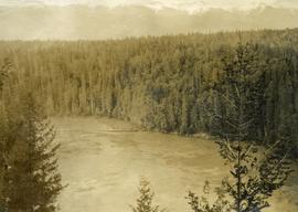
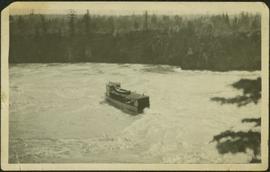
Tree branches in right foreground, and forest above banks on opposite shore in background.
Image depicts the Fraser River at Paddlewheel park, with a train on the other side of the river, in Prince George B.C.
Handwritten annotations on verso read: “Lawn Pool, Memorial, West Coast, VI, Summer ’06,” and “Sept. 15, 2006”.
An 'X' is marked in ink on forest in centre.
Handwritten annotation on verso reads: “Sunset at North Cove Thetis Island Adam Hunter”.
The photographs depict the geographic areas of Stewart, BC, Boundary Pass, Nelson River, Bitter Creek Glacier, Portland Canal, Red Cliff and Bear Creek; as well as the ships “Camosun” and “S.S. Prince George.” Types of subjects identified in this collection include: community life, surveying, mining and transportation (i.e. dog-sledding, horse and buggy, and the Portland Canal Short Line Railway “P.C.S.L. Rlwy”).
Image depicts a group of people throwing a frisbee in a parking lot at an uncertain location, likely in the Peace River Region.
Subseries consists of material collected and created by Kent Sedgwick for research regarding parks and outdoor recreation in Prince George. Material on parks includes Fort George Park (renamed to Lheidli T’enneh Memorial Park in 2015); Cottonwood Island Park; Connaught Hill; Moore's Meadow; L.C. Gunn Park; the Nechako Cutbanks; Paddlewheel Park; Monkman Provincial Park; Fraser Canyon Park; and Carp Lake. Also includes information on the creation of plaques and monuments, including the Alexander Mackenzie monument; the “Arrival of Steel” CN railway plaque; heritage interpretative signs for the Grand Trunk Pacific Railway; the Millar addition; and flooding and rivers. The files consists of various pamphlets and correspondence regarding the development of parks and the creation of interpretive materials.
Photograph depicts a man standing in a loaded canoe floating close to shore. Two men stand on rocky shore in left foreground. Tall hills in background, river rapids behind canoe in midground. Handwritten annotation on recto of photograph: "Parle Pas Rapids Peace River."
Overhead view of a block of business and harbour buildings in Prince Rupert BC. The "Savoy Hotel" is visible in the foreground. Printed annotation on recto reads: "Part of Business Section & Harbour. Prince Rupert B.C. F. Button Photo Pr. Rupert No. 494."
Photograph depicts a bird's eye view of a large river, forest and mountains in the background. On the river's edge there is a scow with several persons standing on it.
Image depicts several eighteen wheelers at the Pass Lake Road and Upper Fraser Road intersection with numerous houses and buildings in the background in McGregor, B.C. Map coordinates 54°04'38.1"N 121°50'00.1"W
Photograph depicts three or more passengers with sleeping/bed rolls on the deck of the S.S. Nechako sternwheeler. There is a river, riverbanks and low hills in the background.
Photograph of man on the back of a passenger car attached to a steam engine. Printed annotation on recto is obscured by emulsion damage and reads: "[illegible] Atlin, B.C."
Photograph depicts view from atop a stage coach, a team of horses pulling a stage coach approaching.
Photograph depicts two freighting stages passing. View is from atop one of the stages.
Image depicts a view of a valley; the slide itself labels the image in two places, "central basin" on the left side of the image, and "Pat's Pass" on the top of the image between the two mountains.
Image depicts the First Nations village of Pavilion, B.C.
Image depicts an old earth flow somewhere near Pavilion, B.C.
Image depicts the remains of an old bridge, somewhere near Pavilion Mountain.
Image depicts the road to Pavilion Mountain.
Side perspective photograph of a Portland Canal Short Line engine being either loaded or unloaded by several men at the station in Stewart, BC. Printed annotation on recto reads: "Aug 9 1911 Stewart BC."
Image depicts the Peace Canyon Dam and generating station under construction on the Peace River.
File contains slides depicting places along the Peace River.
Image depicts the Peace River, possibly near Clayhurst or Hudson's Hope, B.C.
Image depicts what is possibly the Peace River.
Image depicts a river, possibly the Peace River.
Image depicts what is possibly the Peace River running parallel to a road, possibly Highway 29.
Image depicts the Peace River.
Image depicts the Peace River, possibly near Hudson's Hope, B.C.
Image depicts the Peace River.
Image depicts the Peace River and visible layers of sediment deposits in the surrounding cliffs.
Image depicts the Peace River, possibly somewhere near Fort St. John, B.C.
Image depicts a dam, possibly on the Peace River.
Image depicts a dam on what is possibly the Peace River.
Image depicts a dam and a reservoir of water, possibly on the Peace River.
Image depicts what is possibly the Peace River running next to some farm land at an uncertain location.
Image depicts a large group of unidentified individuals sitting on a hill; what is possibly the Peace River is visible in the background.
Image depicts the W.A.C. Bennett Dam on the Peace River in Hudson's Hope, B.C.
Photograph depicts the Peace River Canyon with the Peace River in the foreground and rocky, tree-lined cliffs flanking the river. In the background a forested mountain base is visible.
File consists of clippings related to the Peace River region. Also includes photographs taken by Kent Sedgwick depicting Mackenzie, BC and the Peace River region (2003).
Image depicts a street of shops at an uncertain location somewhere in the Peace River Regional District. A pink and blue building, possibly a theatre, is labelled "Lux."
Image depicts grass burning at an uncertain location in the Peace River Region.
Image depicts a section of forest located somewhere in the Peace River Regional District of B.C.