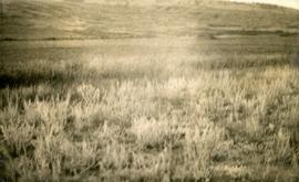
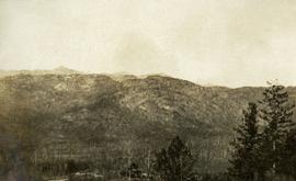
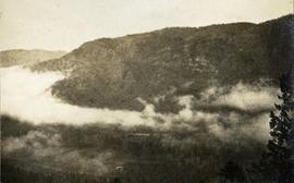
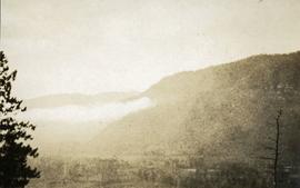
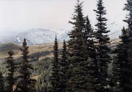
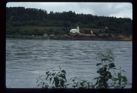
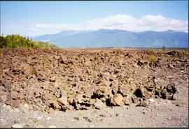
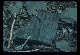
Photograph depicts what appears to be a lava bed, see item 2008.3.1.22.33.
Image depicts Noralee, B.C.
Photograph depicts a close up view of the range grass.
Photograph depicts an open field with a fence. There is a house in the midground and low sparsely treed hills in the background.
Photograph depicts a view of a barn, house, fences and cattle on Norman Lee's ranch.
Photograph depicts a view of open range land in the foreground and rocky bluffs in the background.
A collection of postcard photographs of Port Essington BC, Port Simpson BC, Atlin, Quesnel, McBride, Hagwilget Village, Giscome, Likely, Kitwanga, Smithers, Prince Rupert BC, Prince (Fort) George BC Images depict street scenes, water scenes, community events, businesses, buildings, and aerials of the towns. Collection also depicts a number of Northern BC paddle wheelers.
Photograph depicts looking north and south in North Fork from above Boulder creek.
Image depicts a field north of Dog Creek in the upper Fraser Canyon.
Image depicts numerous power lines and a road somewhere north of Squamish.
Image depicts phyllite, a type of metamorphic rock, on the north shore of Takla Lake.
File contains slides depicting areas along the North Thompson Highway.
File consists of notes and reproductions relating to "Northern Approaches to New Caledonia" lecture conducted by Kent Sedgwick, relating to the article he wrote on "Crossing the Divide: Northern Approaches to New Caledonia". File predominantly contains Kent Sedgwick's handwritten notes and notes and transparent sheets of film depicting various maps of northern British Columbia. File also contains photographs depicting various maps (Oct. 2002).
Photographs within this file document stern wheelers operating in Northern BC from ca. 1901 - 1915.
Photograph depicts a landscape scene in northern British Columbia in an unknown location.
Photograph depicts a small coastal village in northern British Columbia.
Photograph depicts the view to the northwest from the site of the terminal building at the Rainbow Lake Ski Club.
Image depicts the Northwood Pulpmill in Prince George, B.C. taken from above the Nechako River looking east. Map coordinates 53°56'00.0"N 122°44'29.7"W
Image depicts the office at the Northwood Upper Fraser Saw Mill and a sign which reads "Have a safe, quality day." Map coordinates 54.117916, -121.943351
Image depicts the Oblates of Mary Immaculate Catholic Church in Aleza Lake, B.C. Map coordinates 54°07'08.2"N 122°02'00.0"W
Image depicts an oddly shaped tree branch that appears to have grown downwards, and is covered in green, mossy growths. Located somewhere on Haida Gwaii.
File contains photographs depicting four different tours that took place at the mine, plant, and towns owned by Cassiar Asbestos Corporation Ltd. Tours include Prime Minister Pierre Trudeau's visit to Clinton Creek in 1968 and Member of Parliament Iona Campagnolo's visit to Cassiar in 1978. Photographs also depict a party of ambassadors touring Cassiar in 1970, and the dedication of a building in the Cassiar plant in the late 1970s.
File contains slides depicting the Okanagan Brigade Trail.
File contains slides depicting the Okanagan Kettle Valley.
Image depicts an old abandoned cabin at an uncertain location.
Image depicts an old, abandoned church located somewhere in Seton Portage, B.C.
Image depicts a view of Old Aiyansh.
Image depicts an old beehive burner at an uncertain location.
Photograph depicts a collapsed bridge on North Fork creek.
Photograph depicts a creek with banks on either side.
Image depicts several old buildings. The location is uncertain.
Image depicts several old buildings at an uncertain location. The slide is simply labelled "Spring house?"
Image depicts a couple of old buildings, and a field full of tree trunks and dead wood. Located somewhere in or around the Upper Fraser Canyon.
Image depicts an old cabin in the woods at an uncertain location.
Image depicts an old, collapsing cabin which is sloped sideways. The location is uncertain.
Image depicts Sue Sedgwick and a dog standing next to an old, collapsing cabin which is sloped sideways. The location is uncertain.
Photograph depicts a cluster of buildings including a church, a river in the foreground, rolling hills in the background.
Photograph depicts narrow valley between steep cliffs.
Handwritten annotation on verso reads: "on left Vertical side of old Indian fort at Nagas W. Coast Q.C.I".
Image depicts an old, boarded up hotel in Stewart, B.C.