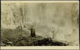
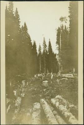
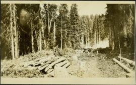
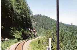
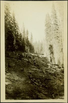
Photograph depicts tree stumps in forest clearing of the railway right-of-way.
Photograph depicts stumps and log piles in forest clearing of the railway right-of-way.
Photograph depicts men walking among stumps and log piles in forest clearing of the railway right-of-way.
Photograph depicts smoke, stumps and log piles in forest clearing of the railway right-of-way.
Photograph depicts opposite shore in background behind river, and close shore in foreground on right. Men can be seen standing and paddling on canoe in distance. Handwritten photo caption on verso and recto of this photograph reads: "On the Clearwater".
Photograph depicts opposite shore in midground behind river, tree-covered hills in background. Handwritten photo caption on verso and recto of this photograph reads: "On the Clearwater".
Image depicts a camper parked on the side of a narrow road along a cliff as another car approaches; located somewhere near Bralorne, B.C.
Image depicts a camper passing under an overhang as it drives along a narrow road near a cliff; located somewhere near Bralorne, B.C.
Postcard depicts Field station in the Rockies. Man standing on the left with a bowler hat was Chris McGregor, a professional (mining?) engineer. Earliest frank seen for the postcard was in July 1906.
Cassiar Asbestos Corporation Ltd opened a second mine in 1967 at what became the one-industry town of Clinton Creek, Y.T. File contains photographs depicting progressive construction of buildings at the Clinton Creek mine, plant, townsite and powerhouse. Mine photos depict the crusher site and tramline station. Plant photos depict the dryer, fibre storage, mill, service, vault, and office buildings, as well as the dry rock storage tunnel, reclaim tunnel, and loading dock. Construction living quarters are depicted as well as the construction of residences at the townsite. The power house was built south of the town and plant, on the shore of the 40 Mile River. Some annotations describe the type of material being used for construction.
Forest and hills on opposite shore in background.
Handwritten annotation on verso reads: "poling canoe up Nass River".
Totem poles (crest poles?) stand in front of a line of houses. Blanketed canoes sit on beach in right foreground; forest in background.
Handwritten annotations on verso read: “Haida Encampment [crossed through with line]"; "Skidegate Queen Charlottes Islands / To illustrate Introduction / Introduction Trophies from a Song [Trail?] Page 1 Heading."
Photograph depicts a close-up of a totem pole behind a fence overlooking a wharf and a ship named Camosun. Photographer’s stamp on verso: “W.E. Nicholson, 268 E. 10th, Vancouver 10, B.C.”
Photograph depicts the CN and CP yard at Armstrong, BC. A landslip took place about 2-3 miles south on the CP track and this equipment was used to fill it.
Photograph depicts the Canadian National Railway (CN) train crossing Powell St. and the C.P.R. tracks to get to North Vancouver.
Photograph depicts the Boston Bar CN depot that once was a dismissal point of some importance that had a roundhouse, turntable, etc. The depot was now empty, awaiting a purchase.
File consists of documentary photographs taken by David Davies of CN in Boston Bar, British Columbia.
File consists of documentary photographs taken by David Davies of the CN branch on Lulu Island, British Columbia.
File consists of documentary photographs taken by David Davies of a CN derailment at Brocklehurst in Kamloops, British Columbia.
Image depicts the CN Building in Prince George, B.C.
Photograph depicts a CN bunk car labelled "Kamloops Auxiliary Capmens Bunk."
Photograph depicts a CN bunk car.
Photograph depicts a CN caboose in Jasper, AB.
Photograph depicts train master Al Wingrave in a caboose stationed at the Kamloops Junction. Undergoing speed checks on the Clearwater Subdivision.
Photograph depicts CN caboose #77018.
Photograph depicts a CN caboose preserved in Kamloops.
Photograph depicts a CN caboose at an unknown location.
Photograph depicts a CN caboose. Possibly taken in Prince George.
Photograph depicts a CN caboose in Blue River, BC
Photograph depicts a caboose that had just reached a terminal relief switch at Blue River. It was eastbound and contained 103 empty grain cars. Taken at the Kamloops Junction.
Photograph depicts the arrival of an eastbound empty grain train, carrying 103 cars, at the Kamloops Junction in Blue River.
Photograph depicts CN car #73057.
Photograph depicts a CN Kamloops Auxiliary car carrying logs.
Photograph depicts CN car #55402, built in 1935.
Photograph depicts CN car #54252 carrying locomotive utility wheels.
Photograph depicts CN car #59121.
Photograph depicts CN car #59350.
Photograph depicts CN Kamloops Auxiliary cars.
Photograph taken somewhere between Blue River and Avola.
Photograph taken snear Cotton Wood Flats.
Photograph taken somehere between Blue River and Avola. Visible is a sulphur train of 82 cars.
Photograph depicts an empty eastbound grain train.
Photograph taken near Cotton Wood Flats. Visible is a falling rock warning fence.
Photograph taken somewhere between Avola and Barriere.
Photograph depicts the point where a train stopped because of a faulty signal at the Clearwater Subdivision. A rear-end brakemen was sent off to protect the rear of the train.
Photograph taken near Cotton Wood Flats.
Photograph taken between Avola and Barriere.