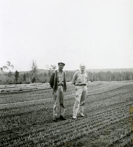
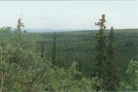
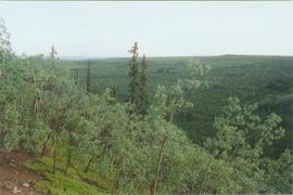
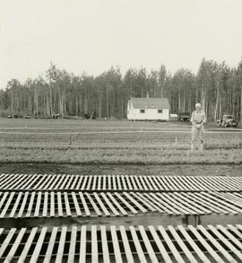
Caption describing photograph: "Rolf Hellenius."
Caption describing photograph: "Rolf Hellenius and Roy Scully."
This collection depicts the construction and development of Roger's Pass Project. Originally part of an album with "Manning - Kumagai" on the front. The photographs depict a railway station, large tent for storage of raw materials, machinery, railway construction equipment, underground tunnel and various people at work in these areas.
Photograph depicts a rocky mountain slope covered in snow.
Image depicts the rocky shore of an unidentified body of water, possibly near Meldrum Creek, B.C.
Photograph depicts the Rocky Mountaineer in downtown Kamloops.
Photograph depicts the Rocky Mountaineer in downtown Kamloops. Locomotive #7488.
Photograph depicts the Rocky Mountaineer Rail Tours yard. Main line track is found on the left and was still used by CN for Okanagan freights and other miscellaneous trafffic.
Photograph depicts cars of the Rocky Mountaineer Rail Tours. Believed that the year the photograph was taken was the first that cars of the company were stored in Kamloops as before they were stored in Vancouver. The initial experience was bad because there was an unseasonable cold snap in November and December that froze all the batteries underneath the cars and ruined them (bursting occured).
Photograph depicts the sidings of the Rocky Mountaineer Railway Tours CN depot in downtown Kamloops.
Photograph depicts a Rocky Mountaineer Rail Tour train passing a newly completed yard.
Photograph depicts a completed yard of the Rocky Mountaineer Rail Tours built on the Kamloops Indian Reserve, about 1 1/4 miles northeast of the VIA waiting room at the CN Kamloops Junction.
Photograph depicts a Rocky Mountaineer Jasper train that had just been propelled into the downtown Kamloops CN station. Once passengers de-trained, the empty train was pulled into R.M.R private trackage on K.I.R. for overnight stabling, cleaning, and restocking.
Photograph depicts a southbound Rocky Mountaineer train coming into the CN Kamlops Junction. Included about 8 empty cars.
Photograph depicts a Rocky Mountaineer train proceeding westward onto the North Thompson bridge. It was then propelled down to the branch to downtown Kamloops.
Photograph depicts a southbound Rocky Mountaineer train coming into the CN Kamlops Junction. Included about 8 empty cars.
Photograph depicts a work in progress in extending access to a new depot for Rocky Mountaineer Rail Tour trains.
Photograph depicts a Rocky Mountaineer train with a propelling locomotive short distance away approaching Chilcoltin Road, Kamloops Indian Reserve. St. Joseph's Church is on the left.
Photograph depicts a Rocky Mountaineer train with a propelling locomotive short distance away approaching Chilcoltin Road, Kamloops Indian Reserve.
Photograph depicts a Rocky Mountain vista seen through a snow-covered forest.
Photograph depicts a Rocky Mountain vista seen across a forested plateau.
Image depicts a view of the Rocky Mountain Trench somewhere near McBride, B.C.
Image depicts the Rocky Mountain Trench from McBride, B.C.
Image depicts a view of an area somewhere near McBride in the Rocky Mountain Trench.
Image depicts the Rocky Mountain Trench from McBride, B.C.
Image depicts a view of the Rocky Mountain Trench somewhere near McBride, B.C.
Image depicts a view of McBride in the Rocky Mountain Trench.
Image depicts a heavily forested area located in the Rocky Mountain Trench, possibly near Dome Creek or Lamming Mills, B.C.
Image depicts a view of the Rocky Mountain Trench.
Photograph of a large crowd gathered at the McBride train station. Printed annotation on recto reads: "'Rocky Mountain Rangers Band, McBride, B.C.'"
Photograph depicts the Rocky Mountain range visible from above distant tree tops.
File contains slides depicting areas in and around the Rockies, Icefield Highway, and Jasper, Alberta.
Photograph is a printed postcard depicting a rock slide and creek near Stewart B.C.
Photograph depicts truck at reject plant in foreground. Mine road can be seen leading to plant in centre background, town in right background. South mountain range visible in distance. Handwritten annotation on recto of photograph: "June 1970 / Looking South across Rock Reject Tailings / Note Southern direction of conveyor [?] towards No 1 Gully. Tom Kiefer".
Photograph depicts a low rock in deep waters, Handwritten annotation below photograph reads, "Rock in Mill Bank Sound, BC coast".
Photograph depicts men on river scow, large rock island or peninsula protruding into river behind them. Trees on opposite shore in background, large rock in foreground. Handwritten annotation on verso of photograph: "Grand Canyon. Fraser River. Big Rock.", on recto of copy print: "1911."
Photograph depicts the rock formations along the Cariboo Road north of Cache Creek. Wyness notes that the rock may be sandstone; there may be red iron oxide visible in the formation.
Image depicts ridge-like rock formations at an uncertain location, though possibly somewhere near the Fraser River.
Photograph depicts a snow-covered rock formation on the north side of Sentinl Peak
Photograph depicts the making of a rock cut on the Pacific Great Eastern Railway line at the Lillooet end of Seton Lake during railway construction.