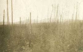
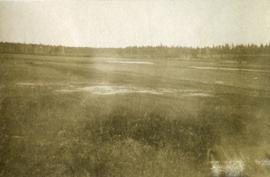
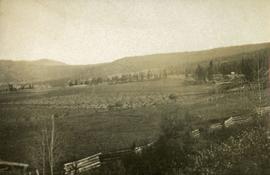
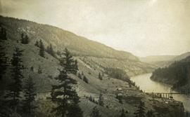
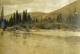
Photograph depicts open range land and treed low hills. There is a log fence in the foreground and roofs of buildings on the right.
Image depicts what is possibly the Chilcotin River.
Image depicts a group of hikers hiking towards what is possibly the Chilcotin River.
Photograph depicts standing trees that have been burnt, possibly after forest fire. Low hills can be seen in the background.
Photograph depicts open grassland with forest in the background.
Image depicts a sign titled "Chilcotin Wildlife Management Area" somewhere near Riske Creek, B.C. It reads: "This trail has been provided by the Fish and Wildlife Branch in co-operation with Riske Creek Ranching Ltd., as access to the Chilcotin Wildlife Management Area. Please do not leave the the trail as the surrounding land is private property."
Photograph depicts two children in a row boat on an unknown lake in BC. Buildings can be seen along the shore in the background.
Image depicts a bridge over the Fraser River, located at Chimney Creek, somewhere south-west of Williams Lake, B.C.
Photograph depicts a long spanned bridge crossing the Fraser River near Chimney Creek, BC.. Album notes state: "views of Chilcotin"
Image depicts Chimney lake with a number of houses near the shore, and a child in the foreground.
Image depicts the Chimney Lake Lodge.
Photograph depicts six men standing outside a small log building. A sawhorse in the foreground, a tall pole "cache" and forest in the background.
Photograph depicts a foreground of forest looking toward Christina lake with mountains in the background.
Photograph depicts the still waters of Christina Lake bordered by forest with mountains in the distance.
Photograph depicts a foreground of forest looking toward Christina lake with mountains in the background.
Image depicts a church on a hill somewhere in Seton Portage, B.C.
Image depicts the Clayhurst Ferry on the Peace River.
Photograph depicts a man standing on a high ladder pouring grain from a sack to a tarp below. Sacks of grain in the foreground, field and trees in the background.
Image depicts a highway, and a section of mountain in the background which is bare due to clear-cut logging. It is possibly somewhere near Prince George, B.C.
Image depicts a logging area, and a section of mountain in the background which is bare due to clear-cut logging. The slide is also labelled "logging show." It is possibly somewhere near Prince George, B.C.
Image depicts a clearing at Island Cache.
Photograph depicts a river, riverbank, forest and treed rolling hills.
Photograph depicts a scow with several men in the center of a river.
Photograph depicts opposite shore in background behind river, and close shore in foreground on right. Men can be seen standing and paddling on canoe in distance. Handwritten photo caption on verso and recto of this photograph reads: "On the Clearwater".
Photograph depicts opposite shore in midground behind river, tree-covered hills in background. Handwritten photo caption on verso and recto of this photograph reads: "On the Clearwater".
Image depicts a camper parked on the side of a narrow road along a cliff as another car approaches; located somewhere near Bralorne, B.C.
Image depicts a camper passing under an overhang as it drives along a narrow road near a cliff; located somewhere near Bralorne, B.C.
Image depicts a climbing either up or down a rock face.
Image depicts a view of the scenery near Clinton, B.C.
Cassiar Asbestos Corporation Ltd opened a second mine in 1967 at what became the one-industry town of Clinton Creek, Y.T. File contains photographs depicting different areas of operations at Clinton Creek. Locations include the mine, plant, town, tailings pile, main office, the 40 Mile River, and surrounding area. Town photos depict the grocery store, cafeteria, medical clinic, school, auditorium residential area, Connell Street and power house. File also includes aerial photographs and images depicting forest fighting, photographers capturing the tailings pile, asbestos samples, mining machinery, staff offices, and operations in the mill, lab, and garage.
Additional photographs integrated into file depict Clinton Creek's surrounding area, and three slides of a tailing pile explosion believed to be Clinton Creek.
Close up photograph of a large residential building in a freshly clear cut area. To the right of the main building is the church and an unidentified commercial building. Annotation on recto reads: "Prince Rupert, BC 1660."
Forest and hills on opposite shore in background.
Handwritten annotation on verso reads: "poling canoe up Nass River".
Image depicts Upper Fraser residential area during demolition of town site. Map coordinates 54°06'51.6"N 121°56'26.3"W
Photograph depicts a close-up of a totem pole behind a fence overlooking a wharf and a ship named Camosun. Photographer’s stamp on verso: “W.E. Nicholson, 268 E. 10th, Vancouver 10, B.C.”
Photograph depicts a close-up of Alert Bay house posts adorned with First Nations carvings. Photographer’s stamp on verso: “W.E. Nicholson, 268 E. 10th, Vancouver 10, B.C.”
File contains slides depicting closeups of flowers at unknown locations.
Street view photograph of a large brick with a vehicle parked in front. Printed annotation on recto reads: "C.N.R. Station Prince George, B.C."
Image depicts the coastline of Haida Gwaii, B.C.
Image depicts a view of the coast of Haida Gwaii.
Image depicts an aerial view of the coastline of Haida Gwaii, B.C.
Image depicts a view of the coast of Haida Gwaii.
Image depicts the coastline of Haida Gwaii, B.C.