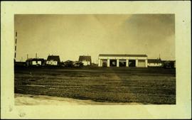
The item is a 35 mm slide photograph depicting a residential duplex house off the Cariboo Highway. It is one of three buildings that were relocated for the airport in 1957.
The item is a 35 mm photograph depicting a stucco duplex on the Cariboo Highway.
Image depicts an unknown building under construction at the corner of 6th Avenue and Dominion Street in Prince George, B.C.
File consists of documentary photographs taken by David Davies of buildings in British Columbia.
File consists of documentary photographs taken by David Davies of agricultural buildings in British Columbia.
File consists of documentary photographs taken by David Davies of churches in British Columbia.
File consists of documentary photographs taken by David Davies of commercial and industrial buildings in British Columbia.
File consists of documentary photographs taken by David Davies of hotels in British Columbia.
File consists of documentary photographs taken by David Davies of various houses in British Columbia.
File consists of documentary photographs taken by David Davies of log dwellings in British Columbia.
File consists of documentary photographs taken by David Davies of public buildings in British Columbia.
File consists of documentary photographs taken by David Davies of stores and service buildings in British Columbia.
Handwritten photo album caption below this photo reads: "D.O.T [Department of Transportation?] Bldgs & Garage, Whitehorse." Photograph depicts numerous buildings and a four-door garage on streets in Whitehorse. Dump trucks and other various vehicles surround garage. Road and gravel covered area crosses foreground.
Royal Canadian Air ForcePhotograph of Prince Rupert businesses amidst clear cut stumps. Businesses include "Stewart and Mobley Groceries, Fruits and Produce." Printed annotation on recto reads: "Prince Rupert, B.C., Oct. 09."
Image depicts numerous buildings and a dock on the shore of Haida Gwaii, B.C..
Photograph depicts two large buildings across street in foreground, van visible on left.
Photographs within this file pertain to specific buildings (i.e. residences, commercial, factories, courthouses, community centres, jails, arenas, hotels); monuments, statues and shrines; bridges and trestles; and building management and construction of buildings throughout northern British Columbia.
The photograph depicts three buildings, white, beige, and blue at the Prince George airport. Annotations on the photograph describe the buildings as, "RCMP, airport terminal building, [and] small arms building."
The photograph depicts two buildings, one beige, the other white, at the Prince George airport.
The photograph depicts three buildings, white, beige, and blue at the Prince George airport.
Image depicts several old buildings in a field, one of which has a caved-in roof, in Newlands, B.C. Map coordinates 54°06'28.2"N 122°12'01.0"W
Image depicts a row of buildings in Upper Fraser, B.C. with the store (titled "Paradise") with a Pepsi sign. Map coordinates 54°07'09.1"N 121°56'47.0"W
Photograph depicts small buildings sited on the north side of the tracks and just west of the Mission City CPR depot. They are all in use and well cared for.
Photograph depicts buildings of the former Vancouver-Lansdale ferry. They appeared to now be used by Kingcome Navigation Co. as well as other businesses.
Photograph depicts three buildings and a water tower on top of a deforested hill with water in the foreground.
Photograph is a printed postcard depicting scattered small buildings and a tent. Trees have been removed from the area around the buildings and many stumps remain.
Photograph depicts a wooden building under construction and piles of wood planks on the shoreline.
Image depicts a view of Bulkley Valley.
Photograph depicts man believed to be Bob Baxter on bulldozer by large framework structure in snow. House stands in background as well as a truck with "CITY OF PRINCE GEORGE" visible on its passenger door. Handwritten annotation on recto of photograph: "Civic centre 1948."
Photograph depicts man driving bulldozer in front of framework for Crusher building, view facing into the mountain. Excavated dirt in foreground.
Image depicts an old, half-collapsed house in Likely, B.C.. The slide labels it as "Bullion house."
Overview of Giscome, BC showing built and natural landscape.
Handwritten annotation in pencil on verso: "Bunkhouse & Dining Room / Giscome BC".
Image depicts bunkhouse, restaurant and store in Sinclair Mills, B.C. Map coordinates 54°01'17.4"N 121°40'53.0"W
The item is a photograph that depicts three veteran houses on Burden Street. Houses include beige siding, beige stucco and a white siding house.
Image depicts Burns Lake, B.C.
Image depicts a street in Burns Lake, B.C.
Image depicts the welcome sign in Burns Lake, B.C.
Photograph depicts group of men in hats and ties standing on wood deck connecting four store fronts. Left to right: Parsons Produce Co., Dunn & Co. Hardware and Tinware, Fortin & LeGappelain Druggists, Cummings & Richardson - Gents, Furnishings, Boots and Shoes. Handwritten annotation on recto of photograph: "Branch Parsons Produce Co at Atlin 1899."
Image depicts a street of businesses, possibly 3rd Avenue, in Prince George, B.C.
Photograph depicts various businesses along 3rd Avenue. The businesses include the Europe Hotel and The Bay in the background. Annotation on verso: "left Europe Hotel, right shearer bldg".
Photograph depicts Businesses in downtown in the North Thompson region, including a business 'Something Old & Something New'.
Photograph depicts Businesses in downtown in the North Thompson region, including a business '5 seasons, Sports Excellence'.
Photograph depicts Businesses in downtown in the North Thompson region, including a business called 'Something old & Something new'.
Photograph depicts Businesses in downtown in the North Thompson region, including a sign reading "Welcome to historic George Street" and a business called "Lizard River".
Photograph depicts Businesses in downtown in the North Thompson region, including a sign reading "Welcome to historic George Street" and Levi's jeans store.
Photograph depicts "Butterchurch" that was built in 1870 under the direction of Father Rondeault of the Oblate Order for missionary work among the Comiakan Natives, a tribe of about 100. It was abandoned by about 1880 because of its location. It was recently restored as a historical shrine.
Image depicts a cabin at an unknown location.