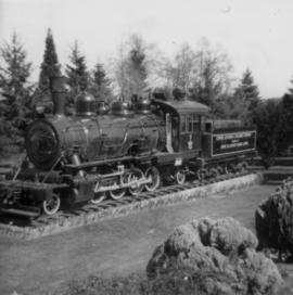
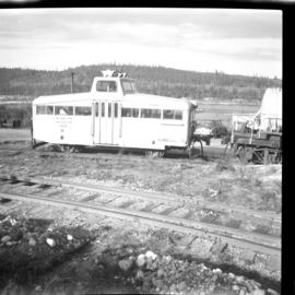
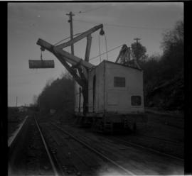
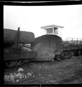
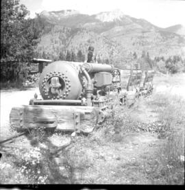
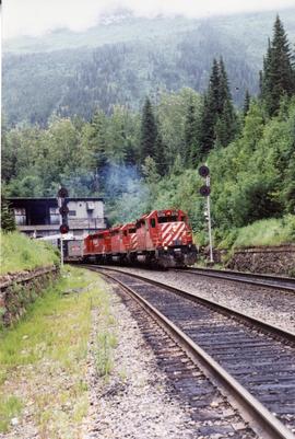
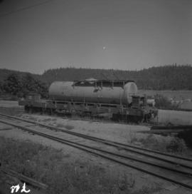
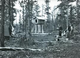
Photograph depicts a homemade snow plough that had a short wheel base between the trucks. The design of its main frame suggets that it might have been a crane before conversion to its present use.
Photograph depicts a former steam locomotive shed.
Photograph depicts a view of the Ladysmith yard, looking north, about 300 yards east of the city centre.
Photograph depicts the outside of the Comox Logging head office in Ladysmith.
Photograph depicts a daily log train from Nanaimo Lakes. About 20 cars were being unloaded at a rather fast rate of 30-60 seconds per car using a mechanical prodder mounted on the frames of an old shay locomotive.
Photograph depicts a deisel switcher #107.
Photograph depicts a grand view of the Ladysmith yards. There had been no steam operations on this line for about 2 years.
Photograph depicts the lower part of the Ladysmith yard, adjacent to a log pond. A semaphore signal was activated by the tide and indicated to the engineer of the log train the suitable depth for offloading logs from the cars.
Photograph depicts a log car repair shop. Visible is one car being repaired as well as another awaiting attention on a switch spur on the right.
Photograph taken about half a mile north of the diamond crossing, looking southeast at the point where the Esquimalt & Nanaimo Railway closely follows the Comox Railway for about 300 yards. The Comox Railway used one every week for log trains.
Photograph depicts sidings for empty log cars about a quarter of a mile south of the diamond crossing. Image captured looking south, towards the Ladysmith yards. The running line is visible on the right side of the photograph and was used week by a daily log train, consisting of a deisel locomotive and 20 cars.
Photograph depicts deisel switcher #108.
Photograph depicts a mobile crane used to offload log trains into a pond.
Photograph depicts a snow plough in the Ladysmith yards.
File consists of documentary photographs taken by David Davies of artifacts of the Comox Logging Railway in Ladysmith, British Columbia.
Photograph depicts a homemade (?) device used to scour boiler tubs of scale. Taken at the former site of the Comox Logging Railway's yard and maintenance facilities.
Photograph depicts a Comox Logging Railway fire fighting tank car at Ladysmith.
Photograph depicts a part of the former ard of the Comox Logging Railway. It was now a little known park. Locomotive #11, Baldwin, also visible.
Photograph depicts former yard of the Comox Logging Railway. Locomotive shed in background. Locomotive #11, Baldwin, also visible.
Photograph depicts former yard and freight stock of the Comox Logging Railway.
Photograph depicts former Comox Logging locomotive #11.
Photograph depicts the former Comox Logging Railway headquarters.
Photograph depicts the Comox Logging Railway main yard at Ladysmith.
Series consists of documents providing information on the Columbia Cellulose Company, Limited including its history, historical and geographical context, and plans for the future. These documents often include photographs, maps, and technical drawings of the mills. Series consists of Skeena Kraft press kit; Feasibility Study of Nass River Valley Log Transport Systems; A Summary History and Progress; Development Study: Northern resources; Columbia Cellulose Company, Limited.
File consists of a compilation of digital images on CD-R from the Office of Development.
Unidentified wood structures in foreground on far left.
Handwritten caption below this photo reads: "Completed Foundations for Crusher, with forms being stripped." Men can be seen working on site. Switchback road, power lines and tramline towers are believed to be in valley in background.
Photograph depicts a compressed air mine locomotive on exhibition at the roadside in Britannia Beach.
Photograph depicts a compressed air mine locomotive.
Image depicts what appears to be a computer room at an uncertain location, possibly in Fort St. John, B.C.
File consists of photographs of UNBC Computer Science.
The item is an interior photograph of a concrete stairwell with red and wooden railings. Picture is likely the interior of the University of Northern British Columbia.
Image depicts several unidentified concrete structures that are badly damaged and cracking, located on old mill site in Giscome, B.C. Map coordinates 54°04'18.0"N 122°22'04.7"W
Caption describing photograph: "Condition after clear cut logging. Birch, balsam, thimbleberry, raspberry, E.S. and fern. Main Access Road, F.E.S. Aleza Lake."
Caption describing photograph: "Condition after hand pulling, piling and burning, and rough clearing. Note roots in soil. Northwest Cor of present clearing."
Image depicts a condominium, possibly in Prince Rupert, B.C.
File consists of photographs of UNBC Conference Centre.
Photograph depicts a group of 18 men wearing suits and ties, standing on front steps of large building with pillars.
Handwritten annotation on verso reads: "Conference of Sand Question Committee at Kincolith on Sunday, June 3rd 1923. Mr. [O'Heara?] present. [illegible initials]".
Photograph depicts framework of one side of the crusher building next to rocks from excavated mountain wall. Lumber in foreground. Handwritten caption beside this photo reads: "Note confined area to work in, and need for rock fences."
Photograph depicts the confluence of the Fraser and Thompson Rivers at Lytton. Wyness originally misnoted the location as Lillooet, BC.
Original photographic print included in "Northern Interior Forest Experiment Station: Report of Preliminary Investigations" by Percy Barr.
File consists of notes, reproductions, and letters relating to Connaught Hill in Prince George. Includes: "Connaught Hill" handwritten notes by Kent Sedgwick (2009); "Prince George in bloom" thank you letter from the Prince George in Bloom Committee to Kent Sedgwick (4 Aug. 2005); and two photographs depicting men at the 2005 National Communities in Bloom Competition in Prince George (2005).
Photograph depicts the western portal of the 1916 Connaught Tunnel. Glacier station was located behind the camera.
Photograph depicts the Connaught Tunnel. Traffic was normally eastbound through it, while westbound traffic went through the new Mt. Macdonald Tunnel.
Photograph depicts the western portal of the 1916 Connaught Tunnel. The tunnel used to be double tracked, but was singled in the 1960s in orde to take piggy-back/container traffic. Curiously, the switch to the single was inside the tunnel.
Postcara depoiocts Connaught Tunnel in the Canadian Rockies.
Man in military uniform, woman, and young boy stand on grass in front of flowering trees. Woman holds infant, bassinet stands on far right. Handwritten annotation on recto of photograph: "The Connell family, Halifax, July 1942. Joan - age 3 months."
Photograph depicts Bob Niven, Ken Dewar,and Henry Giegerich standing in their Consolidated Mining and Smelting Company of Canada Ltd. (CMS) camp at Sand Bay near Thutade Lake. Food cache visible at centre.
Subseries consists of photographic material pertaining to building construction at Cassiar and Clinton Creek. Photos were taken of all the major structures during the building of the Cassiar plant in the early 1950s and the Clinton Creek plant in the early 1970s. There are also photographs pertaining to the new mill that was built at Cassiar in 1970-1971. Smaller scale construction jobs have been included: police station, powerhouse expansion, fiber storage building, sewage collection and treatment plants, accommodations and outside work camps.